
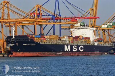
ALESSIA
Container Ship
Current Trip
| Time Travelled | 11 days |
|---|---|
| Remaining Time | --- |
| Distance Travelled | 4234.24 nm |
| Remaining Distance | 11.47 nm |
| AVG Speed | 17.7 Knop |
| MAX Speed | 20.4 Knop |
| AVG Wind | 13.4 knots |
| MAX Wind | 27.2 knots |
| MIN Temp | 24.2°C / 75.56°F |
| MAX Temp | 32°C / 89.6°F |
| Djupgående | 9.6 m |
| Position mottagen | 2 d sen |
Current Position
| Longitud | --- |
|---|---|
| Latitude | --- |
| Status | Under way using engine |
| Fart | 17.1 Knop |
| Kurs | 260.6° |
| Område | South Atlantic Ocean |
| Station | T-AIS |
| Position mottagen | 2 d sen |
Info
Information
The current position of ALESSIA is in South Atlantic Ocean with coordinates -23.60745° / -43.42589° as reported on 2026-01-01 04:48 by AIS to our vessel tracker app. The vessel's current speed is 17.1 Knop and is heading at the port of SANTOS. The estimated time of arrival as calculated by MyShipTracking vessel tracking app is 2026-01-01 13:00 LT
The vessel ALESSIA (IMO: 9225653, MMSI: 636092976) is a Container Ship that was built in 2001 ( 25 År gammal ). It's sailing under the flag of [LR] Liberia.
In this page you can find informations about the vessels current position, last detected port calls, and current voyage information. If the vessels is not in coverage by AIS you will find the latest position.
The current position of ALESSIA is detected by our AIS receivers and we are not responsible for the reliability of the data. The last position was recorded while the vessel was in Coverage by the Ais receivers of our vessel tracking app.
The current draught of ALESSIA as reported by AIS is 9.6 meters
Weather
| Temperature | 26.2°C / 79.16°F |
|---|---|
| Wind Speed | 9 knots |
| Direction | 168° SSE |
| Pressure | 1006.2 hPa |
| Humidity | 79.7 % |
| Cloud Coverage | 76 % |
Featured Company
Last Port Calls
| Port | Arrival | Departure | Time In Port |
|---|---|---|---|
| 2025-12-21 08:17 | 2025-12-22 12:58 | 1 d | |
| 2025-12-15 05:13 | 2025-12-16 09:00 | 1 d | |
| 2025-12-04 13:59 | 2025-12-06 07:35 | 1 d | |
| 2025-12-02 02:12 | 2025-12-02 20:08 | 17 h | |
| 2025-11-21 04:05 | 2025-11-21 04:11 | 5 m | |
| 2025-11-18 12:17 | 2025-11-20 13:53 | 2 d | |
| 2025-11-11 19:57 | 2025-11-13 05:53 | 1 d | |
| 2025-11-10 08:27 | 2025-11-11 08:34 | 1 d |
Most Visited Ports (Last year)
| Port | Arrivals | |
|---|---|---|
| 10 | ||
| 7 | ||
| 6 | ||
| 5 | ||
| 5 | ||
| 5 |
Last Trips
| Origin | Departure | Destination | Arrival | Distance | |
|---|---|---|---|---|---|
| 2025-12-16 09:00 | 2025-12-21 08:17 | 1761.89 nm | |||
| 2025-12-06 07:35 | 2025-12-15 05:13 | 2027.86 nm | |||
| 2025-12-02 20:08 | 2025-12-04 13:59 | 478.52 nm | |||
| 2025-11-21 04:11 | 2025-12-02 02:12 | 4101.06 nm | |||
| 2025-11-20 13:53 | 2025-11-21 04:05 | 235.76 nm | |||
| 2025-11-13 05:53 | 2025-11-18 12:17 | 303.89 nm | |||
| 2025-11-11 08:34 | 2025-11-11 19:57 | 183.31 nm | |||
| 2025-10-30 04:34 | 2025-11-10 08:27 | 4379.29 nm |
Events
| Tid | Event | Detaljer | Position / Dest | Information |
|---|---|---|---|---|
| 2026-01-03 13:01 | STARTAR förflyttning | 13.48 nm, South East of SANTOS |
-24.17198 / -46.22093
COCTG > BRSSZ
|
Fart: 3.7 kn Kurs: 246° |
| 2026-01-01 15:10 | STOPPAR förflyttning | 13.28 nm, South East of SANTOS |
-24.16979 / -46.22419
COCTG > BRSSZ
|
Fart: 0.2 kn Kurs: 228° |
| 2026-01-01 04:52 | Status ändrad | Default Under way using engine |
-23.61304 / -43.44203
COCTG > BRSSZ
|
Fart: 17.1 kn Kurs: 260.6° |
| 2026-01-01 04:48 | UTANFÖR täckningsområde |
-23.60745 / -43.42589
South Atlantic Ocean
COCTG > BRSSZ
|
Fart: 17.1 kn Kurs: 260.6° |
|
| 2026-01-01 04:41 | Status ändrad | Under way using engine Default |
-23.59562 / -43.39204
COCTG > BRSSZ
|
Fart: 16.2 kn Kurs: 255° |
| 2026-01-01 04:00 | Status ändrad | Default Under way using engine |
-23.53486 / -43.20511
COCTG > BRSSZ
|
Fart: 16.9 kn Kurs: 254.8° |
| 2026-01-01 03:20 | Status ändrad | Under way using engine Default |
-23.47285 / -43.01633
COCTG > BRSSZ
|
Fart: 17.1 kn Kurs: 246° |
| 2026-01-01 03:17 | Status ändrad | Default Under way using engine |
-23.46839 / -43.00142
COCTG > BRSSZ
|
Fart: 17.7 kn Kurs: 249.2° |
| 2026-01-01 02:01 | Byter havsområde | Brazilian part of the South Atlantic Ocean Brazilian part of the North Atlantic Ocean |
-23.32890 / -42.61566
South Atlantic Ocean
COCTG > BRSSZ
|
Fart: 18.1 kn Kurs: 248.2° |
| 2026-01-01 01:55 | Status ändrad | Under way using engine Default |
-23.31707 / -42.58498
COCTG > BRSSZ
|
Fart: 18.1 kn Kurs: 245° |