
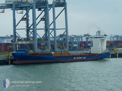
ALDEBARAN J
Container Ship
Current Trip
| Time Travelled | 2 days |
|---|---|
| Remaining Time | 10 h, 48 mins |
| Distance Travelled | 642.00 nm |
| Remaining Distance | 498.20 nm |
| AVG Speed | 13.3 Knop |
| MAX Speed | 15.9 Knop |
| AVG Wind | 11.1 knots |
| MAX Wind | 25 knots |
| MIN Temp | 22.5°C / 72.5°F |
| MAX Temp | 27.5°C / 81.5°F |
| Djupgående | 7 m |
| Position mottagen | 1 d sen |
Current Position
| Longitud | --- |
|---|---|
| Latitude | --- |
| Status | Under way using engine |
| Fart | 14.8 Knop |
| Kurs | 232.3° |
| Område | North Atlantic Ocean |
| Station | T-AIS |
| Position mottagen | 1 d sen |
Information
The current position of ALDEBARAN J is in North Atlantic Ocean with coordinates 23.90696° / -80.95104° as reported on 2025-03-15 01:26 by AIS to our vessel tracker app. The vessel's current speed is 14.8 Knop and is heading at the port of PUERTO SANTO TOMAS. The estimated time of arrival as calculated by MyShipTracking vessel tracking app is 2025-03-16 23:59 LT
The vessel ALDEBARAN J (IMO: 9349186, MMSI: 304972000) is a Container Ship that was built in 2006 ( 19 År gammal ). It's sailing under the flag of [AG] Antigua Barbuda.
In this page you can find informations about the vessels current position, last detected port calls, and current voyage information. If the vessels is not in coverage by AIS you will find the latest position.
The current position of ALDEBARAN J is detected by our AIS receivers and we are not responsible for the reliability of the data. The last position was recorded while the vessel was in Coverage by the Ais receivers of our vessel tracking app.
The current draught of ALDEBARAN J as reported by AIS is 7 meters
Weather
| Temperature | 26.6°C / 79.88°F |
|---|---|
| Wind Speed | 23 knots |
| Direction | 130° SE |
| Pressure | 1009.6 hPa |
| Humidity | 85.4 % |
| Cloud Coverage | 8 % |
Featured Company
Last Port Calls
| Port | Arrival | Departure | Time In Port |
|---|---|---|---|
| 2025-03-13 20:03 | 2025-03-14 12:15 | 16 h | |
| 2025-03-13 19:32 | 2025-03-13 19:43 | 11 m | |
| 2025-03-11 03:48 | 2025-03-11 11:11 | 7 h | |
| 2025-03-10 11:09 | 2025-03-10 23:10 | 12 h | |
| 2025-03-09 17:52 | 2025-03-10 05:51 | 11 h | |
| 2025-03-06 15:21 | 2025-03-07 05:48 | 14 h | |
| 2025-03-06 15:08 | 2025-03-06 15:16 | 7 m | |
| 2025-03-02 22:35 | 2025-03-04 09:54 | 1 d | |
| 2025-03-02 14:59 | 2025-03-02 19:32 | 4 h | |
| 2025-02-27 13:23 | 2025-02-28 04:50 | 15 h |
Most Visited Ports (Last year)
| Port | Arrivals | |
|---|---|---|
| 32 | ||
| 30 | ||
| 25 | ||
| 24 | ||
| 22 | ||
| 19 |
Last Trips
| Origin | Departure | Destination | Arrival | Distance | |
|---|---|---|---|---|---|
| 2025-03-13 15:43 | 2025-03-13 16:03 | 1.05 nm | |||
| 2025-03-11 05:11 | 2025-03-13 15:32 | 856.72 nm | |||
| 2025-03-10 17:10 | 2025-03-10 21:48 | 57.37 nm | |||
| 2025-03-09 23:51 | 2025-03-10 05:09 | 63.15 nm | |||
| 2025-03-07 00:48 | 2025-03-09 11:52 | 846.91 nm | |||
| 2025-03-06 10:16 | 2025-03-06 10:21 | 0.40 nm | |||
| 2025-03-04 03:54 | 2025-03-06 10:08 | 814.89 nm | |||
| 2025-03-02 13:32 | 2025-03-02 16:35 | 0.89 nm | |||
| 2025-02-27 23:50 | 2025-03-02 08:59 | 843.78 nm | |||
| 2025-02-27 08:03 | 2025-02-27 08:23 | 0.97 nm |
Events
| Tid | Event | Detaljer | Position / Dest | Information |
|---|---|---|---|---|
| 2025-03-15 01:30 | Status ändrad | Default Under way using engine |
23.89560 / -80.96706
GTSTC
|
Fart: 14.8 kn Kurs: 232.3° |
| 2025-03-15 01:26 | UTANFÖR täckningsområde |
23.90696 / -80.95104
North Atlantic Ocean
GTSTC
|
Fart: 14.8 kn Kurs: 232.3° |
|
| 2025-03-15 01:22 | Status ändrad | Under way using engine Default |
23.91597 / -80.93828
GTSTC
|
Fart: 14.6 kn Kurs: 232° |
| 2025-03-15 00:47 | Status ändrad | Default Under way using engine |
24.00162 / -80.81670
GTSTC
|
Fart: 14.2 kn Kurs: 232.5° |
| 2025-03-15 00:39 | Status ändrad | Under way using engine Default |
24.02046 / -80.79009
GTSTC
|
Fart: 14 kn Kurs: 233° |
| 2025-03-15 00:39 | I täckningsområde |
24.02046 / -80.79009
North Atlantic Ocean
GTSTC
|
Fart: 14.2 kn Kurs: 232.1° |
|
| 2025-03-14 17:47 | Status ändrad | Default Under way using engine |
25.11191 / -79.65668
GTSTC
|
Fart: 13.3 kn Kurs: 186.3° |
| 2025-03-14 17:44 | UTANFÖR täckningsområde |
25.12228 / -79.65535
North Atlantic Ocean
GTSTC
|
Fart: 13.3 kn Kurs: 186.3° |
|
| 2025-03-14 14:34 | Upptäckt i hav | Bahamas part of the North Atlantic Ocean |
25.76578 / -79.70549
North Atlantic Ocean
GTSTC
|
Fart: 14 kn Kurs: 135.7° |
| 2025-03-14 12:15 | AVGÅTT HAMN |
|
26.08699 / -80.11367
GTSTC
|
Fart: 5.7 kn Kurs: 344° |