
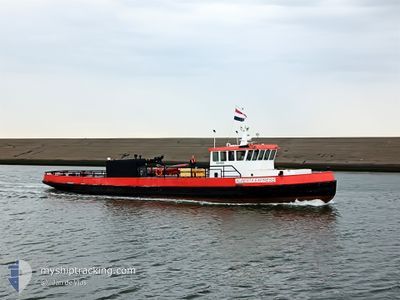
ALBERTA EXPRESS
Other Type
Current Trip
| Trip Time | 8 h, 35 mins |
|---|---|
| Trip Distance | 23.69 nm |
| AVG Speed | 8.1 Knop |
| MAX Speed | 10.9 Knop |
| Djupgående | 1.5 m |
| AVG Wind | 8.6 knots |
| MAX Wind | 12.7 knots |
| MIN Temp | 5.3°C / 41.54°F |
| MAX Temp | 5.6°C / 42.08°F |
| Position mottagen | 1 m sen |
Current Position
| Longitud | --- |
|---|---|
| Latitude | --- |
| Status | Under way using engine |
| Fart | |
| Kurs | --- |
| Område | North Sea |
| Station | T-AIS |
| Position mottagen | 1 m sen |
Info
Information
The current position of ALBERTA EXPRESS is in North Sea with coordinates 53.18711° / 5.43135° as reported on 2025-03-02 00:10 by AIS to our vessel tracker app. The vessel's current speed is 0 Knop and is currently inside the port of HARLINGEN.
The vessel ALBERTA EXPRESS (MMSI: 246195000) is a Other Type It's sailing under the flag of [NL] Netherlands.
In this page you can find informations about the vessels current position, last detected port calls, and current voyage information. If the vessels is not in coverage by AIS you will find the latest position.
The current position of ALBERTA EXPRESS is detected by our AIS receivers and we are not responsible for the reliability of the data. The last position was recorded while the vessel was in Coverage by the Ais receivers of our vessel tracking app.
The current draught of ALBERTA EXPRESS as reported by AIS is 1.5 meters
Weather
| Temperature | 4.6°C / 40.28°F |
|---|---|
| Wind Speed | 6 knots |
| Direction | 273° W |
| Pressure | 1035.4 hPa |
| Humidity | 82.5 % |
| Cloud Coverage | 100 % |
Featured Company
Last Port Calls
| Port | Arrival | Departure | Time In Port |
|---|---|---|---|
| 2025-02-25 15:45 | |||
| 2025-02-19 16:18 | 2025-02-25 07:10 | 5 d | |
| 2025-02-06 13:57 | 2025-02-19 07:08 | 12 d | |
| 2025-02-04 16:02 | 2025-02-06 07:17 | 1 d | |
| 2025-01-30 16:22 | 2025-02-04 07:09 | 4 d | |
| 2025-01-21 15:02 | 2025-01-30 07:12 | 8 d | |
| 2025-01-16 10:19 | 2025-01-21 07:12 | 4 d | |
| 2025-01-16 09:57 |
Most Visited Ports (Last year)
| Port | Arrivals | |
|---|---|---|
| 48 |
Last Trips
| Origin | Departure | Destination | Arrival | Distance | |
|---|---|---|---|---|---|
| 2025-02-25 08:10 | 2025-02-25 16:45 | 23.69 nm | |||
| 2025-02-19 08:08 | 2025-02-19 17:18 | 25.69 nm | |||
| 2025-02-06 08:17 | 2025-02-06 14:57 | 25.62 nm | |||
| 2025-02-04 08:09 | 2025-02-04 17:02 | 22.10 nm | |||
| 2025-01-30 08:12 | 2025-01-30 17:22 | 23.57 nm | |||
| 2025-01-21 08:12 | 2025-01-21 16:02 | 23.80 nm | |||
| 2025-01-16 10:57 | 2025-01-16 11:19 | 1.79 nm |
Events
| Tid | Event | Detaljer | Position / Dest | Information |
|---|---|---|---|---|
| 2025-02-25 16:04 | STOPPAR förflyttning |
53.18718 / 5.43149
[NL] HARLINGEN
|
Fart: 0.3 kn Kurs: 511° |
|
| 2025-02-25 15:45 | ANLÄNDER HAMN |
|
53.17649 / 5.40352
[NL] HARLINGEN
|
Fart: 8.2 kn Kurs: 120.8° |
| 2025-02-25 14:20 | STARTAR förflyttning | 7.18 nm, South East of VLIELAND |
53.18566 / 5.16229
HARLINGEN-ZUIDWAL
|
Fart: 5.5 kn Kurs: 254.7° |
| 2025-02-25 14:16 | I täckningsområde |
53.18625 / 5.16553
North Sea
|
Fart: 0.1 kn Kurs: 145.8° |
|
| 2025-02-25 08:29 | UTANFÖR täckningsområde |
53.18654 / 5.16528
North Sea
|
Fart: 1.1 kn Kurs: 147.5° |
|
| 2025-02-25 07:10 | AVGÅTT HAMN |
|
53.17737 / 5.40085
HARLINGEN-ZUIDWAL
|
Fart: 8.6 kn Kurs: 293.4° |
| 2025-02-25 06:56 | STARTAR förflyttning |
53.18589 / 5.42858
[NL] HARLINGEN
|
Fart: 5.5 kn Kurs: 234.2° |
|
| 2025-02-23 03:43 | I täckningsområde |
53.18711 / 5.43137
North Sea
[NL] HARLINGEN
|
Fart: Kurs: 287° |
|
| 2025-02-23 02:34 | UTANFÖR täckningsområde |
53.18712 / 5.43135
North Sea
[NL] HARLINGEN
|
Fart: Kurs: 287° |
|
| 2025-02-23 02:25 | I täckningsområde |
53.18712 / 5.43135
North Sea
[NL] HARLINGEN
|
Fart: Kurs: 287° |