

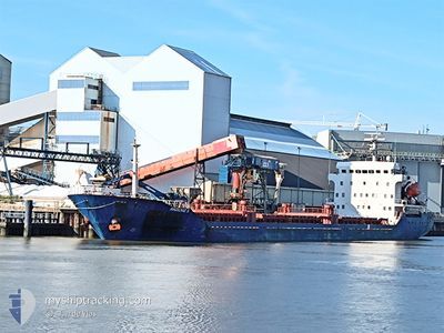
AKDENIZ S
General Cargo

Current Trip
| Time Travelled | 21 h, 31 mins |
|---|---|
| Remaining Time | --- |
| Distance Travelled | 159.38 nm |
| Remaining Distance | --- |
| AVG Speed | 9 Knop |
| MAX Speed | 12.8 Knop |
| AVG Wind | 19.9 knots |
| MAX Wind | 26.8 knots |
| MIN Temp | 8.1°C / 46.58°F |
| MAX Temp | 11.7°C / 53.06°F |
| Djupgående | 4.1 m |
| Position mottagen | 6 h, 21 m sen |
Current Position
| Longitud | --- |
|---|---|
| Latitude | --- |
| Status | Under way using engine |
| Fart | 12.8 Knop |
| Kurs | 191.3° |
| Område | Irish Sea and St. George's Channel |
| Station | T-AIS |
| Position mottagen | 6 h, 21 m sen |
Information
The current position of AKDENIZ S is in Irish Sea and St. George's Channel with coordinates 52.80759° / -5.62172° as reported on 2025-03-28 00:52 by AIS to our vessel tracker app. The vessel's current speed is 12.8 Knop and is heading at the port of ROUEN. The estimated time of arrival as calculated by MyShipTracking vessel tracking app is 2025-03-29 15:00 LT
The vessel AKDENIZ S (IMO: 9519377, MMSI: 352009000) is a General Cargo that was built in 2008 ( 17 År gammal ). It's sailing under the flag of [PA] Panama.
In this page you can find informations about the vessels current position, last detected port calls, and current voyage information. If the vessels is not in coverage by AIS you will find the latest position.
The current position of AKDENIZ S is detected by our AIS receivers and we are not responsible for the reliability of the data. The last position was recorded while the vessel was in Coverage by the Ais receivers of our vessel tracking app.
The current draught of AKDENIZ S as reported by AIS is 4.1 meters
Weather
| Temperature | 8.5°C / 47.3°F |
|---|---|
| Wind Speed | 19 knots |
| Direction | 288° WNW |
| Pressure | 1012.5 hPa |
| Humidity | 81.7 % |
| Cloud Coverage | 35 % |


Featured Company
Last Port Calls
| Port | Arrival | Departure | Time In Port |
|---|---|---|---|
| 2025-03-26 00:13 | 2025-03-27 09:42 | 1 d | |
| 2025-03-12 18:51 | 2025-03-15 13:17 | 2 d | |
| 2025-03-06 19:14 | 2025-03-07 19:25 | 1 d | |
| 2025-02-16 06:42 | 2025-02-19 13:42 | 3 d | |
| 2025-02-08 13:19 | 2025-02-12 03:28 | 3 d | |
| 2025-02-02 07:31 | 2025-02-05 08:26 | 3 d | |
| 2025-01-29 10:39 | 2025-01-29 11:10 | 30 m | |
| 2025-01-25 09:29 | 2025-01-29 10:03 | 4 d | |
| 2025-01-25 07:46 | 2025-01-25 08:28 | 41 m | |
| 2025-01-18 08:04 | 2025-01-21 00:42 | 2 d |
Last Trips
| Origin | Departure | Destination | Arrival | Distance | |
|---|---|---|---|---|---|
| 2025-03-15 13:17 | 2025-03-26 00:13 | 1450.51 nm | |||
| 2025-03-07 19:25 | 2025-03-12 18:51 | 837.01 nm | |||
| 2025-02-19 13:42 | 2025-03-06 19:14 | 1259.68 nm | |||
| 2025-02-12 03:28 | 2025-02-16 06:42 | 747.79 nm | |||
| 2025-02-05 08:26 | 2025-02-08 13:19 | 576.89 nm | |||
| 2025-01-29 11:10 | 2025-02-02 07:31 | 813.42 nm | |||
| 2025-01-29 10:03 | 2025-01-29 10:39 | 2.92 nm | |||
| 2025-01-25 08:28 | 2025-01-25 09:29 | 3.71 nm | |||
| 2025-01-21 00:42 | 2025-01-25 07:46 | 555.36 nm | |||
| 2025-01-15 08:11 | 2025-01-18 08:04 | 718.75 nm |
Events
| Tid | Event | Detaljer | Position / Dest | Information |
|---|---|---|---|---|
| 2025-03-28 00:52 | Status ändrad | Default Under way using engine |
52.80695 / -5.62195
FRURO
|
Fart: 12.8 kn Kurs: 191.3° |
| 2025-03-28 00:52 | UTANFÖR täckningsområde |
52.80759 / -5.62172
Irish Sea and St. George's Channel
FRURO
|
Fart: 12.8 kn Kurs: 191.3° |
|
| 2025-03-28 00:51 | Status ändrad | Under way using engine Default |
52.80868 / -5.62136
FRURO
|
Fart: 12.7 kn Kurs: 192° |
| 2025-03-28 00:44 | Status ändrad | Default Under way using engine |
52.83535 / -5.61207
FRURO
|
Fart: 12.8 kn Kurs: 192.4° |
| 2025-03-27 22:21 | Status ändrad | Under way using engine Default |
53.28079 / -5.50965
FRURO
|
Fart: 8.9 kn Kurs: 190° |
| 2025-03-27 22:20 | Status ändrad | Default Under way using engine |
53.28332 / -5.50879
FRURO
|
Fart: 8.9 kn Kurs: 181° |
| 2025-03-27 21:57 | Upptäckt i hav | Irish part of the Irish Sea and St. George's Channel |
53.33863 / -5.50295
Irish Sea and St. George's Channel
FRURO
|
Fart: 8.4 kn Kurs: 181.6° |
| 2025-03-27 21:57 | Status ändrad | Under way using engine Default |
53.33863 / -5.50295
FRURO
|
Fart: 8.3 kn Kurs: 182° |
| 2025-03-27 21:40 | I täckningsområde |
53.33863 / -5.50295
Irish Sea and St. George's Channel
FRURO
|
Fart: 8.4 kn Kurs: 181.6° |
|
| 2025-03-27 16:19 | UTANFÖR täckningsområde |
53.97063 / -5.41714
Irish Sea and St. George's Channel
FRURO
|
Fart: 7.3 kn Kurs: 184.7° |