
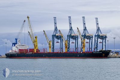
AGIOS NIKOLAOS
Bulk Carrier
Current Trip
| Time Travelled | 1 day |
|---|---|
| Remaining Time | -4 mins |
| Distance Travelled | 449.44 nm |
| Remaining Distance | 2.07 nm |
| AVG Speed | 9.9 Knop |
| MAX Speed | 11.1 Knop |
| AVG Wind | 15.5 knots |
| MAX Wind | 25.9 knots |
| MIN Temp | 14.8°C / 58.64°F |
| MAX Temp | 21.1°C / 69.98°F |
| Djupgående | 8.3 m |
| Position mottagen | 5 m sen |
Current Position
| Longitud | 26.89686° |
|---|---|
| Latitude | 38.78019° |
| Status | Under way using engine |
| Fart | 7.6 Knop |
| Kurs | 106.7° |
| Område | Aegean Sea |
| Station | T-AIS |
| Position mottagen | 5 m sen |
Info
Information
The current position of AGIOS NIKOLAOS is in Aegean Sea with coordinates 38.78019° / 26.89686° as reported on 2024-05-06 10:25 by AIS to our vessel tracker app. The vessel's current speed is 7.6 Knop and is heading at the port of NEMRUT. The estimated time of arrival as calculated by MyShipTracking vessel tracking app is 2024-05-06 10:26 LT
The vessel AGIOS NIKOLAOS (IMO: 9502776, MMSI: 636020106) is a Bulk Carrier that was built in 2010 ( 14 År gammal ). It's sailing under the flag of [LR] Liberia.
In this page you can find informations about the vessels current position, last detected port calls, and current voyage information. If the vessels is not in coverage by AIS you will find the latest position.
The current position of AGIOS NIKOLAOS is detected by our AIS receivers and we are not responsible for the reliability of the data. The last position was recorded while the vessel was in Coverage by the Ais receivers of our vessel tracking app.
The current draught of AGIOS NIKOLAOS as reported by AIS is 8.3 meters
Weather
| Temperature | 20.9°C / 69.62°F |
|---|---|
| Wind Speed | 8 knots |
| Direction | 347° NNW |
| Pressure | 1014.8 hPa |
| Humidity | 28 % |
| Cloud Coverage | --- |
Featured Company
Most Visited Ports (Last year)
| Port | Arrivals | |
|---|---|---|
| 5 | ||
| 2 | ||
| 2 | ||
| 2 | ||
| 1 | ||
| 1 |
Events
| Tid | Event | Detaljer | Position / Dest | Information |
|---|---|---|---|---|
| 2024-05-06 08:08 | Byter havsområde | Turkish part of the Aegean Sea Greek part of the Aegean Sea |
38.76692 / 26.41646
Aegean Sea
TRNEM
|
Fart: 10.8 kn Kurs: 88.8° |
| 2024-05-06 06:56 | ETA ändrat | 2024/05/06 10:30 2024/05/06 11:30 |
38.73145 / 26.14165
TRNEM
|
Fart: 11 kn Kurs: 73.5° |
| 2024-05-06 02:41 | Status ändrad | Under way using engine Default |
38.16850 / 25.81962
TRNEM
|
Fart: 10 kn Kurs: 352° |
| 2024-05-06 02:19 | Status ändrad | Default Under way using engine |
38.10333 / 25.82833
TRNEM
|
Fart: 10.4 kn Kurs: 354.8° |
| 2024-05-05 09:09 | ETA ändrat | 2024/05/06 11:30 2024/05/06 17:00 |
35.84231 / 27.55539
TRNEM
|
Fart: 9.9 kn Kurs: 302.6° |
| 2024-05-05 08:49 | Upptäckt i hav | Greek part of the Aegean Sea |
35.81343 / 27.61274
Aegean Sea
TRNEM
|
Fart: 10 kn Kurs: 302.3° |
| 2024-05-05 02:43 | Upptäckt i hav | Greek part of the Mediterranean Sea - Eastern Basin |
35.59747 / 28.80775
Mediterranean Sea - Eastern Basin
TRNEM
|
Fart: 10.4 kn Kurs: 258.7° |
| 2024-05-05 01:28 | Byter havsområde | Turkish part of the Mediterranean Sea - Eastern Basin Greek part of the Mediterranean Sea - Eastern Basin |
35.63683 / 29.07757
Mediterranean Sea - Eastern Basin
TRNEM
|
Fart: 10.6 kn Kurs: 259.3° |
| 2024-05-05 00:57 | Djupgående ändrat | 8.3 6.4 |
35.65369 / 29.18830
TRNEM
|
Fart: 10.5 kn Kurs: 259.9° |
| 2024-05-05 00:57 | Destination ändrad | TRNEM ANTALYA |
35.65369 / 29.18830
TRNEM
|
Fart: 10.5 kn Kurs: 259.9° |