

AG.ANTONIOS
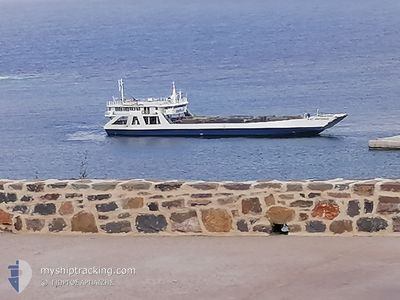
Ro-Ro/Passenger Ship

Current Trip
| Time Travelled | 4 h, 7 mins |
|---|---|
| Remaining Time | --- |
| Distance Travelled | 36.20 nm |
| Remaining Distance | --- |
| AVG Speed | 10.2 Knop |
| MAX Speed | 10.6 Knop |
| AVG Wind | 15.3 knots |
| MAX Wind | 16 knots |
| MIN Temp | 7.1°C / 44.78°F |
| MAX Temp | 9.6°C / 49.28°F |
| Djupgående | 0 m |
| Position mottagen | 32 m sen |
Current Position
| Longitud | --- |
|---|---|
| Latitude | --- |
| Status | Under way using engine |
| Fart | 10.2 Knop |
| Kurs | 254.8° |
| Område | Aegean Sea |
| Station | T-AIS |
| Position mottagen | 32 m sen |
Information
The current position of AG.ANTONIOS is in Aegean Sea with coordinates 36.55144° / 26.37586° as reported on 2025-02-24 13:45 by AIS to our vessel tracker app. The vessel's current speed is 10.2 Knop
The vessel AG.ANTONIOS (IMO: 9027099, MMSI: 237112600) is a Ro-Ro/Passenger Ship that was built in 1977 ( 48 År gammal ). It's sailing under the flag of [GR] Greece.
In this page you can find informations about the vessels current position, last detected port calls, and current voyage information. If the vessels is not in coverage by AIS you will find the latest position.
The current position of AG.ANTONIOS is detected by our AIS receivers and we are not responsible for the reliability of the data. The last position was recorded while the vessel was in Coverage by the Ais receivers of our vessel tracking app.
Weather
| Temperature | 9.5°C / 49.1°F |
|---|---|
| Wind Speed | 16 knots |
| Direction | 348° NNW |
| Pressure | 1029.8 hPa |
| Humidity | 52.9 % |
| Cloud Coverage | --- |


Featured Company
Last Port Calls
| Port | Arrival | Departure | Time In Port |
|---|---|---|---|
| 2025-02-24 10:10 | |||
| 2025-02-22 21:11 | |||
| 2025-02-21 09:20 | 2025-02-21 10:01 | 41 m | |
| 2025-02-19 12:40 | 2025-02-21 02:02 | 1 d | |
| 2025-02-18 09:01 | 2025-02-18 19:57 | 10 h | |
| 2025-02-16 16:26 | 2025-02-17 12:00 | 19 h | |
| 2025-02-16 12:26 | 2025-02-16 14:11 | 1 h | |
| 2025-02-16 09:05 | 2025-02-16 10:35 | 1 h | |
| 2025-02-16 00:01 | 2025-02-16 06:52 | 6 h | |
| 2025-02-15 20:43 | 2025-02-15 21:40 | 56 m |
Last Trips
| Origin | Departure | Destination | Arrival | Distance | |
|---|---|---|---|---|---|
| 2025-02-21 04:02 | 2025-02-21 11:20 | 69.90 nm | |||
| 2025-02-18 21:57 | 2025-02-19 14:40 | 76.09 nm | |||
| 2025-02-17 14:00 | 2025-02-18 11:01 | 7.11 nm | |||
| 2025-02-16 16:11 | 2025-02-16 18:26 | 21.33 nm | |||
| 2025-02-16 12:35 | 2025-02-16 14:26 | 17.24 nm | |||
| 2025-02-16 08:52 | 2025-02-16 11:05 | 21.36 nm | |||
| 2025-02-15 23:40 | 2025-02-16 02:01 | 18.45 nm | |||
| 2025-02-14 20:46 | 2025-02-15 22:43 | 126.35 nm | |||
| 2025-02-14 18:40 | 2025-02-14 19:41 | 7.41 nm | |||
| 2025-02-14 16:57 | 2025-02-14 18:07 | 10.27 nm |
Events
| Tid | Event | Detaljer | Position / Dest | Information |
|---|---|---|---|---|
| 2025-02-24 12:27 | Destination ändrad | GRJTY GRKMI |
36.66796 / 26.60431
GRJTY
|
Fart: 10.6 kn Kurs: 227.9° |
| 2025-02-24 12:27 | ETA ändrat | 2025/02/24 17:00 2025/02/23 05:30 |
36.66796 / 26.60431
GRJTY
|
Fart: 10.6 kn Kurs: 227.9° |
| 2025-02-24 11:59 | Upptäckt i hav | Greek part of the Aegean Sea |
36.72111 / 26.68164
Aegean Sea
|
Fart: 10.5 kn Kurs: 231.2° |
| 2025-02-24 11:57 | Status ändrad | Under way using engine Default |
36.72504 / 26.68705
GRKMI
|
Fart: 10.3 kn Kurs: 227° |
| 2025-02-24 11:41 | I täckningsområde |
36.72111 / 26.68164
Aegean Sea
|
Fart: 10.5 kn Kurs: 231.2° |
|
| 2025-02-24 10:10 | AVGÅTT HAMN |
|
36.91589 / 26.97337
GRKMI
|
Fart: 10.3 kn Kurs: -1° |
| 2025-02-24 09:55 | STARTAR förflyttning |
36.94754 / 26.99075
[GR] KALYMNOS
|
Fart: 8.3 kn Kurs: -1° |
|
| 2025-02-22 23:58 | Status ändrad | Default Under way using engine |
36.70667 / 27.35333
GRKMI
|
Fart: 9.3 kn Kurs: 313.1° |
| 2025-02-22 23:43 | UTANFÖR täckningsområde |
36.66975 / 27.35860
Aegean Sea
GRKMI
|
Fart: 9.3 kn Kurs: 313.1° |
|
| 2025-02-22 22:45 | Status ändrad | Under way using engine Default |
36.61114 / 27.54207
GRKMI
|
Fart: 9.8 kn Kurs: 290° |