
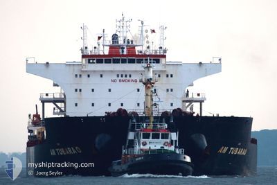
AG SATURN
Bulk Carrier
Current Trip
| Time Travelled | 6 days |
|---|---|
| Remaining Time | --- |
| Distance Travelled | 1664.02 nm |
| Remaining Distance | --- |
| AVG Speed | 9.5 Knop |
| MAX Speed | 13.8 Knop |
| AVG Wind | 13.9 knots |
| MAX Wind | 24.7 knots |
| MIN Temp | 9.8°C / 49.64°F |
| MAX Temp | 16.4°C / 61.52°F |
| Djupgående | 14.6 m |
| Position mottagen | 2 h, 15 m sen |
Current Position
| Longitud | -1.46052° |
|---|---|
| Latitude | 50.24350° |
| Status | Under way using engine |
| Fart | 7.3 Knop |
| Kurs | 254.3° |
| Område | English Channel |
| Station | T-AIS |
| Position mottagen | 2 h, 15 m sen |
Info
Information
The current position of AG SATURN is in English Channel with coordinates 50.24350° / -1.46052° as reported on 2024-06-08 21:29 by AIS to our vessel tracker app. The vessel's current speed is 7.3 Knop and is heading at the port of ICDAS. The estimated time of arrival as calculated by MyShipTracking vessel tracking app is 2024-06-19 09:05 LT
The vessel AG SATURN (IMO: 9593488, MMSI: 636015171) is a Bulk Carrier that was built in 2011 ( 13 År gammal ). It's sailing under the flag of [LR] Liberia.
In this page you can find informations about the vessels current position, last detected port calls, and current voyage information. If the vessels is not in coverage by AIS you will find the latest position.
The current position of AG SATURN is detected by our AIS receivers and we are not responsible for the reliability of the data. The last position was recorded while the vessel was in Coverage by the Ais receivers of our vessel tracking app.
The current draught of AG SATURN as reported by AIS is 14.6 meters
Weather
| Temperature | 13.5°C / 56.3°F |
|---|---|
| Wind Speed | 13 knots |
| Direction | 346° NNW |
| Pressure | 1016 hPa |
| Humidity | 76.4 % |
| Cloud Coverage | 11 % |
Featured Company
Most Visited Ports (Last year)
| Port | Arrivals | |
|---|---|---|
| 4 | ||
| 4 | ||
| 3 | ||
| 2 | ||
| 1 | ||
| 1 |
Events
| Tid | Event | Detaljer | Position / Dest | Information |
|---|---|---|---|---|
| 2024-06-08 21:35 | Status ändrad | Default Under way using engine |
50.24005 / -1.48016
TR IDS
|
Fart: 7.3 kn Kurs: 254.3° |
| 2024-06-08 21:29 | UTANFÖR täckningsområde |
50.24350 / -1.46052
English Channel
TR IDS
|
Fart: 7.3 kn Kurs: 254.3° |
|
| 2024-06-08 13:02 | Status ändrad | Under way using engine Default |
50.66703 / .74534
TR IDS
|
Fart: 9.8 kn Kurs: 239° |
| 2024-06-08 13:01 | Status ändrad | Default Under way using engine |
50.66821 / .74850
TR IDS
|
Fart: 9.7 kn Kurs: 240.1° |
| 2024-06-08 12:46 | Status ändrad | Under way using engine Default |
50.68916 / .80563
TR IDS
|
Fart: 9.4 kn Kurs: 240° |
| 2024-06-08 12:29 | Status ändrad | Default Under way using engine |
50.71063 / .86541
TR IDS
|
Fart: 9.1 kn Kurs: 238.6° |
| 2024-06-08 12:22 | Status ändrad | Under way using engine Default |
50.71973 / .89057
TR IDS
|
Fart: 9.1 kn Kurs: 238° |
| 2024-06-08 12:17 | Status ändrad | Default Under way using engine |
50.72608 / .90708
TR IDS
|
Fart: 9 kn Kurs: 239.1° |
| 2024-06-08 11:56 | Status ändrad | Under way using engine Default |
50.75321 / .97763
TR IDS
|
Fart: 9 kn Kurs: 238° |
| 2024-06-08 11:33 | Status ändrad | Default Under way using engine |
50.78356 / 1.05529
TR IDS
|
Fart: 9.1 kn Kurs: 238.7° |