
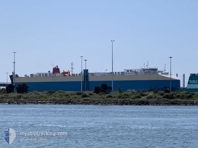
ADRIA ACE
Vehicles Carrier
Current Trip
JPKND
| Time Travelled | 11 h, 54 mins |
|---|---|
| Remaining Time | --- |
| Distance Travelled | 209.90 nm |
| Remaining Distance | --- |
| AVG Speed | 17.9 Knop |
| MAX Speed | 20.6 Knop |
| AVG Wind | 5.7 knots |
| MAX Wind | 10 knots |
| MIN Temp | 6°C / 42.8°F |
| MAX Temp | 12.7°C / 54.86°F |
| Djupgående | 8.1 m |
| Position mottagen | 8 d sen |
Current Position
| Longitud | --- |
|---|---|
| Latitude | --- |
| Status | Under way using engine |
| Fart | 19.4 Knop |
| Kurs | 76.1° |
| Område | Singapore Strait |
| Station | T-AIS |
| Position mottagen | 8 d sen |
Info
Information
The current position of ADRIA ACE is in Singapore Strait with coordinates 1.26369° / 104.17554° as reported on 2025-11-27 11:49 by AIS to our vessel tracker app. The vessel's current speed is 19.4 Knop
The vessel ADRIA ACE (IMO: 9446881, MMSI: 311003900) is a Vehicles Carrier that was built in 2009 ( 16 År gammal ). It's sailing under the flag of [BS] Bahamas.
In this page you can find informations about the vessels current position, last detected port calls, and current voyage information. If the vessels is not in coverage by AIS you will find the latest position.
The current position of ADRIA ACE is detected by our AIS receivers and we are not responsible for the reliability of the data. The last position was recorded while the vessel was in Coverage by the Ais receivers of our vessel tracking app.
The current draught of ADRIA ACE as reported by AIS is 8.1 meters
Weather
| Temperature | 12.6°C / 54.68°F |
|---|---|
| Wind Speed | 2 knots |
| Direction | 304° NW |
| Pressure | 1023.3 hPa |
| Humidity | 54.1 % |
| Cloud Coverage | 32 % |
Featured Company
Last Port Calls
| Port | Arrival | Departure | Time In Port |
|---|---|---|---|
| 2025-12-05 06:57 | 2025-12-05 19:45 | 12 h | |
| 2025-11-15 22:27 | 2025-11-18 14:35 | 2 d | |
| 2025-11-02 07:00 | 2025-11-02 13:54 | 6 h | |
| 2025-10-25 06:56 | 2025-10-25 18:09 | 11 h | |
| 2025-10-20 05:40 | 2025-10-20 18:24 | 12 h | |
| 2025-10-19 07:16 | 2025-10-20 05:03 | 21 h | |
| 2025-10-18 06:24 | 2025-10-18 15:48 | 9 h | |
| 2025-10-05 11:31 | 2025-10-06 00:50 | 13 h | |
| 2025-10-04 05:22 | 2025-10-04 23:05 | 17 h | |
| 2025-10-01 14:18 | 2025-10-03 00:11 | 1 d |
Last Trips
| Origin | Departure | Destination | Arrival | Distance | |
|---|---|---|---|---|---|
| 2025-11-18 14:35 | 2025-12-05 06:57 | 6852.00 nm | |||
| 2025-11-02 13:54 | 2025-11-15 22:27 | 4150.48 nm | |||
| 2025-10-25 18:09 | 2025-11-02 07:00 | 2708.50 nm | |||
| 2025-10-20 18:24 | 2025-10-25 06:56 | 913.81 nm | |||
| 2025-10-20 05:03 | 2025-10-20 05:40 | 7.88 nm | |||
| 2025-10-18 15:48 | 2025-10-19 07:16 | 215.75 nm | |||
| 2025-10-06 00:50 | 2025-10-18 06:24 | 5116.90 nm | |||
| 2025-10-04 23:05 | 2025-10-05 11:31 | 181.27 nm | |||
| 2025-10-03 00:11 | 2025-10-04 05:22 | 397.21 nm | |||
| 2025-09-20 14:56 | 2025-10-01 14:18 | 4396.66 nm |
Events
| Tid | Event | Detaljer | Position / Dest | Information |
|---|---|---|---|---|
| 2025-12-05 10:45 | AVGÅTT HAMN |
|
33.80554 / 131.03538
JPKND
|
Fart: 13.3 kn Kurs: 38° |
| 2025-12-05 10:41 | STARTAR förflyttning |
33.79826 / 131.02011
[JP] KANDA
|
Fart: 13.3 kn Kurs: 38° |
|
| 2025-12-04 22:20 | STOPPAR förflyttning |
33.77725 / 131.00890
[JP] KANDA
|
Fart: 0.2 kn Kurs: 72° |
|
| 2025-12-04 21:57 | ANLÄNDER HAMN |
|
33.80055 / 131.02318
[JP] KANDA
|
Fart: 7.1 kn Kurs: 248° |
| 2025-11-27 17:24 | STARTAR förflyttning | 20.79 nm, North East of TELOK RAMUNIA |
1.55354 / 104.53574
JPKND
|
Fart: 8 kn Kurs: 54° |
| 2025-11-27 16:22 | STOPPAR förflyttning | 20.69 nm, North East of TELOK RAMUNIA |
1.55167 / 104.53500
JPKND
|
Fart: Kurs: -1° |
| 2025-11-27 16:05 | STARTAR förflyttning | 20.28 nm, North East of TELOK RAMUNIA |
1.54790 / 104.52931
JPKND
|
Fart: 4.5 kn Kurs: 29° |
| 2025-11-27 15:16 | STOPPAR förflyttning | 20.09 nm, North East of TELOK RAMUNIA |
1.53833 / 104.53167
JPKND
|
Fart: Kurs: -1° |
| 2025-11-27 11:57 | Status ändrad | Default Under way using engine |
1.27301 / 104.21714
JPKND
|
Fart: 19.4 kn Kurs: 76.1° |
| 2025-11-27 11:49 | UTANFÖR täckningsområde |
1.26369 / 104.17554
Singapore Strait
JPKND
|
Fart: 19.4 kn Kurs: 76.1° |