
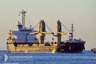
ADAVEGA
Bulk Carrier
Current Trip
| Trip Time | 18 days |
|---|---|
| Trip Distance | 3259.68 nm |
| AVG Speed | 10 Knop |
| MAX Speed | 13.4 Knop |
| Djupgående | 8.9 m |
| AVG Wind | 10.6 knots |
| MAX Wind | 32.4 knots |
| MIN Temp | 10.6°C / 51.08°F |
| MAX Temp | 20.5°C / 68.9°F |
| Position mottagen | 2 m sen |
Current Position
| Longitud | 4.42742° |
|---|---|
| Latitude | 51.89685° |
| Status | Moored |
| Fart | |
| Kurs | 246° |
| Område | North Sea |
| Station | T-AIS |
| Position mottagen | 2 m sen |
Info
Information
The current position of ADAVEGA is in North Sea with coordinates 51.89685° / 4.42742° as reported on 2024-05-15 07:06 by AIS to our vessel tracker app. The vessel's current speed is 0 Knop and is currently inside the port of ROTTERDAM WAALHAVEN.
The vessel ADAVEGA (IMO: 9539339, MMSI: 636019710) is a Bulk Carrier that was built in 2010 ( 14 År gammal ). It's sailing under the flag of [LR] Liberia.
In this page you can find informations about the vessels current position, last detected port calls, and current voyage information. If the vessels is not in coverage by AIS you will find the latest position.
The current position of ADAVEGA is detected by our AIS receivers and we are not responsible for the reliability of the data. The last position was recorded while the vessel was in Coverage by the Ais receivers of our vessel tracking app.
The current draught of ADAVEGA as reported by AIS is 8.9 meters
Weather
| Temperature | 16.1°C / 60.98°F |
|---|---|
| Wind Speed | 4 knots |
| Direction | 195° SSW |
| Pressure | 1005.8 hPa |
| Humidity | 90.6 % |
| Cloud Coverage | 100 % |
Featured Company
Last Port Calls
| Port | Arrival | Departure | Time In Port |
|---|---|---|---|
| 2024-05-13 06:08 | |||
| 2024-04-21 16:47 | 2024-04-24 15:44 | 2 d | |
| 2024-04-12 11:03 | 2024-04-16 13:40 | 4 d | |
| 2024-04-09 17:50 | 2024-04-12 03:10 | 2 d | |
| 2024-04-03 07:56 | 2024-04-05 00:53 | 1 d | |
| 2024-03-19 11:58 | 2024-03-26 16:26 | 7 d | |
| 2024-03-10 19:10 | 2024-03-12 17:26 | 1 d | |
| 2024-03-02 17:48 |
Last Trips
| Origin | Departure | Destination | Arrival | Distance | |
|---|---|---|---|---|---|
| 2024-04-24 18:44 | 2024-05-13 08:08 | 3259.68 nm | |||
| 2024-04-16 15:40 | 2024-04-21 19:47 | 1215.34 nm | |||
| 2024-04-12 05:10 | 2024-04-12 13:03 | 91.38 nm | |||
| 2024-04-05 03:53 | 2024-04-09 19:50 | 1184.66 nm | |||
| 2024-03-26 18:26 | 2024-04-03 10:56 | 523.57 nm | |||
| 2024-03-12 17:26 | 2024-03-19 13:58 | 1850.55 nm | |||
| 2024-02-23 22:37 | 2024-03-02 18:48 | 2082.12 nm |
Events
| Tid | Event | Detaljer | Position / Dest | Information |
|---|---|---|---|---|
| 2024-05-14 11:16 | Status ändrad | Moored Default |
51.89607 / 4.42452
[NL] ROTTERDAM WAALHAVEN
|
Fart: Kurs: 246° |
| 2024-05-14 11:12 | Status ändrad | Default Moored |
51.89601 / 4.42452
[NL] ROTTERDAM WAALHAVEN
|
Fart: Kurs: 246° |
| 2024-05-14 11:01 | Status ändrad | Moored Default |
51.89608 / 4.42453
[NL] ROTTERDAM WAALHAVEN
|
Fart: Kurs: 246° |
| 2024-05-14 10:49 | Status ändrad | Default Moored |
51.89603 / 4.42447
[NL] ROTTERDAM WAALHAVEN
|
Fart: Kurs: 246° |
| 2024-05-14 10:13 | Status ändrad | Moored Default |
51.89595 / 4.42453
[NL] ROTTERDAM WAALHAVEN
|
Fart: Kurs: 246° |
| 2024-05-14 10:00 | Status ändrad | Default Moored |
51.89595 / 4.42455
[NL] ROTTERDAM WAALHAVEN
|
Fart: Kurs: 246° |
| 2024-05-13 06:37 | Status ändrad | Moored Under way using engine |
51.89612 / 4.42447
[NL] ROTTERDAM WAALHAVEN
|
Fart: Kurs: 246° |
| 2024-05-13 06:26 | STOPPAR förflyttning |
51.89592 / 4.42558
[NL] ROTTERDAM WAALHAVEN
|
Fart: 0.3 kn Kurs: 239° |
|
| 2024-05-13 06:08 | ANLÄNDER HAMN |
|
51.89943 / 4.43460
[NL] ROTTERDAM WAALHAVEN
|
Fart: 0.6 kn Kurs: 134° |
| 2024-05-13 01:42 | STARTAR förflyttning | 11.92 nm, North West of BROUWERSDAM |
51.90458 / 3.62837
NL RTM
|
Fart: 3.1 kn Kurs: 48° |