
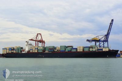
ABYAN
Container Ship
Current Trip
CN ZUH
| Time Travelled | --- |
|---|---|
| Remaining Time | --- |
| Distance Travelled | --- |
| Remaining Distance | --- |
| AVG Speed | --- |
| MAX Speed | --- |
| AVG Wind | --- |
| MAX Wind | --- |
| MIN Temp | --- |
| MAX Temp | --- |
| Djupgående | 14 m |
| Position mottagen | 14 h, 19 m sen |
Current Position
| Longitud | 119.34155° |
|---|---|
| Latitude | 22.73429° |
| Status | Under way using engine |
| Fart | 15.7 Knop |
| Kurs | 216.7° |
| Område | South China Sea |
| Station | T-AIS |
| Position mottagen | 14 h, 19 m sen |
Info
Information
The current position of ABYAN is in South China Sea with coordinates 22.73429° / 119.34155° as reported on 2024-04-28 01:48 by AIS to our vessel tracker app. The vessel's current speed is 15.7 Knop
The vessel ABYAN (IMO: 9349667, MMSI: 422031600) is a Container Ship that was built in 2008 ( 16 År gammal ). It's sailing under the flag of [IR] Iran.
In this page you can find informations about the vessels current position, last detected port calls, and current voyage information. If the vessels is not in coverage by AIS you will find the latest position.
The current position of ABYAN is detected by our AIS receivers and we are not responsible for the reliability of the data. The last position was recorded while the vessel was in Coverage by the Ais receivers of our vessel tracking app.
The current draught of ABYAN as reported by AIS is 14 meters
Weather
| Temperature | 26.4°C / 79.52°F |
|---|---|
| Wind Speed | 8 knots |
| Direction | 182° S |
| Pressure | 1010.9 hPa |
| Humidity | 93.3 % |
| Cloud Coverage | --- |
Featured Company
Last Trips
| Origin | Departure | Destination | Arrival | Distance | |
|---|---|---|---|---|---|
| 2024-04-05 22:26 | 2024-04-18 16:02 | 4900.95 nm | |||
| 2024-03-22 14:33 | 2024-03-31 03:41 | 351.45 nm | |||
| 2024-02-19 10:16 | 2024-02-28 11:29 | 1976.72 nm | |||
| 2024-02-06 09:48 | 2024-02-17 13:58 | 4306.08 nm | |||
| 2024-01-28 23:20 | 2024-02-05 09:20 | 869.56 nm |
Events
| Tid | Event | Detaljer | Position / Dest | Information |
|---|---|---|---|---|
| 2024-04-28 01:48 | Status ändrad | Default Under way using engine |
22.73108 / 119.33901
CN ZUH
|
Fart: 15.7 kn Kurs: 216.7° |
| 2024-04-28 01:48 | UTANFÖR täckningsområde |
22.73429 / 119.34155
South China Sea
|
Fart: 15.7 kn Kurs: 216.7° |
|
| 2024-04-28 01:38 | Status ändrad | Under way using engine Default |
22.76877 / 119.36941
CN ZUH
|
Fart: 15.7 kn Kurs: 218° |
| 2024-04-28 01:23 | I täckningsområde |
22.76835 / 119.36908
South China Sea
|
Fart: 15.6 kn Kurs: 216.4° |
|
| 2024-04-27 19:20 | Status ändrad | Default Under way using engine |
24.21429 / 120.10894
CN ZUH
|
Fart: 15.7 kn Kurs: 202.1° |
| 2024-04-27 19:17 | UTANFÖR täckningsområde |
24.22849 / 120.11534
South China Sea
|
Fart: 15.7 kn Kurs: 202.1° |
|
| 2024-04-27 19:15 | Status ändrad | Under way using engine Default |
24.23333 / 120.11751
CN ZUH
|
Fart: 15.9 kn Kurs: 202° |
| 2024-04-27 19:02 | Status ändrad | Default Under way using engine |
24.28975 / 120.14226
CN ZUH
|
Fart: 15.8 kn Kurs: 201.8° |
| 2024-04-27 18:58 | Byter havsområde | Taiwanese part of the South China Sea Taiwanese part of the Eastern China Sea |
24.30421 / 120.14855
South China Sea
|
Fart: 15.8 kn Kurs: 201.8° |
| 2024-04-27 18:58 | Status ändrad | Under way using engine Default |
24.30421 / 120.14855
CN ZUH
|
Fart: 15.6 kn Kurs: 210° |