

AB PALOMA
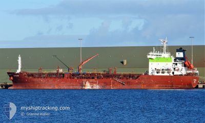
Oil/Chemical Tanker

Current Trip
REREU
| Time Travelled | 14 days |
|---|---|
| Remaining Time | --- |
| Distance Travelled | 1530.08 nm |
| Remaining Distance | --- |
| AVG Speed | 10.4 Knop |
| MAX Speed | 12.6 Knop |
| AVG Wind | 8.9 knots |
| MAX Wind | 15.6 knots |
| MIN Temp | 24.4°C / 75.92°F |
| MAX Temp | 28.5°C / 83.3°F |
| Djupgående | 6 m |
| Position mottagen | 2024-11-06 12:56 |
Current Position
| Longitud | --- |
|---|---|
| Latitude | --- |
| Status | Under way using engine |
| Fart | 12.2 Knop |
| Kurs | 327.9° |
| Område | South Atlantic Ocean |
| Station | T-AIS |
| Position mottagen | 2024-11-06 12:56 |
Information
The current position of AB PALOMA is in South Atlantic Ocean with coordinates -32.23610° / 15.23732° as reported on 2024-11-06 12:56 by AIS to our vessel tracker app. The vessel's current speed is 12.2 Knop
The vessel AB PALOMA (IMO: 9378199, MMSI: 352898752) is a Oil/Chemical Tanker that was built in 2007 ( 18 År gammal ). It's sailing under the flag of [PA] Panama.
In this page you can find informations about the vessels current position, last detected port calls, and current voyage information. If the vessels is not in coverage by AIS you will find the latest position.
The current position of AB PALOMA is detected by our AIS receivers and we are not responsible for the reliability of the data. The last position was recorded while the vessel was in Coverage by the Ais receivers of our vessel tracking app.
The current draught of AB PALOMA as reported by AIS is 6 meters
Weather
| Temperature | 27.8°C / 82.04°F |
|---|---|
| Wind Speed | 12 knots |
| Direction | 197° SSW |
| Pressure | 1008.1 hPa |
| Humidity | 81.1 % |
| Cloud Coverage | 88 % |


Featured Company
Last Port Calls
| Port | Arrival | Departure | Time In Port |
|---|---|---|---|
| 2025-02-03 23:07 | 2025-02-05 05:51 | 1 d | |
| 2025-01-04 10:20 | 2025-01-05 16:08 | 1 d | |
| 2024-12-05 14:46 | 2024-12-06 23:34 | 1 d |
Most Visited Ports (Last year)
| Port | Arrivals | |
|---|---|---|
| 4 | ||
| 3 | ||
| 2 | ||
| 2 | ||
| 1 | ||
| 1 |
Last Trips
| Origin | Departure | Destination | Arrival | Distance | |
|---|---|---|---|---|---|
| 2025-01-05 17:08 | 2025-02-03 23:07 | 3399.81 nm | |||
| 2024-12-06 23:34 | 2025-01-04 11:20 | 2138.53 nm | |||
| 2024-11-21 19:50 | 2024-12-05 14:46 | 781.73 nm |
Events
| Tid | Event | Detaljer | Position / Dest | Information |
|---|---|---|---|---|
| 2025-02-19 14:36 | STOPPAR förflyttning | 4.64 nm, North West of POINTE NOIRE |
-4.74173 / 11.76736
REREU
|
Fart: 0.3 kn Kurs: 190° |
| 2025-02-18 17:39 | STARTAR förflyttning |
-6.08158 / 8.29745
REREU
|
Fart: 3.2 kn Kurs: 65° |
|
| 2025-02-18 08:16 | STOPPAR förflyttning |
-6.08982 / 8.31852
REREU
|
Fart: Kurs: 99° |
|
| 2025-02-18 03:36 | STARTAR förflyttning |
-5.94805 / 8.09235
REREU
|
Fart: 3.8 kn Kurs: 161° |
|
| 2025-02-18 00:45 | STOPPAR förflyttning |
-5.95548 / 8.09770
REREU
|
Fart: 0.3 kn Kurs: 177° |
|
| 2025-02-17 05:33 | STOPPAR förflyttning |
-6.14468 / 8.26420
REREU
|
Fart: 0.3 kn Kurs: 172° |
|
| 2025-02-13 18:41 | STARTAR förflyttning | 8.31 nm, South of LOME |
5.99832 / 1.28440
REREU
|
Fart: 3.7 kn Kurs: 205° |
| 2025-02-13 08:54 | STOPPAR förflyttning | 8.18 nm, South of LOME |
6.00053 / 1.28838
REREU
|
Fart: Kurs: 244° |
| 2025-02-13 07:57 | STARTAR förflyttning | 5.91 nm, South of LOME |
6.03957 / 1.30118
REREU
|
Fart: 5.5 kn Kurs: 183° |
| 2025-02-12 19:27 | STOPPAR förflyttning | 5.57 nm, South of LOME |
6.04553 / 1.30228
REREU
|
Fart: Kurs: 254° |