

ZOI XL
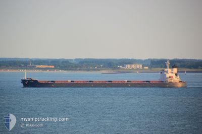
Bulk Carrier

Current Trip
| Time Travelled | 1 day |
|---|---|
| Remaining Time | --- |
| Distance Travelled | 447.29 nm |
| Remaining Distance | --- |
| AVG Speed | 11.2 Knopen |
| MAX Speed | 13.4 Knopen |
| AVG Wind | 16.3 knots |
| MAX Wind | 25.7 knots |
| MIN Temp | 5.4°C / 41.72°F |
| MAX Temp | 14.8°C / 58.64°F |
| Diepgang | 7 M |
| Positie ontvangen | 1 d geleden |
Current Position
| Lengtegraad | --- |
|---|---|
| Breedtegraat | --- |
| Status | Under way using engine |
| Snelheid | 12 Knopen |
| Koers | 251.4° |
| Gebied | Yellow Sea |
| Station | T-AIS |
| Positie ontvangen | 1 d geleden |
Information
The current position of ZOI XL is in Yellow Sea with coordinates 37.34903° / 126.50936° as reported on 2025-03-24 23:02 by AIS to our vessel tracker app. The vessel's current speed is 12 Knopen and is heading at the port of NANTONG. The estimated time of arrival as calculated by MyShipTracking vessel tracking app is 2025-03-28 04:00 LT
The vessel ZOI XL (IMO: 9326275, MMSI: 538007281) is a Bulk Carrier that was built in 2006 ( 19 Jaar oud ). It's sailing under the flag of [MH] Marshall Is.
In this page you can find informations about the vessels current position, last detected port calls, and current voyage information. If the vessels is not in coverage by AIS you will find the latest position.
The current position of ZOI XL is detected by our AIS receivers and we are not responsible for the reliability of the data. The last position was recorded while the vessel was in Coverage by the Ais receivers of our vessel tracking app.
The current draught of ZOI XL as reported by AIS is 7 meters
Weather
| Temperature | 14.2°C / 57.56°F |
|---|---|
| Wind Speed | 17 knots |
| Direction | 178° S |
| Pressure | 998.4 hPa |
| Humidity | 93.7 % |
| Cloud Coverage | 80 % |


Featured Company
Last Port Calls
| Port | Arrival | Departure | Time In Port |
|---|---|---|---|
| 2025-03-14 05:08 | 2025-03-25 07:20 | 11 d | |
| 2025-01-25 13:51 | 2025-01-26 16:35 | 1 d |
Last Trips
| Origin | Departure | Destination | Arrival | Distance | |
|---|---|---|---|---|---|
| 2025-01-26 16:35 | 2025-03-14 05:08 | 10105.20 nm | |||
| 2024-12-31 10:00 | 2025-01-25 13:51 | 5834.69 nm |
Events
| Tijd | Evenement | Details | Positie / Bestemming | Info |
|---|---|---|---|---|
| 2025-03-26 13:31 | Stop beweging |
31.05722 / 122.67453
NANTONG
|
Snelheid: Koers: 210° |
|
| 2025-03-24 23:07 | Status Changed | Default Under way using engine |
37.34651 / 126.48636
NANTONG
|
Snelheid: 12 kn Koers: 251.4° |
| 2025-03-24 23:02 | Buitenbereik |
37.34903 / 126.50936
Yellow Sea
NANTONG
|
Snelheid: 12 kn Koers: 251.4° |
|
| 2025-03-24 22:54 | Status Changed | Under way using engine Default |
37.36908 / 126.53047
NANTONG
|
Snelheid: 12.7 kn Koers: 212° |
| 2025-03-24 22:50 | Status Changed | Default Under way using engine |
37.38163 / 126.54036
NANTONG
|
Snelheid: 12.6 kn Koers: 212.5° |
| 2025-03-24 22:20 | Vertrekhaven |
|
37.46622 / 126.58885
NANTONG
|
Snelheid: 7 kn Koers: 249° |
| 2025-03-24 22:18 | Draught Changed | 7 11.7 |
37.46690 / 126.59256
[KR] INCHEON
|
Snelheid: 6.1 kn Koers: 259° |
| 2025-03-24 22:18 | Destination Changed | NANTONG INCHEON |
37.46690 / 126.59256
[KR] INCHEON
|
Snelheid: 6.1 kn Koers: 259° |
| 2025-03-24 22:18 | ETA Changed | 2025/03/27 20:00 2025/03/13 17:40 |
37.46690 / 126.59256
[KR] INCHEON
|
Snelheid: 6.1 kn Koers: 259° |
| 2025-03-24 22:15 | Start beweging |
37.46620 / 126.59803
[KR] INCHEON
|
Snelheid: 3.3 kn Koers: 282° |