

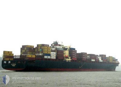
ZIM VIETNAM
Container Ship

Current Trip
| Time Travelled | 3 days |
|---|---|
| Remaining Time | 17 h, 6 mins |
| Distance Travelled | 1406.57 nm |
| Remaining Distance | 333.94 nm |
| AVG Speed | 18.2 Knopen |
| MAX Speed | 20.1 Knopen |
| AVG Wind | 13.1 knots |
| MAX Wind | 20.9 knots |
| MIN Temp | 8.8°C / 47.84°F |
| MAX Temp | 16.3°C / 61.34°F |
| Diepgang | 13.7 M |
| Positie ontvangen | Nu |
Current Position
| Lengtegraad | --- |
|---|---|
| Breedtegraat | --- |
| Status | Under way using engine |
| Snelheid | 19.5 Knopen |
| Koers | 60° |
| Gebied | English Channel |
| Station | T-AIS |
| Positie ontvangen | Nu |
Information
The current position of ZIM VIETNAM is in English Channel with coordinates 49.18897° / -4.56685° as reported on 2025-02-17 05:52 by AIS to our vessel tracker app. The vessel's current speed is 19.5 Knopen and is heading at the port of THAMES. The estimated time of arrival as calculated by MyShipTracking vessel tracking app is 2025-02-17 22:59 LT
The vessel ZIM VIETNAM (IMO: 9244922, MMSI: 636022113) is a Container Ship that was built in 2003 ( 22 Jaar oud ). It's sailing under the flag of [LR] Liberia.
In this page you can find informations about the vessels current position, last detected port calls, and current voyage information. If the vessels is not in coverage by AIS you will find the latest position.
The current position of ZIM VIETNAM is detected by our AIS receivers and we are not responsible for the reliability of the data. The last position was recorded while the vessel was in Coverage by the Ais receivers of our vessel tracking app.
The current draught of ZIM VIETNAM as reported by AIS is 13.7 meters
Weather
| Temperature | 8.9°C / 48.02°F |
|---|---|
| Wind Speed | 15 knots |
| Direction | 116° ESE |
| Pressure | 1015.4 hPa |
| Humidity | 73.2 % |
| Cloud Coverage | 100 % |


Featured Company
Last Port Calls
| Port | Arrival | Departure | Time In Port |
|---|---|---|---|
| 2025-02-12 23:58 | 2025-02-14 00:56 | 1 d | |
| 2025-02-07 12:04 | 2025-02-09 05:55 | 1 d | |
| 2025-02-03 04:02 | 2025-02-06 19:31 | 3 d | |
| 2025-01-30 15:32 | 2025-02-02 22:11 | 3 d | |
| 2025-01-22 05:42 | 2025-01-23 06:30 | 1 d | |
| 2025-01-18 20:49 | 2025-01-20 10:46 | 1 d | |
| 2025-01-14 12:51 | 2025-01-15 15:41 | 1 d | |
| 2025-01-12 06:12 | 2025-01-13 15:56 | 1 d | |
| 2025-01-09 07:51 | 2025-01-10 06:14 | 22 h | |
| 2024-12-29 13:38 | 2024-12-31 05:35 | 1 d |
Last Trips
| Origin | Departure | Destination | Arrival | Distance | |
|---|---|---|---|---|---|
| 2025-02-09 07:55 | 2025-02-13 00:58 | 1653.01 nm | |||
| 2025-02-06 21:31 | 2025-02-07 14:04 | 213.06 nm | |||
| 2025-02-03 00:11 | 2025-02-03 06:02 | 82.56 nm | |||
| 2025-01-23 07:30 | 2025-01-30 17:32 | 3271.21 nm | |||
| 2025-01-20 11:46 | 2025-01-22 06:42 | 269.92 nm | |||
| 2025-01-15 16:41 | 2025-01-18 21:49 | 410.42 nm | |||
| 2025-01-13 16:56 | 2025-01-14 13:51 | 301.55 nm | |||
| 2025-01-10 06:14 | 2025-01-12 07:12 | 154.61 nm | |||
| 2024-12-31 07:35 | 2025-01-09 07:51 | 3334.08 nm | |||
| 2024-12-29 03:21 | 2024-12-29 15:38 | 208.87 nm |
Events
| Tijd | Evenement | Details | Positie / Bestemming | Info |
|---|---|---|---|---|
| 2025-02-17 05:52 | Status Changed | Under way using engine Default |
49.18897 / -4.56685
GBLGP
|
Snelheid: 19.6 kn Koers: 60° |
| 2025-02-17 05:51 | Status Changed | Default Under way using engine |
49.18713 / -4.57180
GBLGP
|
Snelheid: 19.6 kn Koers: 60° |
| 2025-02-17 05:44 | Status Changed | Under way using engine Default |
49.16783 / -4.62562
GBLGP
|
Snelheid: 19.5 kn Koers: 62° |
| 2025-02-17 05:43 | Status Changed | Default Under way using engine |
49.16605 / -4.63102
GBLGP
|
Snelheid: 19.5 kn Koers: 63° |
| 2025-02-17 05:36 | Status Changed | Under way using engine Default |
49.14872 / -4.68347
GBLGP
|
Snelheid: 19.4 kn Koers: 62° |
| 2025-02-17 05:35 | Status Changed | Default Under way using engine |
49.14642 / -4.69005
GBLGP
|
Snelheid: 19.4 kn Koers: 61° |
| 2025-02-17 05:08 | Wijzig zee gebeid | French part of the English Channel French part of the Celtic Sea |
49.07775 / -4.89038
English Channel
GBLGP
|
Snelheid: 19.4 kn Koers: 62° |
| 2025-02-17 04:32 | Status Changed | Under way using engine Default |
48.98033 / -5.14687
GBLGP
|
Snelheid: 19.1 kn Koers: 59° |
| 2025-02-17 04:27 | Status Changed | Default Under way using engine |
48.96903 / -5.17888
GBLGP
|
Snelheid: 19 kn Koers: 63° |
| 2025-02-17 04:07 | Status Changed | Under way using engine Default |
48.92137 / -5.32125
GBLGP
|
Snelheid: 18.7 kn Koers: 63° |