

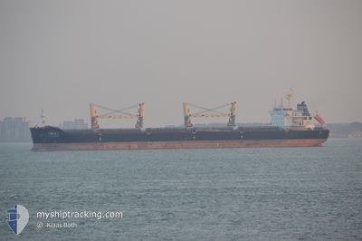
ZHONG HAI CHANG YUN6
Bulk Carrier

Current Trip
| Time Travelled | 26 days |
|---|---|
| Remaining Time | --- |
| Distance Travelled | 3256.53 nm |
| Remaining Distance | --- |
| AVG Speed | 8.4 Knopen |
| MAX Speed | 13.3 Knopen |
| AVG Wind | 8.4 knots |
| MAX Wind | 23.8 knots |
| MIN Temp | 20.8°C / 69.44°F |
| MAX Temp | 29.3°C / 84.74°F |
| Diepgang | 13 M |
| Positie ontvangen | 2 m geleden |
Current Position
| Lengtegraad | --- |
|---|---|
| Breedtegraat | --- |
| Status | At anchor |
| Snelheid | |
| Koers | 278° |
| Gebied | Singapore Strait |
| Station | T-AIS |
| Positie ontvangen | 2 m geleden |
Information
The current position of ZHONG HAI CHANG YUN6 is in Singapore Strait with coordinates 1.28918° / 103.95608° as reported on 2025-03-08 01:25 by AIS to our vessel tracker app. The vessel's current speed is 0 Knopen
The vessel ZHONG HAI CHANG YUN6 (IMO: 9617179, MMSI: 414712000) is a Bulk Carrier that was built in 2012 ( 13 Jaar oud ). It's sailing under the flag of [CN] China.
In this page you can find informations about the vessels current position, last detected port calls, and current voyage information. If the vessels is not in coverage by AIS you will find the latest position.
The current position of ZHONG HAI CHANG YUN6 is detected by our AIS receivers and we are not responsible for the reliability of the data. The last position was recorded while the vessel was in Coverage by the Ais receivers of our vessel tracking app.
The current draught of ZHONG HAI CHANG YUN6 as reported by AIS is 13 meters
Weather
| Temperature | 27.2°C / 80.96°F |
|---|---|
| Wind Speed | 10 knots |
| Direction | 40° NE |
| Pressure | 1008.9 hPa |
| Humidity | 81.1 % |
| Cloud Coverage | 100 % |


Featured Company
Last Trips
Events
| Tijd | Evenement | Details | Positie / Bestemming | Info |
|---|---|---|---|---|
| 2025-03-08 00:47 | Status Changed | At anchor Default |
1.28918 / 103.95605
SGSIN-PEBGB
|
Snelheid: Koers: 276° |
| 2025-03-08 00:33 | Status Changed | Default At anchor |
1.28917 / 103.95607
SGSIN-PEBGB
|
Snelheid: 0.1 kn Koers: 275° |
| 2025-03-08 00:00 | Status Changed | At anchor Default |
1.28922 / 103.95601
SGSIN-PEBGB
|
Snelheid: Koers: 276° |
| 2025-03-07 23:55 | Status Changed | Default At anchor |
1.28920 / 103.95597
SGSIN-PEBGB
|
Snelheid: Koers: 278° |
| 2025-03-07 23:19 | Status Changed | At anchor Default |
1.28764 / 103.95586
SGSIN-PEBGB
|
Snelheid: 0.3 kn Koers: 324° |
| 2025-03-07 23:16 | Status Changed | Default At anchor |
1.28740 / 103.95564
SGSIN-PEBGB
|
Snelheid: 0.6 kn Koers: 334° |
| 2025-03-07 21:40 | Status Changed | At anchor Default |
1.28872 / 103.95291
SGSIN-PEBGB
|
Snelheid: 0.1 kn Koers: 87° |
| 2025-03-07 21:35 | Status Changed | Default At anchor |
1.28878 / 103.95294
SGSIN-PEBGB
|
Snelheid: 0.1 kn Koers: 87° |
| 2025-03-07 21:23 | Status Changed | At anchor Default |
1.28883 / 103.95295
SGSIN-PEBGB
|
Snelheid: Koers: 87° |
| 2025-03-07 21:20 | Status Changed | Default At anchor |
1.28880 / 103.95295
SGSIN-PEBGB
|
Snelheid: Koers: 86° |