
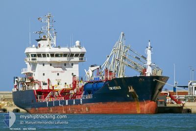
YM VENUS
Oil/Chemical Tanker
Current Trip
| Trip Time | 3 days |
|---|---|
| Trip Distance | 415.21 nm |
| AVG Speed | 8.7 Knopen |
| MAX Speed | 11.2 Knopen |
| Diepgang | 6.2 M |
| AVG Wind | 5.6 knots |
| MAX Wind | 22.8 knots |
| MIN Temp | 7°C / 44.6°F |
| MAX Temp | 19.8°C / 67.64°F |
| Positie ontvangen | 5 h, 2 m geleden |
Current Position
| Lengtegraad | --- |
|---|---|
| Breedtegraat | --- |
| Status | Under way using engine |
| Snelheid | 0.1 Knopen |
| Koers | 161° |
| Gebied | Sea of Marmara |
| Station | T-AIS |
| Positie ontvangen | 5 h, 2 m geleden |
Info
Information
The current position of YM VENUS is in Sea of Marmara with coordinates 40.75199° / 29.86069° as reported on 2024-11-22 05:57 by AIS to our vessel tracker app. The vessel's current speed is 0.1 Knopen and is currently inside the port of DERINCE.
The vessel YM VENUS (IMO: 9291585, MMSI: 215826000) is a Oil/Chemical Tanker that was built in 2005 ( 19 Jaar oud ). It's sailing under the flag of [MT] Malta.
In this page you can find informations about the vessels current position, last detected port calls, and current voyage information. If the vessels is not in coverage by AIS you will find the latest position.
The current position of YM VENUS is detected by our AIS receivers and we are not responsible for the reliability of the data. The last position was recorded while the vessel was in Coverage by the Ais receivers of our vessel tracking app.
The current draught of YM VENUS as reported by AIS is 6.2 meters
Weather
| Temperature | 15°C / 59°F |
|---|---|
| Wind Speed | 1 knots |
| Direction | 95° E |
| Pressure | 1013.3 hPa |
| Humidity | 63.7 % |
| Cloud Coverage | 13 % |
Featured Company
Last Port Calls
| Port | Arrival | Departure | Time In Port |
|---|---|---|---|
| 2024-11-22 05:07 | |||
| 2024-11-18 06:59 | 2024-11-18 23:33 | 16 h | |
| 2024-11-14 22:28 | 2024-11-15 20:04 | 21 h | |
| 2024-11-10 22:20 | 2024-11-11 12:16 | 13 h | |
| 2024-11-03 04:39 | 2024-11-03 23:40 | 19 h | |
| 2024-10-28 10:20 | 2024-10-29 11:08 | 1 d | |
| 2024-10-24 07:13 | 2024-10-25 01:11 | 17 h | |
| 2024-10-14 18:54 | 2024-10-16 10:32 | 1 d | |
| 2024-10-10 16:13 | 2024-10-11 12:17 | 20 h | |
| 2024-10-06 22:44 | 2024-10-07 13:58 | 15 h |
Last Trips
| Origin | Departure | Destination | Arrival | Distance | |
|---|---|---|---|---|---|
| 2024-11-19 01:33 | 2024-11-22 08:07 | 415.21 nm | |||
| 2024-11-15 21:04 | 2024-11-18 08:59 | 519.03 nm | |||
| 2024-11-11 13:16 | 2024-11-14 23:28 | 814.76 nm | |||
| 2024-11-04 02:40 | 2024-11-10 23:20 | 1623.30 nm | |||
| 2024-10-29 12:08 | 2024-11-03 07:39 | 869.78 nm | |||
| 2024-10-25 03:11 | 2024-10-28 11:20 | 812.31 nm | |||
| 2024-10-16 12:32 | 2024-10-24 09:13 | 1881.54 nm | |||
| 2024-10-11 14:17 | 2024-10-14 20:54 | 818.03 nm | |||
| 2024-10-07 15:58 | 2024-10-10 18:13 | 816.51 nm | |||
| 2024-10-03 16:25 | 2024-10-07 00:44 | 887.52 nm |
Events
| Tijd | Evenement | Details | Positie / Bestemming | Info |
|---|---|---|---|---|
| 2024-11-22 06:15 | Status Changed | Default Under way using engine |
40.75204 / 29.86064
[TR] DERINCE
|
Snelheid: 0.1 kn Koers: 161° |
| 2024-11-22 05:57 | Buitenbereik |
40.75199 / 29.86069
Sea of Marmara
[TR] DERINCE
|
Snelheid: 0.1 kn Koers: 19.6° |
|
| 2024-11-22 05:20 | Stop beweging |
40.75000 / 29.86033
[TR] DERINCE
|
Snelheid: 0.3 kn Koers: 59° |
|
| 2024-11-22 05:07 | Aankomsthaven |
|
40.74567 / 29.85233
[TR] DERINCE
|
Snelheid: 3.2 kn Koers: 59° |
| 2024-11-22 04:00 | Start beweging | 0.66 nm, South West of EVYAP |
40.76749 / 29.69866
GRPIR>TRDRC
|
Snelheid: 3.3 kn Koers: 145° |
| 2024-11-22 03:54 | Status Changed | Under way using engine At anchor |
40.76883 / 29.69600
GRPIR>TRDRC
|
Snelheid: 0.5 kn Koers: 101° |
| 2024-11-21 14:16 | Status Changed | At anchor Under way using engine |
40.76840 / 29.69657
GRPIR>TRDRC
|
Snelheid: 0.3 kn Koers: 72° |
| 2024-11-21 14:15 | Stop beweging | 0.73 nm, West of EVYAP |
40.76843 / 29.69660
GRPIR>TRDRC
|
Snelheid: 0.3 kn Koers: 83° |
| 2024-11-21 13:49 | Start beweging | 1.8 nm, West of EVYAP |
40.76333 / 29.67417
GRPIR>TRDRC
|
Snelheid: 3.9 kn Koers: 62° |
| 2024-11-21 13:41 | Status Changed | Under way using engine At anchor |
40.76083 / 29.67033
GRPIR>TRDRC
|
Snelheid: 0.5 kn Koers: 49° |