
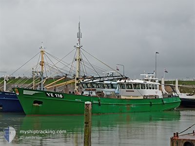
YE116 ELIZABETH
Fishing Vessel
Current Trip
WADDENZEE
| Time Travelled | 2 days |
|---|---|
| Remaining Time | --- |
| Distance Travelled | 135.95 nm |
| Remaining Distance | --- |
| AVG Speed | 6.6 Knopen |
| MAX Speed | 13.4 Knopen |
| AVG Wind | 9.2 knots |
| MAX Wind | 13 knots |
| MIN Temp | 8.6°C / 47.48°F |
| MAX Temp | 13.2°C / 55.76°F |
| Diepgang | 1 M |
| Positie ontvangen | 1 m geleden |
Current Position
| Lengtegraad | 5.15720° |
|---|---|
| Breedtegraat | 53.24953° |
| Status | Under way using engine |
| Snelheid | 8.7 Knopen |
| Koers | 201.5° |
| Gebied | North Sea |
| Station | T-AIS |
| Positie ontvangen | 1 m geleden |
Info
Information
The current position of YE116 ELIZABETH is in North Sea with coordinates 53.24953° / 5.15720° as reported on 2024-05-08 12:19 by AIS to our vessel tracker app. The vessel's current speed is 8.7 Knopen
The vessel YE116 ELIZABETH (IMO: 8897863, MMSI: 244731000) is a Fishing Vessel that was built in 1994 ( 30 Jaar oud ). It's sailing under the flag of [NL] Netherlands.
In this page you can find informations about the vessels current position, last detected port calls, and current voyage information. If the vessels is not in coverage by AIS you will find the latest position.
The current position of YE116 ELIZABETH is detected by our AIS receivers and we are not responsible for the reliability of the data. The last position was recorded while the vessel was in Coverage by the Ais receivers of our vessel tracking app.
The current draught of YE116 ELIZABETH as reported by AIS is 1 meters
Weather
| Temperature | 11.7°C / 53.06°F |
|---|---|
| Wind Speed | 10 knots |
| Direction | 12° NNE |
| Pressure | 1028.1 hPa |
| Humidity | 89.1 % |
| Cloud Coverage | 69 % |
Featured Company
Last Port Calls
| Port | Arrival | Departure | Time In Port |
|---|---|---|---|
| 2024-05-02 13:46 | 2024-05-06 04:24 | 3 d | |
| 2024-04-25 11:18 | 2024-04-29 05:46 | 3 d | |
| 2024-04-23 14:59 | 2024-04-23 15:12 | 12 m | |
| 2024-04-23 10:58 | 2024-04-23 11:13 | 14 m | |
| 2024-04-18 16:20 | 2024-04-22 05:13 | 3 d | |
| 2024-04-16 05:44 | 2024-04-16 08:40 | 2 h | |
| 2024-04-11 16:08 | 2024-04-15 06:13 | 3 d | |
| 2024-04-09 10:45 | 2024-04-09 14:51 | 4 h | |
| 2024-04-08 15:37 | 2024-04-09 05:08 | 13 h | |
| 2024-04-04 09:30 | 2024-04-07 20:39 | 3 d |
Most Visited Ports (Last year)
| Port | Arrivals | |
|---|---|---|
| 82 | ||
| 34 | ||
| 5 | ||
| 2 | ||
| 2 | ||
| 1 |
Last Trips
| Origin | Departure | Destination | Arrival | Distance | |
|---|---|---|---|---|---|
| 2024-04-29 07:46 | 2024-05-02 15:46 | 170.42 nm | |||
| 2024-04-23 17:12 | 2024-04-25 13:18 | 111.91 nm | |||
| 2024-04-23 13:13 | 2024-04-23 16:59 | 1.68 nm | |||
| 2024-04-22 07:13 | 2024-04-23 12:58 | 48.62 nm | |||
| 2024-04-16 10:40 | 2024-04-18 18:20 | 47.16 nm | |||
| 2024-04-15 08:13 | 2024-04-16 07:44 | 1.80 nm | |||
| 2024-04-09 16:51 | 2024-04-11 18:08 | 45.17 nm | |||
| 2024-04-09 07:08 | 2024-04-09 12:45 | 1.43 nm | |||
| 2024-04-07 22:39 | 2024-04-08 17:37 | 44.15 nm | |||
| 2024-04-02 06:29 | 2024-04-04 11:30 | 47.74 nm |
Events
| Tijd | Evenement | Details | Positie / Bestemming | Info |
|---|---|---|---|---|
| 2024-05-08 11:49 | Start beweging | 3.48 nm, South East of TERSCHELLING |
53.30465 / 5.26295
WADDENZEE
|
Snelheid: 11.7 kn Koers: 225.8° |
| 2024-05-08 11:48 | Stop beweging | 3.37 nm, South East of TERSCHELLING |
53.30694 / 5.26412
WADDENZEE
|
Snelheid: 0.3 kn Koers: 87° |
| 2024-05-08 11:43 | Start beweging | 3.41 nm, South East of TERSCHELLING |
53.30609 / 5.26379
WADDENZEE
|
Snelheid: 5.9 kn Koers: 271.1° |
| 2024-05-08 11:39 | Stop beweging | 3.47 nm, South East of TERSCHELLING |
53.30613 / 5.26699
WADDENZEE
|
Snelheid: 0.2 kn Koers: 26° |
| 2024-05-08 10:52 | Start beweging | 5.38 nm, East of TERSCHELLING |
53.35204 / 5.36786
WADDENZEE
|
Snelheid: 5.4 kn Koers: 205.6° |
| 2024-05-08 10:49 | Stop beweging | 5.47 nm, East of TERSCHELLING |
53.35303 / 5.37040
WADDENZEE
|
Snelheid: 0.2 kn Koers: 9° |
| 2024-05-08 04:05 | Start beweging | 8.3 nm, North East of OUDESCHILD |
53.09845 / 5.06391
WADDENZEE
|
Snelheid: 3.1 kn Koers: 165° |
| 2024-05-08 03:56 | Stop beweging | 8.25 nm, East of OUDESCHILD |
53.09430 / 5.06544
WADDENZEE
|
Snelheid: 0.1 kn Koers: 276° |
| 2024-05-08 03:40 | Start beweging | 8.31 nm, North East of OUDESCHILD |
53.09690 / 5.06546
WADDENZEE
|
Snelheid: 3.1 kn Koers: 12° |
| 2024-05-07 20:18 | Binnenbereik |
53.09849 / 5.06752
North Sea
|
Snelheid: 0.1 kn Koers: 283.1° |