
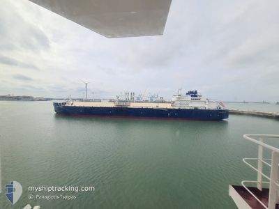
YAKOV GAKKEL
Other Type
Current Trip
FOR ORDERS
| Time Travelled | 2 days |
|---|---|
| Remaining Time | --- |
| Distance Travelled | 1055.95 nm |
| Remaining Distance | --- |
| AVG Speed | 15.6 Knopen |
| MAX Speed | 19.5 Knopen |
| AVG Wind | 12.2 knots |
| MAX Wind | 21.3 knots |
| MIN Temp | -28.3°C / -18.94°F |
| MAX Temp | -0.5°C / 31.1°F |
| Diepgang | 10.9 M |
| Positie ontvangen | 7 d geleden |
Current Position
| Lengtegraad | --- |
|---|---|
| Breedtegraat | --- |
| Status | Under way using engine |
| Snelheid | 17.7 Knopen |
| Koers | 49.8° |
| Gebied | Barentsz Sea |
| Station | T-AIS |
| Positie ontvangen | 7 d geleden |
Info
Information
The current position of YAKOV GAKKEL is in Barentsz Sea with coordinates 72.31222° / 25.72490° as reported on 2025-02-10 01:19 by AIS to our vessel tracker app. The vessel's current speed is 17.7 Knopen
The vessel YAKOV GAKKEL (IMO: 9750672, MMSI: 311000634) is a Other Type It's sailing under the flag of [BS] Bahamas.
In this page you can find informations about the vessels current position, last detected port calls, and current voyage information. If the vessels is not in coverage by AIS you will find the latest position.
The current position of YAKOV GAKKEL is detected by our AIS receivers and we are not responsible for the reliability of the data. The last position was recorded while the vessel was in Coverage by the Ais receivers of our vessel tracking app.
The current draught of YAKOV GAKKEL as reported by AIS is 10.9 meters
Weather
| Temperature | -0.4°C / 31.28°F |
|---|---|
| Wind Speed | 20 knots |
| Direction | 19° NNE |
| Pressure | 1014.7 hPa |
| Humidity | 74.7 % |
| Cloud Coverage | 100 % |
Featured Company
Last Port Calls
| Port | Arrival | Departure | Time In Port |
|---|---|---|---|
| 2025-02-13 08:38 | 2025-02-14 10:16 | 1 d | |
| 2025-02-05 15:09 | 2025-02-06 14:40 | 23 h | |
| 2025-01-29 00:17 | 2025-01-30 00:47 | 1 d | |
| 2025-01-18 04:53 | 2025-01-19 07:42 | 1 d | |
| 2025-01-09 07:42 | 2025-01-10 07:34 | 23 h | |
| 2025-01-01 23:28 | 2025-01-02 23:31 | 1 d | |
| 2024-12-22 20:01 | 2024-12-24 02:10 | 1 d | |
| 2024-12-12 13:58 | 2024-12-14 02:38 | 1 d | |
| 2024-12-12 13:26 | 2024-12-12 13:38 | 12 m | |
| 2024-12-02 04:33 | 2024-12-03 07:28 | 1 d |
Last Trips
| Origin | Departure | Destination | Arrival | Distance | |
|---|---|---|---|---|---|
| 2025-02-06 14:40 | 2025-02-13 08:38 | 2645.03 nm | |||
| 2025-01-30 00:47 | 2025-02-05 15:09 | 2672.35 nm | |||
| 2025-01-19 07:42 | 2025-01-29 00:17 | 3203.39 nm | |||
| 2025-01-10 07:34 | 2025-01-18 04:53 | 3187.52 nm | |||
| 2025-01-02 23:31 | 2025-01-09 07:42 | 2646.83 nm | |||
| 2024-12-24 02:10 | 2025-01-01 23:28 | 2760.23 nm | |||
| 2024-12-14 02:38 | 2024-12-22 20:01 | 3290.53 nm | |||
| 2024-12-12 13:38 | 2024-12-12 13:58 | 0.24 nm | |||
| 2024-12-03 07:28 | 2024-12-12 13:26 | 3492.02 nm | |||
| 2024-11-24 07:34 | 2024-12-02 04:33 | 3293.89 nm |
Events
| Tijd | Evenement | Details | Positie / Bestemming | Info |
|---|---|---|---|---|
| 2025-02-14 05:16 | Vertrekhaven |
|
71.29092 / 72.12476
FOR ORDERS
|
Snelheid: 2.3 kn Koers: 37° |
| 2025-02-13 03:38 | Aankomsthaven |
|
71.27479 / 72.09439
[RU] SABETTA
|
Snelheid: 9.7 kn Koers: 226° |
| 2025-02-13 03:13 | Start beweging | 4.21 nm, North East of SABETTA |
71.32597 / 72.24120
FOR ORDERS
|
Snelheid: 10.4 kn Koers: 227° |
| 2025-02-13 02:54 | Stop beweging | 5.04 nm, North East of SABETTA |
71.33500 / 72.27333
FOR ORDERS
|
Snelheid: Koers: -1° |
| 2025-02-10 01:24 | Status Changed | Default Under way using engine |
72.32980 / 25.79545
FOR ORDERS
|
Snelheid: 17.7 kn Koers: 49.8° |
| 2025-02-10 01:19 | Buitenbereik |
72.31222 / 25.72490
Barentsz Sea
FOR ORDERS
|
Snelheid: 17.7 kn Koers: 49.8° |
|
| 2025-02-09 23:10 | Wijzig zee gebeid | Norwegian part of the Barentsz Sea Norwegian part of the Norwegian Sea |
71.91583 / 24.19817
Barentsz Sea
FOR ORDERS
|
Snelheid: 17.2 kn Koers: 50.1° |
| 2025-02-09 00:17 | Status Changed | Under way using engine Default |
67.34625 / 9.07925
FOR ORDERS
|
Snelheid: 18.4 kn Koers: 26° |
| 2025-02-09 00:17 | Binnenbereik |
67.34625 / 9.07925
Norwegian Sea
FOR ORDERS
|
Snelheid: 18.1 kn Koers: 26.9° |
|
| 2025-02-08 12:21 | Buitenbereik |
64.01984 / 5.35329
Norwegian Sea
FOR ORDERS
|
Snelheid: 18.4 kn Koers: 22.6° |