
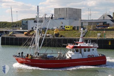
WR40 ANNA CAROLA
Fishing
Current Trip
| Trip Time | 4 days |
|---|---|
| Trip Distance | 343.49 nm |
| AVG Speed | 3.9 Knopen |
| MAX Speed | 3.9 Knopen |
| Diepgang | 2 M |
| AVG Wind | 19.6 knots |
| MAX Wind | 30.3 knots |
| MIN Temp | 10.5°C / 50.9°F |
| MAX Temp | 15.6°C / 60.08°F |
| Positie ontvangen | 1 d geleden |
Current Position
| Lengtegraad | --- |
|---|---|
| Breedtegraat | --- |
| Status | Engaged in Fishing |
| Snelheid | |
| Koers | --- |
| Gebied | North Sea |
| Station | T-AIS |
| Positie ontvangen | 1 d geleden |
Info
Information
The current position of WR40 ANNA CAROLA is in North Sea with coordinates 53.18025° / 5.41761° as reported on 2024-10-04 12:21 by AIS to our vessel tracker app. The vessel's current speed is 0 Knopen and is currently inside the port of HARLINGEN.
The vessel WR40 ANNA CAROLA (IMO: 8341682, MMSI: 244810627) is a Fishing It's sailing under the flag of [NL] Netherlands.
In this page you can find informations about the vessels current position, last detected port calls, and current voyage information. If the vessels is not in coverage by AIS you will find the latest position.
The current position of WR40 ANNA CAROLA is detected by our AIS receivers and we are not responsible for the reliability of the data. The last position was recorded while the vessel was in Coverage by the Ais receivers of our vessel tracking app.
The current draught of WR40 ANNA CAROLA as reported by AIS is 2 meters
Weather
| Temperature | 13.9°C / 57.02°F |
|---|---|
| Wind Speed | 4 knots |
| Direction | 37° NE |
| Pressure | 1021.9 hPa |
| Humidity | 64.7 % |
| Cloud Coverage | 4 % |
Featured Company
Last Port Calls
| Port | Arrival | Departure | Time In Port |
|---|---|---|---|
| 2024-10-03 23:34 | |||
| 2024-09-27 05:36 | 2024-09-29 21:51 | 2 d | |
| 2024-09-20 06:07 | 2024-09-22 21:59 | 2 d | |
| 2024-09-13 07:07 | 2024-09-15 21:55 | 2 d | |
| 2024-09-11 12:52 | 2024-09-11 14:17 | 1 h | |
| 2024-09-08 14:31 | 2024-09-08 21:54 | 7 h | |
| 2024-09-06 11:55 | 2024-09-08 08:16 | 1 d | |
| 2024-09-05 11:53 | 2024-09-06 07:42 | 19 h | |
| 2024-08-30 07:00 | 2024-09-01 21:57 | 2 d | |
| 2024-08-22 10:18 | 2024-08-27 13:34 | 5 d |
Last Trips
| Origin | Departure | Destination | Arrival | Distance | |
|---|---|---|---|---|---|
| 2024-09-29 23:51 | 2024-10-04 01:34 | 343.49 nm | |||
| 2024-09-22 23:59 | 2024-09-27 07:36 | 377.04 nm | |||
| 2024-09-15 23:55 | 2024-09-20 08:07 | 338.16 nm | |||
| 2024-09-11 16:17 | 2024-09-13 09:07 | 106.62 nm | |||
| 2024-09-08 23:54 | 2024-09-11 14:52 | 212.50 nm | |||
| 2024-09-08 10:16 | 2024-09-08 16:31 | 46.34 nm | |||
| 2024-09-06 09:42 | 2024-09-06 13:55 | 33.09 nm | |||
| 2024-09-01 23:57 | 2024-09-05 13:53 | 247.04 nm | |||
| 2024-08-27 15:34 | 2024-08-30 09:00 | 167.67 nm | |||
| 2024-08-18 23:44 | 2024-08-22 12:18 | 284.44 nm |
Events
| Tijd | Evenement | Details | Positie / Bestemming | Info |
|---|---|---|---|---|
| 2024-10-04 12:21 | Buitenbereik |
53.18025 / 5.41761
North Sea
[NL] HARLINGEN
|
Snelheid: Koers: 304.8° |
|
| 2024-10-04 10:52 | Binnenbereik |
53.18027 / 5.41758
North Sea
[NL] HARLINGEN
|
Snelheid: Koers: 304.8° |
|
| 2024-10-04 07:27 | Buitenbereik |
53.18022 / 5.41766
North Sea
[NL] HARLINGEN
|
Snelheid: Koers: 281.2° |
|
| 2024-10-03 23:34 | Stop beweging |
53.18171 / 5.41871
[NL] HARLINGEN
|
Snelheid: 0.3 kn Koers: 209° |
|
| 2024-10-03 23:34 | Aankomsthaven |
|
53.18171 / 5.41871
[NL] HARLINGEN
|
Snelheid: 0.9 kn Koers: 215° |
| 2024-10-03 10:22 | Start beweging | 4.73 nm, North West of FRANEKER |
53.25304 / 5.48239
DEN OEVER
|
Snelheid: 4.5 kn Koers: 227° |
| 2024-10-03 10:16 | Stop beweging | 4.75 nm, North West of FRANEKER |
53.25417 / 5.48482
DEN OEVER
|
Snelheid: 0.1 kn Koers: 49° |
| 2024-10-03 04:25 | Binnenbereik |
53.28333 / 5.19833
North Sea
|
Snelheid: 2.3 kn Koers: 283.3° |
|
| 2024-10-02 19:54 | Buitenbereik |
53.23579 / 5.28309
North Sea
|
Snelheid: 3 kn Koers: 100.2° |
|
| 2024-10-02 16:19 | Start beweging | 3.27 nm, South of TERSCHELLING |
53.30314 / 5.19630
DEN OEVER
|
Snelheid: 5.8 kn Koers: 283.4° |