
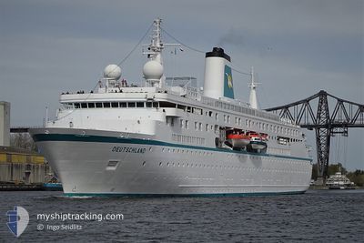
DEUTSCHLAND
Passengers Ship
Current Trip
| Time Travelled | 1 day |
|---|---|
| Remaining Time | 2 h, 46 mins |
| Distance Travelled | 391.65 nm |
| Remaining Distance | 62.72 nm |
| AVG Speed | 12.6 Knopen |
| MAX Speed | 15.9 Knopen |
| AVG Wind | 14.1 knots |
| MAX Wind | 27 knots |
| MIN Temp | 10.4°C / 50.72°F |
| MAX Temp | 14.5°C / 58.1°F |
| Diepgang | 5.8 M |
| Positie ontvangen | 9 h, 15 m geleden |
Current Position
| Lengtegraad | 5.25087° |
|---|---|
| Breedtegraat | 55.01586° |
| Status | Under way using engine |
| Snelheid | 9.4 Knopen |
| Koers | 124.8° |
| Gebied | North Sea |
| Station | T-AIS |
| Positie ontvangen | 9 h, 15 m geleden |
Info
Information
The current position of DEUTSCHLAND is in North Sea with coordinates 55.01586° / 5.25087° as reported on 2024-05-16 17:24 by AIS to our vessel tracker app. The vessel's current speed is 9.4 Knopen and is heading at the port of BREMERHAVEN. The estimated time of arrival as calculated by MyShipTracking vessel tracking app is 2024-05-17 07:25 LT
The vessel DEUTSCHLAND (IMO: 9141807, MMSI: 311000410) is a Passengers Ship that was built in 1998 ( 26 Jaar oud ). It's sailing under the flag of [BS] Bahamas.
In this page you can find informations about the vessels current position, last detected port calls, and current voyage information. If the vessels is not in coverage by AIS you will find the latest position.
The current position of DEUTSCHLAND is detected by our AIS receivers and we are not responsible for the reliability of the data. The last position was recorded while the vessel was in Coverage by the Ais receivers of our vessel tracking app.
The current draught of DEUTSCHLAND as reported by AIS is 5.8 meters
Weather
| Temperature | 13.9°C / 57.02°F |
|---|---|
| Wind Speed | 11 knots |
| Direction | 103° ESE |
| Pressure | 1008.9 hPa |
| Humidity | 89.5 % |
| Cloud Coverage | 61 % |
Featured Company
Last Port Calls
| Port | Arrival | Departure | Time In Port |
|---|---|---|---|
| 2024-05-15 07:50 | 2024-05-15 20:10 | 12 h | |
| 2024-05-14 07:34 | 2024-05-14 13:34 | 5 h | |
| 2024-05-12 07:02 | 2024-05-12 13:14 | 6 h | |
| 2024-05-11 07:00 | 2024-05-11 20:29 | 13 h | |
| 2024-05-10 07:27 | 2024-05-10 22:10 | 14 h | |
| 2024-05-08 07:34 | 2024-05-08 18:13 | 10 h | |
| 2024-05-07 07:26 | 2024-05-07 19:12 | 11 h | |
| 2024-04-20 06:25 | 2024-05-05 19:12 | 15 d | |
| 2024-04-10 07:17 | 2024-04-13 20:21 | 3 d | |
| 2024-04-02 07:19 | 2024-04-07 20:29 | 5 d |
Most Visited Ports (Last year)
| Port | Arrivals | |
|---|---|---|
| 10 | ||
| 3 | ||
| 3 | ||
| 3 | ||
| 3 | ||
| 2 |
Last Trips
| Origin | Departure | Destination | Arrival | Distance | |
|---|---|---|---|---|---|
| 2024-05-14 13:34 | 2024-05-15 07:50 | 234.95 nm | |||
| 2024-05-12 13:14 | 2024-05-14 07:34 | 431.97 nm | |||
| 2024-05-11 20:29 | 2024-05-12 07:02 | 110.12 nm | |||
| 2024-05-10 22:10 | 2024-05-11 07:00 | 121.85 nm | |||
| 2024-05-08 18:13 | 2024-05-10 07:27 | 344.44 nm | |||
| 2024-05-07 19:12 | 2024-05-08 07:34 | 179.42 nm | |||
| 2024-05-05 19:12 | 2024-05-07 07:26 | 455.51 nm | |||
| 2024-04-13 20:21 | 2024-04-20 06:25 | 1222.70 nm | |||
| 2024-04-07 20:29 | 2024-04-10 07:17 | 462.76 nm | |||
| 2024-03-22 20:43 | 2024-04-02 07:19 | 2835.17 nm |
Events
| Tijd | Evenement | Details | Positie / Bestemming | Info |
|---|---|---|---|---|
| 2024-05-16 17:34 | Status Changed | Default Under way using engine |
55.00167 / 5.28667
DE BRV
|
Snelheid: 9.4 kn Koers: 124.8° |
| 2024-05-16 17:24 | Buitenbereik |
55.01586 / 5.25087
North Sea
DE BRV
|
Snelheid: 9.4 kn Koers: 124.8° |
|
| 2024-05-16 17:00 | Status Changed | Under way using engine Default |
55.05079 / 5.15668
DE BRV
|
Snelheid: 9 kn Koers: 120° |
| 2024-05-16 16:46 | Status Changed | Default Under way using engine |
55.06833 / 5.09833
DE BRV
|
Snelheid: 9.7 kn Koers: 120.5° |
| 2024-05-16 16:39 | Status Changed | Under way using engine Default |
55.07941 / 5.07208
DE BRV
|
Snelheid: 9.7 kn Koers: 123° |
| 2024-05-16 16:39 | Binnenbereik |
55.07941 / 5.07208
North Sea
DE BRV
|
Snelheid: 9.7 kn Koers: 120.9° |
|
| 2024-05-16 15:31 | Status Changed | Default Under way using engine |
55.17833 / 4.79500
DE BRV
|
Snelheid: 10 kn Koers: 120.9° |
| 2024-05-16 15:16 | Buitenbereik |
55.19996 / 4.73522
North Sea
DE BRV
|
Snelheid: 10 kn Koers: 120.9° |
|
| 2024-05-16 15:07 | Gevonden in zee | German part of the North Sea |
55.21312 / 4.69844
North Sea
DE BRV
|
Snelheid: 10 kn Koers: 123.1° |
| 2024-05-16 15:07 | Status Changed | Under way using engine Default |
55.21312 / 4.69844
DE BRV
|
Snelheid: 10 kn Koers: 123° |