
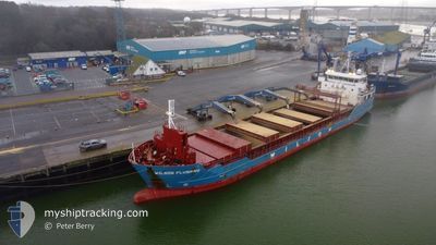
WILSON FLUSHING
General Cargo
Current Trip
NO STY
| Time Travelled | 2 days |
|---|---|
| Remaining Time | --- |
| Distance Travelled | 242.00 nm |
| Remaining Distance | --- |
| AVG Speed | 7.4 Knopen |
| MAX Speed | 9.7 Knopen |
| AVG Wind | 16.4 knots |
| MAX Wind | 32.3 knots |
| MIN Temp | -6.5°C / 20.3°F |
| MAX Temp | 3.3°C / 37.94°F |
| Diepgang | 4.3 M |
| Positie ontvangen | 2 m geleden |
Current Position
| Lengtegraad | --- |
|---|---|
| Breedtegraat | --- |
| Status | Under way using engine |
| Snelheid | 9.8 Knopen |
| Koers | 22.4° |
| Gebied | Norwegian Sea |
| Station | T-AIS |
| Positie ontvangen | 2 m geleden |
Info
Information
The current position of WILSON FLUSHING is in Norwegian Sea with coordinates 68.48582° / 16.12027° as reported on 2025-03-17 05:14 by AIS to our vessel tracker app. The vessel's current speed is 9.8 Knopen
The vessel WILSON FLUSHING (IMO: 9491745, MMSI: 314396000) is a General Cargo that was built in 2012 ( 13 Jaar oud ). It's sailing under the flag of [BB] Barbados.
In this page you can find informations about the vessels current position, last detected port calls, and current voyage information. If the vessels is not in coverage by AIS you will find the latest position.
The current position of WILSON FLUSHING is detected by our AIS receivers and we are not responsible for the reliability of the data. The last position was recorded while the vessel was in Coverage by the Ais receivers of our vessel tracking app.
The current draught of WILSON FLUSHING as reported by AIS is 4.3 meters
Weather
| Temperature | -3.6°C / 25.52°F |
|---|---|
| Wind Speed | 4 knots |
| Direction | 258° WSW |
| Pressure | 1009.5 hPa |
| Humidity | 92.9 % |
| Cloud Coverage | 100 % |
Featured Company
Last Port Calls
| Port | Arrival | Departure | Time In Port |
|---|---|---|---|
| 2025-03-13 21:21 | 2025-03-15 00:40 | 1 d | |
| 2025-03-07 04:15 | 2025-03-07 22:38 | 18 h | |
| 2025-03-03 21:44 | 2025-03-05 16:51 | 1 d | |
| 2025-02-14 08:12 | 2025-02-17 18:37 | 3 d | |
| 2025-02-09 23:21 | 2025-02-12 19:44 | 2 d | |
| 2025-01-31 13:33 | 2025-02-06 07:45 | 5 d | |
| 2025-01-28 19:05 | 2025-01-31 00:28 | 2 d | |
| 2025-01-20 17:54 | 2025-01-20 23:41 | 5 h |
Last Trips
| Origin | Departure | Destination | Arrival | Distance | |
|---|---|---|---|---|---|
| 2025-03-07 22:38 | 2025-03-13 21:21 | 1280.57 nm | |||
| 2025-03-05 16:51 | 2025-03-07 04:15 | 350.67 nm | |||
| 2025-02-17 18:37 | 2025-03-03 21:44 | 2840.82 nm | |||
| 2025-02-12 19:44 | 2025-02-14 08:12 | 333.63 nm | |||
| 2025-02-06 07:45 | 2025-02-09 23:21 | 761.82 nm | |||
| 2025-01-31 00:28 | 2025-01-31 13:33 | 104.94 nm | |||
| 2025-01-20 23:41 | 2025-01-28 19:05 | 1693.70 nm | |||
| 2024-12-31 13:19 | 2025-01-20 17:54 | 3262.50 nm |
Events
| Tijd | Evenement | Details | Positie / Bestemming | Info |
|---|---|---|---|---|
| 2025-03-17 04:45 | Start beweging | 0.51 nm, North East of LOEDINGEN |
68.42552 / 16.01568
NO STY
|
Snelheid: 4.6 kn Koers: 34° |
| 2025-03-17 04:39 | Status Changed | Under way using engine At anchor |
68.42357 / 16.01325
NO STY
|
Snelheid: 0.1 kn Koers: 301° |
| 2025-03-16 23:07 | Status Changed | At anchor Default |
68.42403 / 16.01501
NO STY
|
Snelheid: 0.1 kn Koers: 259° |
| 2025-03-16 23:01 | Status Changed | Default At anchor |
68.42416 / 16.01567
NO STY
|
Snelheid: 0.1 kn Koers: 259° |
| 2025-03-16 21:19 | Status Changed | At anchor Default |
68.42347 / 16.01538
NO STY
|
Snelheid: Koers: 307° |
| 2025-03-16 21:16 | Status Changed | Default At anchor |
68.42342 / 16.01549
NO STY
|
Snelheid: Koers: 307° |
| 2025-03-16 07:52 | Stop beweging | 0.28 nm, North East of LOEDINGEN |
68.42217 / 16.01033
NO STY
|
Snelheid: 0.3 kn Koers: 18° |
| 2025-03-16 07:43 | Status Changed | At anchor Under way using engine |
68.42252 / 16.01060
NO STY
|
Snelheid: 0.5 kn Koers: 8° |
| 2025-03-14 23:42 | Status Changed | Under way using engine Moored |
66.30480 / 14.07749
NO STY
|
Snelheid: 8 kn Koers: 247.4° |
| 2025-03-14 23:40 | Vertrekhaven |
|
66.30611 / 14.08509
NO STY
|
Snelheid: 7.4 kn Koers: 250° |