
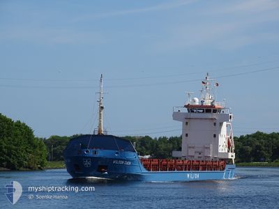
WILSON CAEN
General Cargo
Current Trip
NO ORS
| Time Travelled | 11 days |
|---|---|
| Remaining Time | --- |
| Distance Travelled | 2488.78 nm |
| Remaining Distance | --- |
| AVG Speed | 9.1 Knopen |
| MAX Speed | 13 Knopen |
| AVG Wind | 15.7 knots |
| MAX Wind | 31 knots |
| MIN Temp | 7°C / 44.6°F |
| MAX Temp | 18.6°C / 65.48°F |
| Diepgang | 3.9 M |
| Positie ontvangen | 1 m geleden |
Current Position
| Lengtegraad | 5.99503° |
|---|---|
| Breedtegraat | 62.43989° |
| Status | Under way using engine |
| Snelheid | 11.7 Knopen |
| Koers | 138.2° |
| Gebied | Norwegian Sea |
| Station | T-AIS |
| Positie ontvangen | 1 m geleden |
Info
Information
The current position of WILSON CAEN is in Norwegian Sea with coordinates 62.43989° / 5.99503° as reported on 2024-05-01 11:03 by AIS to our vessel tracker app. The vessel's current speed is 11.7 Knopen
The vessel WILSON CAEN (IMO: 9173290, MMSI: 314179000) is a General Cargo that was built in 1998 ( 26 Jaar oud ). It's sailing under the flag of [BB] Barbados.
In this page you can find informations about the vessels current position, last detected port calls, and current voyage information. If the vessels is not in coverage by AIS you will find the latest position.
The current position of WILSON CAEN is detected by our AIS receivers and we are not responsible for the reliability of the data. The last position was recorded while the vessel was in Coverage by the Ais receivers of our vessel tracking app.
The current draught of WILSON CAEN as reported by AIS is 3.9 meters
Weather
| Temperature | 9.6°C / 49.28°F |
|---|---|
| Wind Speed | 2 knots |
| Direction | 250° WSW |
| Pressure | 1022.9 hPa |
| Humidity | 75.4 % |
| Cloud Coverage | 86 % |
Featured Company
Last Port Calls
| Port | Arrival | Departure | Time In Port |
|---|---|---|---|
| 2024-04-17 05:25 | 2024-04-20 04:29 | 2 d | |
| 2024-04-15 17:45 | 2024-04-16 13:57 | 20 h | |
| 2024-04-03 17:55 | 2024-04-05 15:15 | 1 d | |
| 2024-03-22 18:16 | 2024-03-22 21:15 | 2 h | |
| 2024-03-12 17:30 | 2024-03-14 03:02 | 1 d | |
| 2024-03-04 15:17 | 2024-03-06 03:17 | 1 d |
Last Trips
| Origin | Departure | Destination | Arrival | Distance | |
|---|---|---|---|---|---|
| 2024-04-16 15:57 | 2024-04-17 07:25 | 76.38 nm | |||
| 2024-04-05 17:15 | 2024-04-15 19:45 | 1890.16 nm | |||
| 2024-03-22 22:15 | 2024-04-03 19:55 | 1368.80 nm | |||
| 2024-03-14 04:02 | 2024-03-22 19:16 | 1035.69 nm | |||
| 2024-03-06 04:17 | 2024-03-12 18:30 | 1322.88 nm | |||
| 2024-02-22 08:46 | 2024-03-04 16:17 | 2197.51 nm |
Events
| Tijd | Evenement | Details | Positie / Bestemming | Info |
|---|---|---|---|---|
| 2024-05-01 08:34 | Draught Changed | 3.9 4 |
62.36313 / 5.11343
NO ORS
|
Snelheid: 11.5 kn Koers: 45.3° |
| 2024-04-30 23:55 | Wijzig zee gebeid | Norwegian part of the Norwegian Sea Norwegian part of the North Sea |
61.00821 / 4.25035
Norwegian Sea
NO ORS
|
Snelheid: 9.9 kn Koers: 4.5° |
| 2024-04-30 04:43 | Status Changed | Under way using engine Default |
58.08754 / 4.06330
NO ORS
|
Snelheid: 8.9 kn Koers: 4° |
| 2024-04-30 04:38 | Status Changed | Default Under way using engine |
58.07496 / 4.06202
NO ORS
|
Snelheid: 8.8 kn Koers: 3.3° |
| 2024-04-30 03:16 | Status Changed | Under way using engine Default |
57.87340 / 4.03273
NO ORS
|
Snelheid: 8.8 kn Koers: 4° |
| 2024-04-30 03:16 | Binnenbereik |
57.87898 / 4.03373
North Sea
NO ORS
|
Snelheid: 8.9 kn Koers: 4.3° |
|
| 2024-04-29 23:57 | Buitenbereik |
57.36998 / 3.95771
North Sea
NO ORS
|
Snelheid: 9.2 kn Koers: 4.9° |
|
| 2024-04-29 22:45 | Status Changed | Under way using engine Default |
57.18600 / 3.93569
NO ORS
|
Snelheid: 9.2 kn Koers: 4° |
| 2024-04-29 22:24 | Status Changed | Default Under way using engine |
57.13085 / 3.93106
NO ORS
|
Snelheid: 9.2 kn Koers: 2.9° |
| 2024-04-29 20:37 | Status Changed | Under way using engine Default |
56.85635 / 3.89741
NO ORS
|
Snelheid: 9.1 kn Koers: 5° |