
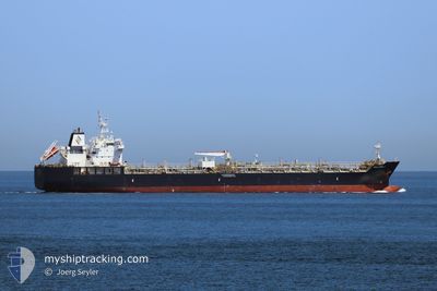
WILLARD J
Tanker
Current Trip
| Time Travelled | 5 days |
|---|---|
| Remaining Time | 14 days |
| Distance Travelled | 1408.92 nm |
| Remaining Distance | 4009.24 nm |
| AVG Speed | 11.8 Knopen |
| MAX Speed | 16.6 Knopen |
| AVG Wind | 14.4 knots |
| MAX Wind | 31 knots |
| MIN Temp | 12.5°C / 54.5°F |
| MAX Temp | 17.6°C / 63.68°F |
| Diepgang | 9.1 M |
| Positie ontvangen | 2 d geleden |
Current Position
| Lengtegraad | -8.86574° |
|---|---|
| Breedtegraat | 45.65387° |
| Status | Under way using engine |
| Snelheid | 9.8 Knopen |
| Koers | 208.1° |
| Gebied | North Atlantic Ocean |
| Station | T-AIS |
| Positie ontvangen | 2 d geleden |
Info
Information
The current position of WILLARD J is in North Atlantic Ocean with coordinates 45.65387° / -8.86574° as reported on 2024-05-13 16:52 by AIS to our vessel tracker app. The vessel's current speed is 9.8 Knopen and is heading at the port of HOUSTON. The estimated time of arrival as calculated by MyShipTracking vessel tracking app is 2024-05-30 15:10 LT
The vessel WILLARD J (IMO: 9749362, MMSI: 538006809) is a Tanker It's sailing under the flag of [MH] Marshall Is.
In this page you can find informations about the vessels current position, last detected port calls, and current voyage information. If the vessels is not in coverage by AIS you will find the latest position.
The current position of WILLARD J is detected by our AIS receivers and we are not responsible for the reliability of the data. The last position was recorded while the vessel was in Coverage by the Ais receivers of our vessel tracking app.
The current draught of WILLARD J as reported by AIS is 9.1 meters
Weather
| Temperature | 15.4°C / 59.72°F |
|---|---|
| Wind Speed | 17 knots |
| Direction | 352° N |
| Pressure | 1023.1 hPa |
| Humidity | 81.7 % |
| Cloud Coverage | 54 % |
Featured Company
Last Port Calls
| Port | Arrival | Departure | Time In Port |
|---|---|---|---|
| 2024-05-10 01:47 | 2024-05-11 08:31 | 1 d | |
| 2024-05-07 08:12 | 2024-05-08 22:33 | 1 d | |
| 2024-04-28 21:02 | 2024-04-30 15:12 | 1 d | |
| 2024-04-26 01:39 | 2024-04-27 08:12 | 1 d | |
| 2024-04-18 02:54 | 2024-04-20 14:11 | 2 d | |
| 2024-04-14 18:48 | 2024-04-16 00:38 | 1 d | |
| 2024-04-10 17:34 | 2024-04-13 20:53 | 3 d | |
| 2024-03-30 11:59 | 2024-03-31 22:35 | 1 d | |
| 2024-03-18 22:41 | |||
| 2024-03-06 03:37 |
Last Trips
| Origin | Departure | Destination | Arrival | Distance | |
|---|---|---|---|---|---|
| 2024-05-09 00:33 | 2024-05-10 03:47 | 230.01 nm | |||
| 2024-04-30 17:12 | 2024-05-07 10:12 | 458.19 nm | |||
| 2024-04-27 09:12 | 2024-04-28 23:02 | 417.69 nm | |||
| 2024-04-20 16:11 | 2024-04-26 02:39 | 517.90 nm | |||
| 2024-04-16 02:38 | 2024-04-18 04:54 | 479.55 nm | |||
| 2024-04-13 21:53 | 2024-04-14 20:48 | 226.36 nm | |||
| 2024-03-31 20:05 | 2024-04-10 18:34 | 2663.50 nm | |||
| 2024-03-18 17:41 | 2024-03-30 09:29 | 2943.73 nm |
Events
| Tijd | Evenement | Details | Positie / Bestemming | Info |
|---|---|---|---|---|
| 2024-05-13 16:59 | Status Changed | Default Under way using engine |
45.63669 / -8.87992
US HOU
|
Snelheid: 9.8 kn Koers: 208.1° |
| 2024-05-13 16:52 | Buitenbereik |
45.65387 / -8.86574
North Atlantic Ocean
US HOU
|
Snelheid: 9.8 kn Koers: 208.1° |
|
| 2024-05-13 15:37 | Wijzig zee gebeid | Spanish part of the North Atlantic Ocean High seas of the North Atlantic Ocean |
45.82176 / -8.70620
North Atlantic Ocean
US HOU
|
Snelheid: 9.6 kn Koers: 212.2° |
| 2024-05-13 15:10 | Wijzig zee gebeid | High seas of the North Atlantic Ocean French part of the North Atlantic Ocean |
45.88454 / -8.64378
North Atlantic Ocean
US HOU
|
Snelheid: 10.3 kn Koers: 212° |
| 2024-05-13 14:02 | Gevonden in zee | French part of the North Atlantic Ocean |
46.05141 / -8.50039
North Atlantic Ocean
US HOU
|
Snelheid: 10.6 kn Koers: 212.9° |
| 2024-05-13 14:01 | Status Changed | Under way using engine Default |
46.05392 / -8.49824
US HOU
|
Snelheid: 10.9 kn Koers: 212° |
| 2024-05-13 13:48 | Binnenbereik |
46.05141 / -8.50039
North Atlantic Ocean
US HOU
|
Snelheid: 10.6 kn Koers: 212.9° |
|
| 2024-05-13 00:15 | Status Changed | Default Under way using engine |
48.20455 / -6.46269
US HOU
|
Snelheid: 12.2 kn Koers: 208.3° |
| 2024-05-13 00:07 | Status Changed | Under way using engine Default |
48.22554 / -6.44290
US HOU
|
Snelheid: 12.3 kn Koers: 215° |
| 2024-05-13 00:07 | Buitenbereik |
48.22554 / -6.44290
Celtic Sea
US HOU
|
Snelheid: 12.2 kn Koers: 208.3° |