
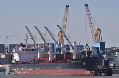
WESTERN FEDORA
Cargo
Current Trip
MAJFL>ARQQN
| Time Travelled | 3 days |
|---|---|
| Remaining Time | --- |
| Distance Travelled | 913.21 nm |
| Remaining Distance | --- |
| AVG Speed | 12.2 Knopen |
| MAX Speed | 13.4 Knopen |
| AVG Wind | 17.6 knots |
| MAX Wind | 24 knots |
| MIN Temp | 15.7°C / 60.26°F |
| MAX Temp | 20.1°C / 68.18°F |
| Diepgang | 10.2 M |
| Positie ontvangen | 1 d geleden |
Current Position
| Lengtegraad | -15.23369° |
|---|---|
| Breedtegraat | 25.89196° |
| Status | Under way using engine |
| Snelheid | 12.3 Knopen |
| Koers | 225.7° |
| Gebied | North Atlantic Ocean |
| Station | T-AIS |
| Positie ontvangen | 1 d geleden |
Info
Information
The current position of WESTERN FEDORA is in North Atlantic Ocean with coordinates 25.89196° / -15.23369° as reported on 2024-05-06 02:10 by AIS to our vessel tracker app. The vessel's current speed is 12.3 Knopen
The vessel WESTERN FEDORA (IMO: 9609689, MMSI: 210239000) is a Cargo It's sailing under the flag of [CY] Cyprus.
In this page you can find informations about the vessels current position, last detected port calls, and current voyage information. If the vessels is not in coverage by AIS you will find the latest position.
The current position of WESTERN FEDORA is detected by our AIS receivers and we are not responsible for the reliability of the data. The last position was recorded while the vessel was in Coverage by the Ais receivers of our vessel tracking app.
The current draught of WESTERN FEDORA as reported by AIS is 10.2 meters
Weather
| Temperature | 19.2°C / 66.56°F |
|---|---|
| Wind Speed | 11 knots |
| Direction | 359° N |
| Pressure | 1009.1 hPa |
| Humidity | 90.8 % |
| Cloud Coverage | 71 % |
Featured Company
Last Port Calls
| Port | Arrival | Departure | Time In Port |
|---|---|---|---|
| 2024-05-02 01:09 | 2024-05-04 05:31 | 2 d | |
| 2024-04-27 19:29 | 2024-04-30 13:04 | 2 d | |
| 2024-04-07 07:21 | 2024-04-20 05:48 | 12 d |
Most Visited Ports (Last year)
| Port | Arrivals | |
|---|---|---|
| 3 | ||
| 1 | ||
| 1 | ||
| 1 | ||
| 1 | ||
| 1 |
Last Trips
| Origin | Departure | Destination | Arrival | Distance | |
|---|---|---|---|---|---|
| 2024-04-30 14:04 | 2024-05-02 02:09 | 19.41 nm | |||
| 2024-04-20 06:48 | 2024-04-27 20:29 | 1447.26 nm | |||
| 2024-02-28 18:24 | 2024-04-07 08:21 | 6374.05 nm |
Events
| Tijd | Evenement | Details | Positie / Bestemming | Info |
|---|---|---|---|---|
| 2024-05-06 02:16 | Status Changed | Default Under way using engine |
25.87333 / -15.24667
MAJFL>ARQQN
|
Snelheid: 12.3 kn Koers: 225.7° |
| 2024-05-06 02:10 | Buitenbereik |
25.89196 / -15.23369
North Atlantic Ocean
MAJFL>ARQQN
|
Snelheid: 12.3 kn Koers: 225.7° |
|
| 2024-05-06 02:09 | Status Changed | Under way using engine Default |
25.89398 / -15.23138
MAJFL>ARQQN
|
Snelheid: 12.3 kn Koers: 223° |
| 2024-05-06 02:05 | Status Changed | Default Under way using engine |
25.90345 / -15.22117
MAJFL>ARQQN
|
Snelheid: 12.4 kn Koers: 225.4° |
| 2024-05-06 01:49 | Status Changed | Under way using engine Default |
25.94538 / -15.18036
MAJFL>ARQQN
|
Snelheid: 12.4 kn Koers: 215° |
| 2024-05-06 01:46 | Status Changed | Default Under way using engine |
25.95448 / -15.17382
MAJFL>ARQQN
|
Snelheid: 12.4 kn Koers: 212.4° |
| 2024-05-06 01:37 | Status Changed | Under way using engine Default |
25.98071 / -15.15440
MAJFL>ARQQN
|
Snelheid: 12.5 kn Koers: 213° |
| 2024-05-06 01:34 | Status Changed | Default Under way using engine |
25.98982 / -15.14770
MAJFL>ARQQN
|
Snelheid: 12.5 kn Koers: 213.9° |
| 2024-05-06 00:16 | Status Changed | Under way using engine Default |
26.21554 / -14.98518
MAJFL>ARQQN
|
Snelheid: 12.3 kn Koers: 213° |
| 2024-05-06 00:14 | Binnenbereik |
26.21554 / -14.98518
North Atlantic Ocean
MAJFL>ARQQN
|
Snelheid: 12.4 kn Koers: 211.8° |