
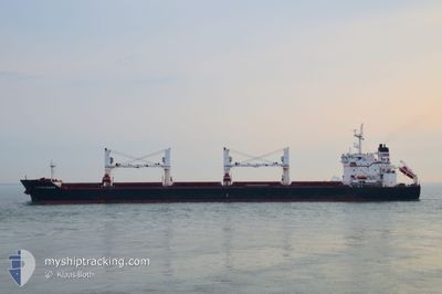
WESTERN BOHEME
Bulk Carrier
Current Trip
| Trip Time | 29 days |
|---|---|
| Trip Distance | 5447.12 nm |
| AVG Speed | 10.3 Knopen |
| MAX Speed | 12.1 Knopen |
| Diepgang | 10.6 M |
| AVG Wind | 12.2 knots |
| MAX Wind | 26.4 knots |
| MIN Temp | 14.6°C / 58.28°F |
| MAX Temp | 31.1°C / 87.98°F |
| Positie ontvangen | 6 d geleden |
Current Position
| Lengtegraad | --- |
|---|---|
| Breedtegraat | --- |
| Status | Under way using engine |
| Snelheid | 12 Knopen |
| Koers | 34° |
| Gebied | South Atlantic Ocean |
| Station | T-AIS |
| Positie ontvangen | 6 d geleden |
Info
Information
The current position of WESTERN BOHEME is in South Atlantic Ocean with coordinates -12.86936° / -38.53697° as reported on 2024-11-18 14:17 by AIS to our vessel tracker app. The vessel's current speed is 12 Knopen and is currently inside the port of ARATU.
The vessel WESTERN BOHEME (IMO: 9609691, MMSI: 210261000) is a Bulk Carrier that was built in 2012 ( 12 Jaar oud ). It's sailing under the flag of [CY] Cyprus.
In this page you can find informations about the vessels current position, last detected port calls, and current voyage information. If the vessels is not in coverage by AIS you will find the latest position.
The current position of WESTERN BOHEME is detected by our AIS receivers and we are not responsible for the reliability of the data. The last position was recorded while the vessel was in Coverage by the Ais receivers of our vessel tracking app.
The current draught of WESTERN BOHEME as reported by AIS is 10.6 meters
Weather
| Temperature | 23.3°C / 73.94°F |
|---|---|
| Wind Speed | 9 knots |
| Direction | 161° SSE |
| Pressure | 1015.3 hPa |
| Humidity | 94.3 % |
| Cloud Coverage | 97 % |
Featured Company
Events
| Tijd | Evenement | Details | Positie / Bestemming | Info |
|---|---|---|---|---|
| 2024-11-18 15:20 | Stop beweging |
-12.77840 / -38.50145
[BR] ARATU
|
Snelheid: Koers: 34° |
|
| 2024-11-18 15:05 | Aankomsthaven |
|
-12.77856 / -38.50183
[BR] ARATU
|
Snelheid: 1.3 kn Koers: 33° |
| 2024-11-18 14:21 | Status Changed | Default Under way using engine |
-12.85694 / -38.52823
EGDAM>BRARB
|
Snelheid: 12 kn Koers: 34° |
| 2024-11-18 14:17 | Buitenbereik |
-12.86936 / -38.53697
South Atlantic Ocean
[BR] ARATU
|
Snelheid: 12 kn Koers: 34° |
|
| 2024-11-18 14:16 | Status Changed | Under way using engine Default |
-12.87247 / -38.53916
EGDAM>BRARB
|
Snelheid: 11.8 kn Koers: 32° |
| 2024-11-18 14:09 | Status Changed | Default Under way using engine |
-12.89069 / -38.54956
EGDAM>BRARB
|
Snelheid: 11 kn Koers: 19° |
| 2024-11-18 14:09 | Status Changed | Under way using engine Default |
-12.89318 / -38.55050
EGDAM>BRARB
|
Snelheid: 11.8 kn Koers: 21° |
| 2024-11-18 14:05 | Status Changed | Default Under way using engine |
-12.90297 / -38.55418
EGDAM>BRARB
|
Snelheid: 11 kn Koers: 19° |
| 2024-11-18 12:43 | Start beweging | 8.93 nm, South West of SALVADOR |
-13.09842 / -38.58831
EGDAM>BRARB
|
Snelheid: 4 kn Koers: 24° |
| 2024-11-18 12:32 | Status Changed | Under way using engine Default |
-13.10223 / -38.59219
EGDAM>BRARB
|
Snelheid: 0.2 kn Koers: 27° |