

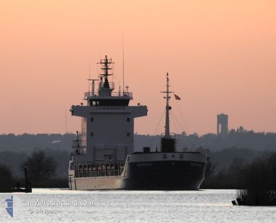
WERRATAL
General Cargo

Current Trip
| Time Travelled | 3 days |
|---|---|
| Remaining Time | 1 day |
| Distance Travelled | 56.12 nm |
| Remaining Distance | 218.20 nm |
| AVG Speed | 8.4 Knopen |
| MAX Speed | 9.5 Knopen |
| AVG Wind | 5.8 knots |
| MAX Wind | 16 knots |
| MIN Temp | 11.4°C / 52.52°F |
| MAX Temp | 17.6°C / 63.68°F |
| Diepgang | 3.2 M |
| Positie ontvangen | 40 m geleden |
Current Position
| Lengtegraad | --- |
|---|---|
| Breedtegraat | --- |
| Status | Under way using engine |
| Snelheid | 8.1 Knopen |
| Koers | 228° |
| Gebied | Mediterranean Sea - Eastern Basin |
| Station | T-AIS |
| Positie ontvangen | 40 m geleden |
Information
The current position of WERRATAL is in Mediterranean Sea - Eastern Basin with coordinates 34.15186° / 32.62590° as reported on 2025-02-18 18:36 by AIS to our vessel tracker app. The vessel's current speed is 8.1 Knopen and is heading at the port of ABU QIR. The estimated time of arrival as calculated by MyShipTracking vessel tracking app is 2025-02-19 23:00 LT
The vessel WERRATAL (IMO: 9192636, MMSI: 304214000) is a General Cargo that was built in 2001 ( 24 Jaar oud ). It's sailing under the flag of [AG] Antigua Barbuda.
In this page you can find informations about the vessels current position, last detected port calls, and current voyage information. If the vessels is not in coverage by AIS you will find the latest position.
The current position of WERRATAL is detected by our AIS receivers and we are not responsible for the reliability of the data. The last position was recorded while the vessel was in Coverage by the Ais receivers of our vessel tracking app.
The current draught of WERRATAL as reported by AIS is 3.2 meters
Weather
| Temperature | 17.3°C / 63.14°F |
|---|---|
| Wind Speed | 5 knots |
| Direction | 227° SW |
| Pressure | 1017.3 hPa |
| Humidity | 65.7 % |
| Cloud Coverage | 83 % |


Featured Company
Last Trips
| Origin | Departure | Destination | Arrival | Distance | |
|---|---|---|---|---|---|
| 2025-02-06 19:20 | 2025-02-14 08:37 | 1425.88 nm | |||
| 2025-01-29 12:47 | 2025-02-01 17:52 | 699.60 nm | |||
| 2025-01-16 13:55 | 2025-01-25 19:23 | 1442.92 nm | |||
| 2024-12-30 14:59 | 2024-12-30 15:22 | 0.67 nm |
Events
| Tijd | Evenement | Details | Positie / Bestemming | Info |
|---|---|---|---|---|
| 2025-02-18 16:34 | Status Changed | Under way using engine Default |
34.33780 / 32.85244
EG AKI
|
Snelheid: 8.7 kn Koers: 258° |
| 2025-02-18 16:33 | Status Changed | Default Under way using engine |
34.33827 / 32.85535
EG AKI
|
Snelheid: 8.6 kn Koers: 256.6° |
| 2025-02-18 13:16 | Draught Changed | 3.2 3.4 |
34.63851 / 33.31530
EG AKI
|
Snelheid: 8.9 kn Koers: 227.6° |
| 2025-02-18 13:16 | Destination Changed | EG AKI CYZYY |
34.63851 / 33.31530
EG AKI
|
Snelheid: 8.9 kn Koers: 227.6° |
| 2025-02-18 13:16 | ETA Changed | 2025/02/19 16:00 2025/02/13 06:00 |
34.63851 / 33.31530
EG AKI
|
Snelheid: 8.9 kn Koers: 227.6° |
| 2025-02-18 12:48 | Status Changed | Under way using engine Default |
34.68427 / 33.37554
CYZYY
|
Snelheid: 9.5 kn Koers: 162° |
| 2025-02-18 12:40 | Status Changed | Default Under way using engine |
34.70419 / 33.36872
CYZYY
|
Snelheid: 5.2 kn Koers: 158.2° |
| 2025-02-18 12:35 | Start beweging | 1.45 nm, South East of ZYGI |
34.71376 / 33.36435
CYZYY
|
Snelheid: 5.2 kn Koers: 158.2° |
| 2025-02-18 12:27 | Status Changed | Under way using engine Default |
34.71565 / 33.36307
CYZYY
|
Snelheid: 0.6 kn Koers: 149° |
| 2025-02-18 12:25 | Status Changed | Default Under way using engine |
34.71544 / 33.36351
CYZYY
|
Snelheid: 0.2 kn Koers: 146° |