
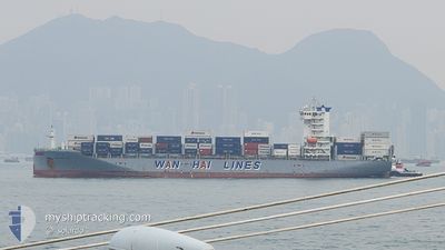
WAN HAI 291
Cargo B
Current Trip
VN CLP
| Time Travelled | 16 h, 34 mins |
|---|---|
| Remaining Time | --- |
| Distance Travelled | 272.62 nm |
| Remaining Distance | --- |
| AVG Speed | 16.6 Knopen |
| MAX Speed | 19.2 Knopen |
| AVG Wind | 4.8 knots |
| MAX Wind | 14 knots |
| MIN Temp | 25.1°C / 77.18°F |
| MAX Temp | 28.7°C / 83.66°F |
| Diepgang | 10.1 M |
| Positie ontvangen | 9 h, 35 m geleden |
Current Position
| Lengtegraad | --- |
|---|---|
| Breedtegraat | --- |
| Status | Under way using engine |
| Snelheid | 18.2 Knopen |
| Koers | 178.7° |
| Gebied | Malacca Strait |
| Station | T-AIS |
| Positie ontvangen | 9 h, 35 m geleden |
Info
Information
The current position of WAN HAI 291 is in Malacca Strait with coordinates 3.97018° / 100.41254° as reported on 2025-03-01 10:35 by AIS to our vessel tracker app. The vessel's current speed is 18.2 Knopen
The vessel WAN HAI 291 (IMO: 9871385, MMSI: 563143100) is a Cargo B It's sailing under the flag of [SG] Singapore.
In this page you can find informations about the vessels current position, last detected port calls, and current voyage information. If the vessels is not in coverage by AIS you will find the latest position.
The current position of WAN HAI 291 is detected by our AIS receivers and we are not responsible for the reliability of the data. The last position was recorded while the vessel was in Coverage by the Ais receivers of our vessel tracking app.
The current draught of WAN HAI 291 as reported by AIS is 10.1 meters
Weather
| Temperature | 26°C / 78.8°F |
|---|---|
| Wind Speed | 14 knots |
| Direction | 52° NE |
| Pressure | 1008 hPa |
| Humidity | 83.3 % |
| Cloud Coverage | 33 % |
Featured Company
Last Port Calls
| Port | Arrival | Departure | Time In Port |
|---|---|---|---|
| 2025-02-27 22:10 | 2025-03-01 03:37 | 1 d | |
| 2025-02-26 10:33 | 2025-02-27 09:13 | 22 h | |
| 2025-02-18 19:45 | 2025-02-19 07:33 | 11 h | |
| 2025-02-18 04:57 | 2025-02-18 13:37 | 8 h | |
| 2025-02-14 13:15 | 2025-02-15 08:12 | 18 h | |
| 2025-02-12 22:39 | 2025-02-14 11:29 | 1 d | |
| 2025-02-09 04:35 | 2025-02-09 09:58 | 5 h | |
| 2025-02-04 14:25 | 2025-02-05 06:05 | 15 h | |
| 2025-01-29 23:52 | 2025-01-30 08:54 | 9 h | |
| 2025-01-23 01:17 | 2025-01-24 01:21 | 1 d |
Last Trips
| Origin | Departure | Destination | Arrival | Distance | |
|---|---|---|---|---|---|
| 2025-02-27 17:13 | 2025-02-28 06:10 | 195.73 nm | |||
| 2025-02-19 15:33 | 2025-02-26 18:33 | 2126.36 nm | |||
| 2025-02-18 21:37 | 2025-02-19 03:45 | 90.32 nm | |||
| 2025-02-15 17:12 | 2025-02-18 12:57 | 1172.17 nm | |||
| 2025-02-14 20:29 | 2025-02-14 22:15 | 13.37 nm | |||
| 2025-02-09 18:58 | 2025-02-13 07:39 | 18.21 nm | |||
| 2025-02-05 14:05 | 2025-02-09 13:35 | 1627.83 nm | |||
| 2025-01-30 16:54 | 2025-02-04 22:25 | 85.97 nm | |||
| 2025-01-24 09:21 | 2025-01-30 07:52 | 1993.53 nm | |||
| 2025-01-22 18:32 | 2025-01-23 09:17 | 196.72 nm |
Events
| Tijd | Evenement | Details | Positie / Bestemming | Info |
|---|---|---|---|---|
| 2025-03-01 10:39 | Status Changed | Default Under way using engine |
3.94969 / 100.41643
VN CLP
|
Snelheid: 18.2 kn Koers: 178.7° |
| 2025-03-01 10:35 | Buitenbereik |
3.97018 / 100.41254
Malacca Strait
VN CLP
|
Snelheid: 18.2 kn Koers: 178.7° |
|
| 2025-03-01 10:04 | Draught Changed | 10.1 9.9 |
4.12833 / 100.38303
VN CLP
|
Snelheid: 18.5 kn Koers: 157.7° |
| 2025-03-01 10:04 | Destination Changed | VN CLP MYPEN |
4.12833 / 100.38303
VN CLP
|
Snelheid: 18.5 kn Koers: 157.7° |
| 2025-03-01 10:04 | ETA Changed | 2025/03/03 16:30 2025/02/27 21:30 |
4.12833 / 100.38303
VN CLP
|
Snelheid: 18.5 kn Koers: 157.7° |
| 2025-03-01 09:36 | Status Changed | Under way using engine Default |
4.25717 / 100.32572
MYPEN
|
Snelheid: 18.6 kn Koers: 168° |
| 2025-03-01 09:28 | Binnenbereik |
4.25717 / 100.32572
Malacca Strait
|
Snelheid: 18.7 kn Koers: 160.9° |
|
| 2025-03-01 03:37 | Vertrekhaven |
|
5.44909 / 100.34872
MYPEN
|
Snelheid: 9.6 kn Koers: 344° |
| 2025-03-01 03:26 | Start beweging |
5.42193 / 100.35573
[MY] PENANG
|
Snelheid: 6.1 kn Koers: 355° |
|
| 2025-02-27 22:53 | Stop beweging |
5.41971 / 100.36055
[MY] PENANG
|
Snelheid: Koers: 184° |