
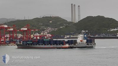
WAN HAI 232
Container Ship
Current Trip
| Trip Time | 4 days |
|---|---|
| Trip Distance | 1652.24 nm |
| AVG Speed | 14.9 Knopen |
| MAX Speed | 18.4 Knopen |
| Diepgang | 9.6 M |
| AVG Wind | 9.2 knots |
| MAX Wind | 21.4 knots |
| MIN Temp | 26.1°C / 78.98°F |
| MAX Temp | 30.6°C / 87.08°F |
| Positie ontvangen | 1 d geleden |
Current Position
| Lengtegraad | 103.39522° |
|---|---|
| Breedtegraat | 1.25046° |
| Status | Under way using engine |
| Snelheid | 17.3 Knopen |
| Koers | 304.1° |
| Gebied | Malacca Strait |
| Station | T-AIS |
| Positie ontvangen | 1 d geleden |
Info
Information
The current position of WAN HAI 232 is in Malacca Strait with coordinates 1.25046° / 103.39522° as reported on 2024-06-07 00:46 by AIS to our vessel tracker app. The vessel's current speed is 17.3 Knopen and is currently inside the port of PORT KLANG.
The vessel WAN HAI 232 (IMO: 9208162, MMSI: 416047000) is a Container Ship that was built in 2000 ( 24 Jaar oud ). It's sailing under the flag of [TW] Taiwan.
In this page you can find informations about the vessels current position, last detected port calls, and current voyage information. If the vessels is not in coverage by AIS you will find the latest position.
The current position of WAN HAI 232 is detected by our AIS receivers and we are not responsible for the reliability of the data. The last position was recorded while the vessel was in Coverage by the Ais receivers of our vessel tracking app.
The current draught of WAN HAI 232 as reported by AIS is 9.6 meters
Weather
| Temperature | 29.4°C / 84.92°F |
|---|---|
| Wind Speed | 7 knots |
| Direction | 297° WNW |
| Pressure | 1006.9 hPa |
| Humidity | 71.4 % |
| Cloud Coverage | 100 % |
Featured Company
Last Port Calls
| Port | Arrival | Departure | Time In Port |
|---|---|---|---|
| 2024-06-08 00:21 | |||
| 2024-06-03 08:47 | 2024-06-03 16:22 | 7 h | |
| 2024-06-01 04:02 | 2024-06-01 14:50 | 10 h | |
| 2024-05-30 19:24 | 2024-05-31 08:22 | 12 h | |
| 2024-05-30 00:48 | 2024-05-30 07:36 | 6 h | |
| 2024-05-28 12:19 | 2024-05-29 00:17 | 11 h | |
| 2024-05-24 19:24 | 2024-05-25 02:48 | 7 h | |
| 2024-05-23 06:12 | 2024-05-24 03:00 | 20 h | |
| 2024-05-21 15:03 | 2024-05-22 14:36 | 23 h | |
| 2024-05-20 01:21 | 2024-05-20 21:00 | 19 h |
Last Trips
| Origin | Departure | Destination | Arrival | Distance | |
|---|---|---|---|---|---|
| 2024-06-03 16:22 | 2024-06-08 00:21 | 1652.24 nm | |||
| 2024-06-01 14:50 | 2024-06-03 08:47 | 394.23 nm | |||
| 2024-05-31 08:22 | 2024-06-01 04:02 | 208.41 nm | |||
| 2024-05-30 07:36 | 2024-05-30 19:24 | 202.17 nm | |||
| 2024-05-29 00:17 | 2024-05-30 00:48 | 354.02 nm | |||
| 2024-05-25 02:48 | 2024-05-28 12:19 | 1447.53 nm | |||
| 2024-05-24 03:00 | 2024-05-24 19:24 | 243.63 nm | |||
| 2024-05-22 14:36 | 2024-05-23 06:12 | 195.27 nm | |||
| 2024-05-20 21:00 | 2024-05-21 15:03 | 198.43 nm | |||
| 2024-05-16 00:12 | 2024-05-20 01:21 | 1647.45 nm |
Events
| Tijd | Evenement | Details | Positie / Bestemming | Info |
|---|---|---|---|---|
| 2024-06-07 17:21 | Stop beweging |
3.02699 / 101.35677
[MY] PORT KLANG
|
Snelheid: 0.3 kn Koers: 181° |
|
| 2024-06-07 16:21 | Aankomsthaven |
|
2.91728 / 101.27873
[MY] PORT KLANG
|
Snelheid: 12.8 kn Koers: 36° |
| 2024-06-07 15:17 | Start beweging | 16.73 nm, South West of PORT KLANG |
2.75247 / 101.21406
MY PKG
|
Snelheid: 3.5 kn Koers: 346° |
| 2024-06-07 14:25 | Stop beweging | 16.47 nm, South West of PORT KLANG |
2.75386 / 101.22085
MY PKG
|
Snelheid: 0.3 kn Koers: 277° |
| 2024-06-07 01:25 | Status Changed | Default Under way using engine |
1.35984 / 103.25221
MY PKG
|
Snelheid: 17.3 kn Koers: 304.1° |
| 2024-06-07 00:46 | Buitenbereik |
1.25046 / 103.39522
Malacca Strait
MY PKG
|
Snelheid: 17.3 kn Koers: 304.1° |
|
| 2024-06-07 00:43 | Wijzig zee gebeid | Malaysian part of the Malacca Strait Malaysian part of the Singapore Strait |
1.24323 / 103.40583
Malacca Strait
MY PKG
|
Snelheid: 17.3 kn Koers: 303.2° |
| 2024-06-07 00:04 | Wijzig zee gebeid | Malaysian part of the Singapore Strait Indonesian part of the Singapore Strait |
1.19803 / 103.58714
Singapore Strait
MY PKG
|
Snelheid: 17.4 kn Koers: 283.7° |
| 2024-06-06 23:34 | Wijzig zee gebeid | Indonesian part of the Singapore Strait Singaporean part of the Singapore Strait |
1.14689 / 103.71704
Singapore Strait
MY PKG
|
Snelheid: 15.7 kn Koers: 298.8° |
| 2024-06-06 22:07 | Wijzig zee gebeid | Singaporean part of the Singapore Strait Indonesian part of the Singapore Strait |
1.26179 / 104.00932
Singapore Strait
MY PKG
|
Snelheid: 14.6 kn Koers: 270.5° |