
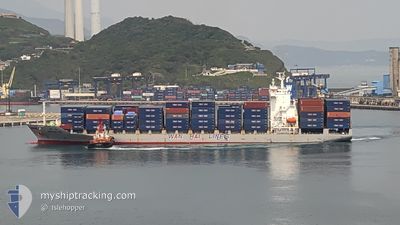
WAN HAI 172
Container Ship
Current Trip
| Time Travelled | 2 days |
|---|---|
| Remaining Time | 3 h, 27 mins |
| Distance Travelled | 1146.97 nm |
| Remaining Distance | 48.99 nm |
| AVG Speed | 15.3 Knopen |
| MAX Speed | 20 Knopen |
| AVG Wind | 11.8 knots |
| MAX Wind | 24.1 knots |
| MIN Temp | 17.1°C / 62.78°F |
| MAX Temp | 23.9°C / 75.02°F |
| Diepgang | 7.6 M |
| Positie ontvangen | 2 h, 8 m geleden |
Current Position
| Lengtegraad | 139.65178° |
|---|---|
| Breedtegraat | 34.85028° |
| Status | Under way using engine |
| Snelheid | 8.5 Knopen |
| Koers | 22.8° |
| Gebied | North Pacific Ocean |
| Station | T-AIS |
| Positie ontvangen | 2 h, 8 m geleden |
Info
Information
The current position of WAN HAI 172 is in North Pacific Ocean with coordinates 34.85028° / 139.65178° as reported on 2024-04-27 20:41 by AIS to our vessel tracker app. The vessel's current speed is 8.5 Knopen and is heading at the port of TOKYO. The estimated time of arrival as calculated by MyShipTracking vessel tracking app is 2024-04-28 02:16 LT
The vessel WAN HAI 172 (IMO: 9380269, MMSI: 477225300) is a Container Ship that was built in 2009 ( 15 Jaar oud ). It's sailing under the flag of [HK] Hong Kong.
In this page you can find informations about the vessels current position, last detected port calls, and current voyage information. If the vessels is not in coverage by AIS you will find the latest position.
The current position of WAN HAI 172 is detected by our AIS receivers and we are not responsible for the reliability of the data. The last position was recorded while the vessel was in Coverage by the Ais receivers of our vessel tracking app.
The current draught of WAN HAI 172 as reported by AIS is 7.6 meters
Weather
| Temperature | 17.8°C / 64.04°F |
|---|---|
| Wind Speed | 4 knots |
| Direction | 29° NNE |
| Pressure | 1013.7 hPa |
| Humidity | 86.2 % |
| Cloud Coverage | 4 % |
Featured Company
Last Port Calls
| Port | Arrival | Departure | Time In Port |
|---|---|---|---|
| 2024-04-24 15:08 | 2024-04-24 23:50 | 8 h | |
| 2024-04-24 01:37 | 2024-04-24 08:17 | 6 h | |
| 2024-04-23 07:48 | 2024-04-23 17:35 | 9 h | |
| 2024-04-21 19:29 | 2024-04-22 07:32 | 12 h | |
| 2024-03-29 23:57 | 2024-03-30 16:46 | 16 h | |
| 2024-03-25 02:16 | 2024-03-25 12:27 | 10 h | |
| 2024-03-21 22:00 | 2024-03-24 22:00 | 3 d | |
| 2024-03-21 02:56 | 2024-03-21 15:38 | 12 h | |
| 2024-03-16 19:06 | 2024-03-17 06:30 | 11 h | |
| 2024-03-15 05:36 | 2024-03-15 18:46 | 13 h |
Last Trips
| Origin | Departure | Destination | Arrival | Distance | |
|---|---|---|---|---|---|
| 2024-04-24 16:17 | 2024-04-24 23:08 | 89.16 nm | |||
| 2024-04-24 01:35 | 2024-04-24 09:37 | 125.61 nm | |||
| 2024-04-22 15:32 | 2024-04-23 15:48 | 356.00 nm | |||
| 2024-03-31 00:46 | 2024-04-22 03:29 | 549.59 nm | |||
| 2024-03-25 19:27 | 2024-03-30 07:57 | 1694.11 nm | |||
| 2024-03-25 05:00 | 2024-03-25 09:16 | 39.62 nm | |||
| 2024-03-21 22:38 | 2024-03-22 05:00 | 27.55 nm | |||
| 2024-03-17 14:30 | 2024-03-21 09:56 | 1485.17 nm | |||
| 2024-03-16 02:46 | 2024-03-17 03:06 | 352.73 nm | |||
| 2024-03-14 16:36 | 2024-03-15 13:36 | 139.91 nm |
Events
| Tijd | Evenement | Details | Positie / Bestemming | Info |
|---|---|---|---|---|
| 2024-04-27 20:43 | Status Changed | Default Under way using engine |
34.85614 / 139.65505
JPTYO O
|
Snelheid: 8.5 kn Koers: 22.8° |
| 2024-04-27 20:41 | Buitenbereik |
34.85028 / 139.65178
North Pacific Ocean
JPTYO O
|
Snelheid: 8.5 kn Koers: 22.8° |
|
| 2024-04-27 20:38 | Status Changed | Under way using engine Default |
34.84537 / 139.64862
JPTYO O
|
Snelheid: 8.8 kn Koers: 30° |
| 2024-04-27 20:18 | Status Changed | Default Under way using engine |
34.80410 / 139.61523
JPTYO O
|
Snelheid: 8.9 kn Koers: 21.8° |
| 2024-04-27 19:37 | Wijzig zee gebeid | Japanese part of the North Pacific Ocean Japanese part of the Philippine Sea |
34.76465 / 139.60528
North Pacific Ocean
JPTYO O
|
Snelheid: 2.7 kn Koers: 14.3° |
| 2024-04-27 19:36 | Status Changed | Under way using engine Default |
34.76365 / 139.60497
JPTYO O
|
Snelheid: 6.3 kn Koers: 21° |
| 2024-04-27 19:24 | Status Changed | Default Under way using engine |
34.74812 / 139.59639
JPTYO O
|
Snelheid: 10 kn Koers: 20.9° |
| 2024-04-27 18:31 | Status Changed | Under way using engine Default |
34.61753 / 139.51792
JPTYO O
|
Snelheid: 12 kn Koers: 77° |
| 2024-04-27 18:20 | Status Changed | Default Under way using engine |
34.61078 / 139.47717
JPTYO O
|
Snelheid: 11.5 kn Koers: 74.4° |
| 2024-04-27 18:15 | Status Changed | Under way using engine Default |
34.60649 / 139.45464
JPTYO O
|
Snelheid: 11.7 kn Koers: 79° |