
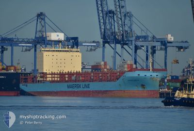
VUOKSI MAERSK
Cargo
Current Trip
| Time Travelled | 4 days |
|---|---|
| Remaining Time | --- |
| Distance Travelled | 1407.33 nm |
| Remaining Distance | 1248.60 nm |
| AVG Speed | 15.1 Knopen |
| MAX Speed | 18.6 Knopen |
| AVG Wind | 10.1 knots |
| MAX Wind | 25.1 knots |
| MIN Temp | 12.4°C / 54.32°F |
| MAX Temp | 16.1°C / 60.98°F |
| Diepgang | 11 M |
| Positie ontvangen | 19 h, 58 m geleden |
Current Position
| Lengtegraad | --- |
|---|---|
| Breedtegraat | --- |
| Status | Under way using engine |
| Snelheid | 18.4 Knopen |
| Koers | 288.8° |
| Gebied | Mediterranean Sea - Eastern Basin |
| Station | T-AIS |
| Positie ontvangen | 19 h, 58 m geleden |
Info
Information
The current position of VUOKSI MAERSK is in Mediterranean Sea - Eastern Basin with coordinates 36.53152° / 14.13217° as reported on 2025-02-17 01:54 by AIS to our vessel tracker app. The vessel's current speed is 18.4 Knopen and is heading at the port of PORT SAID. The estimated time of arrival as calculated by MyShipTracking vessel tracking app is 2025-02-13 07:00 LT
The vessel VUOKSI MAERSK (IMO: 9775775, MMSI: 219133000) is a Cargo It's sailing under the flag of [DK] Denmark.
In this page you can find informations about the vessels current position, last detected port calls, and current voyage information. If the vessels is not in coverage by AIS you will find the latest position.
The current position of VUOKSI MAERSK is detected by our AIS receivers and we are not responsible for the reliability of the data. The last position was recorded while the vessel was in Coverage by the Ais receivers of our vessel tracking app.
The current draught of VUOKSI MAERSK as reported by AIS is 11 meters
Weather
| Temperature | 14.2°C / 57.56°F |
|---|---|
| Wind Speed | 6 knots |
| Direction | 289° WNW |
| Pressure | 1018.2 hPa |
| Humidity | 73.2 % |
| Cloud Coverage | 2 % |
Featured Company
Last Port Calls
| Port | Arrival | Departure | Time In Port |
|---|---|---|---|
| 2025-02-13 08:57 | 2025-02-14 10:28 | 1 d | |
| 2025-02-11 07:20 | 2025-02-12 22:05 | 1 d | |
| 2025-02-09 07:41 | 2025-02-10 09:49 | 1 d | |
| 2025-01-28 19:00 | 2025-01-29 05:27 | 10 h | |
| 2025-01-24 11:56 | 2025-01-25 15:50 | 1 d | |
| 2025-01-22 20:01 | 2025-01-23 12:34 | 16 h | |
| 2025-01-21 02:27 | 2025-01-21 22:11 | 19 h | |
| 2025-01-06 09:36 | 2025-01-07 07:28 | 21 h | |
| 2025-01-02 03:54 | 2025-01-05 21:42 | 3 d | |
| 2024-12-30 12:25 | 2024-12-31 18:06 | 1 d |
Most Visited Ports (Last year)
| Port | Arrivals | |
|---|---|---|
| 17 | ||
| 8 | ||
| 7 | ||
| 7 | ||
| 7 | ||
| 6 |
Last Trips
| Origin | Departure | Destination | Arrival | Distance | |
|---|---|---|---|---|---|
| 2025-02-13 00:05 | 2025-02-13 10:57 | 150.98 nm | |||
| 2025-02-10 11:49 | 2025-02-11 09:20 | 278.83 nm | |||
| 2025-01-29 06:27 | 2025-02-09 09:41 | 3300.03 nm | |||
| 2025-01-25 16:50 | 2025-01-28 20:00 | 491.46 nm | |||
| 2025-01-23 13:34 | 2025-01-24 12:56 | 276.91 nm | |||
| 2025-01-21 22:11 | 2025-01-22 21:01 | 152.03 nm | |||
| 2025-01-05 23:42 | 2025-01-21 02:27 | 3500.85 nm | |||
| 2025-01-05 23:42 | 2025-01-06 11:36 | 150.30 nm | |||
| 2024-12-31 20:06 | 2025-01-02 05:54 | 279.34 nm | |||
| 2024-12-22 04:11 | 2024-12-30 14:25 | 3481.66 nm |
Events
| Tijd | Evenement | Details | Positie / Bestemming | Info |
|---|---|---|---|---|
| 2025-02-17 01:57 | Status Changed | Default Under way using engine |
36.53647 / 14.11410
ILASD - EGPSD
|
Snelheid: 18.4 kn Koers: 288.8° |
| 2025-02-17 01:54 | Buitenbereik |
36.53152 / 14.13217
Mediterranean Sea - Eastern Basin
|
Snelheid: 18.4 kn Koers: 288.8° |
|
| 2025-02-17 01:26 | Status Changed | Under way using engine Default |
36.48845 / 14.29837
ILASD - EGPSD
|
Snelheid: 18.3 kn Koers: 290° |
| 2025-02-17 01:09 | Status Changed | Default Under way using engine |
36.46110 / 14.40370
ILASD - EGPSD
|
Snelheid: 18.2 kn Koers: 289.8° |
| 2025-02-17 01:06 | Status Changed | Under way using engine Default |
36.45697 / 14.41783
ILASD - EGPSD
|
Snelheid: 18.2 kn Koers: 289° |
| 2025-02-17 01:06 | Wijzig zee gebeid | Italian part of the Mediterranean Sea - Eastern Basin Egyptian part of the Mediterranean Sea - Eastern Basin |
36.45697 / 14.41783
Mediterranean Sea - Eastern Basin
|
Snelheid: 18.2 kn Koers: 289.8° |
| 2025-02-17 00:53 | Binnenbereik |
36.45697 / 14.41783
Mediterranean Sea - Eastern Basin
|
Snelheid: 18.2 kn Koers: 289.8° |
|
| 2025-02-14 11:57 | Status Changed | Default Moored |
31.50118 / 32.30765
ILASD - EGPSD
|
Snelheid: 14.8 kn Koers: 294.3° |
| 2025-02-14 11:55 | Wijzig zee gebeid | Egyptian part of the Mediterranean Sea - Eastern Basin Israeli part of the Mediterranean Sea - Eastern Basin |
31.49688 / 32.31942
Mediterranean Sea - Eastern Basin
|
Snelheid: 14.8 kn Koers: 294.3° |
| 2025-02-14 11:55 | Buitenbereik |
31.49688 / 32.31942
Mediterranean Sea - Eastern Basin
|
Snelheid: 14.8 kn Koers: 294.3° |