

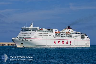
VOLCAN DE TINAMAR
Ro-Ro/Passenger Ship

Current Trip
| Time Travelled | 6 h, 17 mins |
|---|---|
| Remaining Time | --- |
| Distance Travelled | 140.00 nm |
| Remaining Distance | --- |
| AVG Speed | 22.2 Knopen |
| MAX Speed | 23.9 Knopen |
| AVG Wind | 8.6 knots |
| MAX Wind | 16 knots |
| MIN Temp | 16.9°C / 62.42°F |
| MAX Temp | 20.3°C / 68.54°F |
| Diepgang | 6 M |
| Positie ontvangen | 3 m geleden |
Current Position
| Lengtegraad | --- |
|---|---|
| Breedtegraat | --- |
| Status | Under way using engine |
| Snelheid | 22.7 Knopen |
| Koers | 218.3° |
| Gebied | North Atlantic Ocean |
| Station | T-AIS |
| Positie ontvangen | 3 m geleden |
Information
The current position of VOLCAN DE TINAMAR is in North Atlantic Ocean with coordinates 34.74833° / -8.09417° as reported on 2025-03-29 18:29 by AIS to our vessel tracker app. The vessel's current speed is 22.7 Knopen
The vessel VOLCAN DE TINAMAR (IMO: 9506291, MMSI: 225423000) is a Ro-Ro/Passenger Ship that was built in 2011 ( 14 Jaar oud ). It's sailing under the flag of [ES] Spain.
In this page you can find informations about the vessels current position, last detected port calls, and current voyage information. If the vessels is not in coverage by AIS you will find the latest position.
The current position of VOLCAN DE TINAMAR is detected by our AIS receivers and we are not responsible for the reliability of the data. The last position was recorded while the vessel was in Coverage by the Ais receivers of our vessel tracking app.
The current draught of VOLCAN DE TINAMAR as reported by AIS is 6 meters
Weather
| Temperature | 17.6°C / 63.68°F |
|---|---|
| Wind Speed | 8 knots |
| Direction | 32° NNE |
| Pressure | 1016.9 hPa |
| Humidity | 77.8 % |
| Cloud Coverage | --- |


Featured Company
Last Port Calls
| Port | Arrival | Departure | Time In Port |
|---|---|---|---|
| 2025-03-28 21:52 | 2025-03-29 13:16 | 15 h | |
| 2025-03-27 15:18 | 2025-03-27 16:35 | 1 h | |
| 2025-03-26 16:58 | 2025-03-27 10:12 | 17 h | |
| 2025-03-25 16:58 | 2025-03-25 23:23 | 6 h | |
| 2025-03-25 04:52 | 2025-03-25 11:09 | 6 h | |
| 2025-03-24 18:08 | 2025-03-24 23:32 | 5 h | |
| 2025-03-24 03:00 | 2025-03-24 15:17 | 12 h | |
| 2025-03-23 21:42 | 2025-03-24 00:31 | 2 h | |
| 2025-03-23 14:53 | 2025-03-23 16:59 | 2 h | |
| 2025-03-21 21:57 | 2025-03-22 13:24 | 15 h |
Most Visited Ports (Last year)
| Port | Arrivals | |
|---|---|---|
| 235 | ||
| 202 | ||
| 84 | ||
| 51 | ||
| 3 |
Last Trips
| Origin | Departure | Destination | Arrival | Distance | |
|---|---|---|---|---|---|
| 2025-03-27 16:35 | 2025-03-28 21:52 | 582.13 nm | |||
| 2025-03-27 10:12 | 2025-03-27 15:18 | 110.23 nm | |||
| 2025-03-25 23:23 | 2025-03-26 16:58 | 201.56 nm | |||
| 2025-03-25 11:09 | 2025-03-25 16:58 | 109.98 nm | |||
| 2025-03-24 23:32 | 2025-03-25 04:52 | 110.67 nm | |||
| 2025-03-24 15:17 | 2025-03-24 18:08 | 50.97 nm | |||
| 2025-03-24 00:31 | 2025-03-24 03:00 | 51.34 nm | |||
| 2025-03-23 16:59 | 2025-03-23 21:42 | 106.93 nm | |||
| 2025-03-22 13:24 | 2025-03-23 14:53 | 586.55 nm | |||
| 2025-03-20 16:23 | 2025-03-21 21:57 | 586.87 nm |
Events
| Tijd | Evenement | Details | Positie / Bestemming | Info |
|---|---|---|---|---|
| 2025-03-29 15:01 | Wijzig zee gebeid | Moroccan part of the North Atlantic Ocean Spanish part of the North Atlantic Ocean |
35.79491 / -7.08382
North Atlantic Ocean
ARRECIFE
|
Snelheid: 23.3 kn Koers: 219.1° |
| 2025-03-29 15:00 | Status Changed | Under way using engine Default |
35.79836 / -7.08039
ARRECIFE
|
Snelheid: 23.4 kn Koers: 219° |
| 2025-03-29 14:50 | Status Changed | Default Under way using engine |
35.84970 / -7.02962
ARRECIFE
|
Snelheid: 23.4 kn Koers: 218.7° |
| 2025-03-29 14:37 | Status Changed | Under way using engine Default |
35.92063 / -6.95918
ARRECIFE
|
Snelheid: 23.5 kn Koers: 218° |
| 2025-03-29 14:20 | Status Changed | Default Under way using engine |
36.00499 / -6.87562
ARRECIFE
|
Snelheid: 23.6 kn Koers: 219.8° |
| 2025-03-29 13:57 | Status Changed | Under way using engine Default |
36.12403 / -6.75989
ARRECIFE
|
Snelheid: 23.5 kn Koers: 220° |
| 2025-03-29 13:52 | Status Changed | Default Under way using engine |
36.14868 / -6.73579
ARRECIFE
|
Snelheid: 23.5 kn Koers: 217.4° |
| 2025-03-29 13:47 | Status Changed | Under way using engine Default |
36.17518 / -6.71023
ARRECIFE
|
Snelheid: 23.5 kn Koers: 217° |
| 2025-03-29 13:36 | Status Changed | Default Under way using engine |
36.23232 / -6.65700
ARRECIFE
|
Snelheid: 23.6 kn Koers: 218.3° |
| 2025-03-29 13:16 | Status Changed | Under way using engine Default |
36.33520 / -6.55662
ARRECIFE
|
Snelheid: 23.8 kn Koers: 220° |