
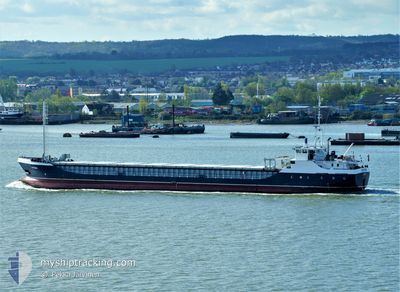
VICTRESS
General Cargo
Current Trip
| Time Travelled | 3 days |
|---|---|
| Remaining Time | --- |
| Distance Travelled | 543.27 nm |
| Remaining Distance | --- |
| AVG Speed | 7.1 Knopen |
| MAX Speed | 9.7 Knopen |
| AVG Wind | 10.2 knots |
| MAX Wind | 20.8 knots |
| MIN Temp | 13.1°C / 55.58°F |
| MAX Temp | 20.6°C / 69.08°F |
| Diepgang | 4.5 M |
| Positie ontvangen | 1 d geleden |
Current Position
| Lengtegraad | 23.62557° |
|---|---|
| Breedtegraat | 37.30671° |
| Status | Under way using engine |
| Snelheid | 7.4 Knopen |
| Koers | 219.2° |
| Gebied | Aegean Sea |
| Station | T-AIS |
| Positie ontvangen | 1 d geleden |
Info
Information
The current position of VICTRESS is in Aegean Sea with coordinates 37.30671° / 23.62557° as reported on 2024-05-04 17:11 by AIS to our vessel tracker app. The vessel's current speed is 7.4 Knopen and is heading at the port of LONDON. The estimated time of arrival as calculated by MyShipTracking vessel tracking app is 2024-05-20 20:24 LT
The vessel VICTRESS (IMO: 9030498, MMSI: 357544000) is a General Cargo that was built in 1992 ( 32 Jaar oud ). It's sailing under the flag of [PA] Panama.
In this page you can find informations about the vessels current position, last detected port calls, and current voyage information. If the vessels is not in coverage by AIS you will find the latest position.
The current position of VICTRESS is detected by our AIS receivers and we are not responsible for the reliability of the data. The last position was recorded while the vessel was in Coverage by the Ais receivers of our vessel tracking app.
The current draught of VICTRESS as reported by AIS is 4.5 meters
Weather
| Temperature | 18.6°C / 65.48°F |
|---|---|
| Wind Speed | 7 knots |
| Direction | 316° NW |
| Pressure | 1016.5 hPa |
| Humidity | 78.7 % |
| Cloud Coverage | --- |
Featured Company
Last Port Calls
| Port | Arrival | Departure | Time In Port |
|---|---|---|---|
| 2024-04-30 14:05 | 2024-05-02 13:05 | 1 d | |
| 2024-03-23 16:16 | 2024-04-15 13:08 | 22 d | |
| 2024-03-20 09:26 | |||
| 2024-03-13 06:59 | 2024-03-15 15:00 | 2 d |
Events
| Tijd | Evenement | Details | Positie / Bestemming | Info |
|---|---|---|---|---|
| 2024-05-04 17:21 | Status Changed | Default Under way using engine |
37.29002 / 23.60876
GBLON
|
Snelheid: 7.4 kn Koers: 219.2° |
| 2024-05-04 17:11 | Buitenbereik |
37.30671 / 23.62557
Aegean Sea
GBLON
|
Snelheid: 7.4 kn Koers: 219.2° |
|
| 2024-05-04 17:06 | Status Changed | Under way using engine Default |
37.31513 / 23.63408
GBLON
|
Snelheid: 7.2 kn Koers: 220° |
| 2024-05-04 16:57 | Status Changed | Default Under way using engine |
37.32813 / 23.64730
GBLON
|
Snelheid: 7.2 kn Koers: 218.6° |
| 2024-05-04 16:30 | Status Changed | Under way using engine Default |
37.36978 / 23.68916
GBLON
|
Snelheid: 7.2 kn Koers: 219° |
| 2024-05-04 15:50 | Status Changed | Default Under way using engine |
37.43180 / 23.74908
GBLON
|
Snelheid: 7.1 kn Koers: 215.8° |
| 2024-05-04 15:31 | Status Changed | Under way using engine Default |
37.46178 / 23.77759
GBLON
|
Snelheid: 7 kn Koers: 219° |
| 2024-05-04 15:14 | Status Changed | Default Under way using engine |
37.48755 / 23.80461
GBLON
|
Snelheid: 7 kn Koers: 233.6° |
| 2024-05-04 15:08 | Status Changed | Under way using engine Default |
37.49752 / 23.81482
GBLON
|
Snelheid: 6.6 kn Koers: 238° |
| 2024-05-04 14:56 | Status Changed | Default Under way using engine |
37.50893 / 23.83776
GBLON
|
Snelheid: 6.4 kn Koers: 240.4° |