
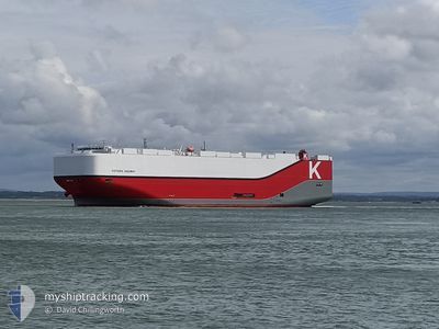
VICTORIA HIGHWAY
Cargo
Current Trip
| Trip Time | 16 days |
|---|---|
| Trip Distance | 4304.38 nm |
| AVG Speed | 12.6 Knopen |
| MAX Speed | 12.6 Knopen |
| Diepgang | 9.1 M |
| AVG Wind | 12.2 knots |
| MAX Wind | 35.3 knots |
| MIN Temp | -4°C / 24.8°F |
| MAX Temp | 19.9°C / 67.82°F |
| Positie ontvangen | 3 m geleden |
Current Position
| Lengtegraad | --- |
|---|---|
| Breedtegraat | --- |
| Status | Moored |
| Snelheid | |
| Koers | 242° |
| Gebied | North Sea |
| Station | T-AIS |
| Positie ontvangen | 3 m geleden |
Info
Information
The current position of VICTORIA HIGHWAY is in North Sea with coordinates 53.57552° / 8.55260° as reported on 2025-02-18 13:28 by AIS to our vessel tracker app. The vessel's current speed is 0 Knopen and is currently inside the port of BREMERHAVEN.
The vessel VICTORIA HIGHWAY (IMO: 9827255, MMSI: 374069000) is a Cargo It's sailing under the flag of [PA] Panama.
In this page you can find informations about the vessels current position, last detected port calls, and current voyage information. If the vessels is not in coverage by AIS you will find the latest position.
The current position of VICTORIA HIGHWAY is detected by our AIS receivers and we are not responsible for the reliability of the data. The last position was recorded while the vessel was in Coverage by the Ais receivers of our vessel tracking app.
The current draught of VICTORIA HIGHWAY as reported by AIS is 9.1 meters
Weather
| Temperature | 2.1°C / 35.78°F |
|---|---|
| Wind Speed | 8 knots |
| Direction | 128° SE |
| Pressure | 1030 hPa |
| Humidity | 36.1 % |
| Cloud Coverage | --- |
Featured Company
Last Port Calls
| Port | Arrival | Departure | Time In Port |
|---|---|---|---|
| 2025-02-17 23:26 | |||
| 2025-01-31 08:26 | 2025-02-01 03:47 | 19 h | |
| 2025-01-29 14:56 | 2025-01-30 18:33 | 1 d | |
| 2025-01-27 00:59 | 2025-01-27 19:39 | 18 h | |
| 2025-01-26 06:15 | 2025-01-27 00:34 | 18 h | |
| 2025-01-25 15:51 | 2025-01-26 05:37 | 13 h | |
| 2025-01-12 09:26 | 2025-01-13 23:03 | 1 d | |
| 2025-01-09 07:58 | 2025-01-10 23:18 | 1 d | |
| 2025-01-08 17:12 | 2025-01-09 02:58 | 9 h | |
| 2025-01-04 03:54 | 2025-01-04 21:46 | 17 h |
Most Visited Ports (Last year)
| Port | Arrivals | |
|---|---|---|
| 9 | ||
| 8 | ||
| 8 | ||
| 8 | ||
| 8 | ||
| 8 |
Last Trips
| Origin | Departure | Destination | Arrival | Distance | |
|---|---|---|---|---|---|
| 2025-01-31 22:47 | 2025-02-18 00:26 | 4304.38 nm | |||
| 2025-01-30 13:33 | 2025-01-31 03:26 | 165.53 nm | |||
| 2025-01-27 14:39 | 2025-01-29 09:56 | 696.31 nm | |||
| 2025-01-26 19:34 | 2025-01-26 19:59 | 1.03 nm | |||
| 2025-01-26 00:37 | 2025-01-26 01:15 | 4.46 nm | |||
| 2025-01-14 00:03 | 2025-01-25 10:51 | 4445.65 nm | |||
| 2025-01-11 00:18 | 2025-01-12 10:26 | 348.38 nm | |||
| 2025-01-09 03:58 | 2025-01-09 08:58 | 66.31 nm | |||
| 2025-01-04 21:46 | 2025-01-08 18:12 | 699.07 nm | |||
| 2024-12-19 06:39 | 2025-01-04 03:54 | 3771.01 nm |
Events
| Tijd | Evenement | Details | Positie / Bestemming | Info |
|---|---|---|---|---|
| 2025-02-18 06:34 | Status Changed | Moored Default |
53.57550 / 8.55263
[DE] BREMERHAVEN
|
Snelheid: Koers: 243° |
| 2025-02-18 06:28 | Status Changed | Default Moored |
53.57550 / 8.55258
[DE] BREMERHAVEN
|
Snelheid: Koers: 243° |
| 2025-02-18 01:04 | Status Changed | Moored Under way using engine |
53.57550 / 8.55264
[DE] BREMERHAVEN
|
Snelheid: Koers: 242° |
| 2025-02-18 00:05 | Stop beweging |
53.56933 / 8.54956
[DE] BREMERHAVEN
|
Snelheid: 0.3 kn Koers: 183° |
|
| 2025-02-17 23:26 | Aankomsthaven |
|
53.60315 / 8.50076
[DE] BREMERHAVEN
|
Snelheid: 10 kn Koers: 142.4° |
| 2025-02-17 20:53 | ETA Changed | 2025/02/17 21:30 2025/02/18 02:00 |
53.91224 / 7.85643
DE CUX > DE BRV
|
Snelheid: 5.8 kn Koers: 186.9° |
| 2025-02-17 20:45 | Start beweging | 9.04 nm, North of WANGEROOGE |
53.92410 / 7.85547
DE CUX > DE BRV
|
Snelheid: 3.1 kn Koers: 129° |
| 2025-02-17 20:42 | Status Changed | Under way using engine At anchor |
53.92486 / 7.85292
DE CUX > DE BRV
|
Snelheid: 0.5 kn Koers: 88° |
| 2025-02-17 20:37 | Status Changed | At anchor Default |
53.92462 / 7.85142
DE CUX > DE BRV
|
Snelheid: 0.5 kn Koers: 112° |
| 2025-02-17 20:31 | Status Changed | Default At anchor |
53.92529 / 7.84985
DE CUX > DE BRV
|
Snelheid: 0.1 kn Koers: 111° |