
VIBRANT CURIOSITY
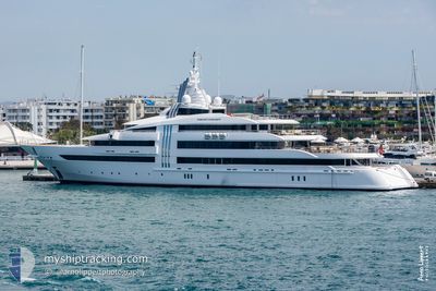
Yacht
Current Trip
| Time Travelled | 36 days |
|---|---|
| Remaining Time | --- |
| Distance Travelled | 725.12 nm |
| Remaining Distance | --- |
| AVG Speed | 11 Knopen |
| MAX Speed | 17.5 Knopen |
| AVG Wind | 14.1 knots |
| MAX Wind | 24 knots |
| MIN Temp | 24.6°C / 76.28°F |
| MAX Temp | 26.6°C / 79.88°F |
| Diepgang | 4 M |
| Positie ontvangen | 3 m geleden |
Current Position
| Lengtegraad | --- |
|---|---|
| Breedtegraat | --- |
| Status | At anchor |
| Snelheid | 0.3 Knopen |
| Koers | 54° |
| Gebied | Caribbean Sea |
| Station | T-AIS |
| Positie ontvangen | 3 m geleden |
Info
Information
The current position of VIBRANT CURIOSITY is in Caribbean Sea with coordinates 18.44740° / -64.71651° as reported on 2025-03-17 08:31 by AIS to our vessel tracker app. The vessel's current speed is 0.3 Knopen
The vessel VIBRANT CURIOSITY (IMO: 1010002, MMSI: 248983000) is a Yacht that was built in 2009 ( 16 Jaar oud ). It's sailing under the flag of [MT] Malta.
In this page you can find informations about the vessels current position, last detected port calls, and current voyage information. If the vessels is not in coverage by AIS you will find the latest position.
The current position of VIBRANT CURIOSITY is detected by our AIS receivers and we are not responsible for the reliability of the data. The last position was recorded while the vessel was in Coverage by the Ais receivers of our vessel tracking app.
The current draught of VIBRANT CURIOSITY as reported by AIS is 4 meters
Weather
| Temperature | 25°C / 77°F |
|---|---|
| Wind Speed | 13 knots |
| Direction | 38° NE |
| Pressure | 1015 hPa |
| Humidity | 73.4 % |
| Cloud Coverage | --- |
Featured Company
Last Port Calls
| Port | Arrival | Departure | Time In Port |
|---|---|---|---|
| 2025-01-20 12:04 | 2025-02-08 08:36 | 18 d | |
| 2025-01-15 11:51 |
Most Visited Ports (Last year)
| Port | Arrivals | |
|---|---|---|
| 3 | ||
| 2 | ||
| 2 | ||
| 2 | ||
| 2 | ||
| 1 |
Last Trips
| Origin | Departure | Destination | Arrival | Distance | |
|---|---|---|---|---|---|
| 2025-01-15 11:51 | 2025-01-20 12:04 | 1174.34 nm |
Events
| Tijd | Evenement | Details | Positie / Bestemming | Info |
|---|---|---|---|---|
| 2025-03-16 00:04 | Binnenbereik |
18.44757 / -64.71634
Caribbean Sea
|
Snelheid: 0.1 kn Koers: 284.3° |
|
| 2025-03-15 21:22 | Buitenbereik |
18.44753 / -64.71596
Caribbean Sea
|
Snelheid: 0.1 kn Koers: 22.3° |
|
| 2025-03-15 21:22 | Binnenbereik |
18.44753 / -64.71596
Caribbean Sea
|
Snelheid: 0.1 kn Koers: 22.3° |
|
| 2025-03-15 20:10 | Buitenbereik |
18.44757 / -64.71592
Caribbean Sea
|
Snelheid: 0.1 kn Koers: 317.2° |
|
| 2025-03-15 18:46 | Binnenbereik |
18.44770 / -64.71582
Caribbean Sea
|
Snelheid: 0.2 kn Koers: 305.8° |
|
| 2025-03-15 16:46 | Buitenbereik |
18.44770 / -64.71587
Caribbean Sea
|
Snelheid: 0.2 kn Koers: 78.7° |
|
| 2025-03-13 23:28 | Binnenbereik |
18.44732 / -64.71623
Caribbean Sea
|
Snelheid: 0.2 kn Koers: 57.3° |
|
| 2025-03-13 22:25 | Buitenbereik |
18.44747 / -64.71563
Caribbean Sea
|
Snelheid: 0.1 kn Koers: 48.4° |
|
| 2025-03-13 12:26 | Status Changed | At anchor Under way using engine |
18.44813 / -64.71592
SOPERS HOLE BVI
|
Snelheid: 0.6 kn Koers: 174° |
| 2025-03-13 12:24 | Stop beweging | 2.03 nm, East of JOST VAN DYKE |
18.44784 / -64.71582
SOPERS HOLE BVI
|
Snelheid: 0.1 kn Koers: 179° |