
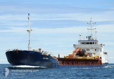
VESTBRIS
General Cargo
Current Trip
| Time Travelled | 3 days |
|---|---|
| Remaining Time | 23 mins |
| Distance Travelled | 485.03 nm |
| Remaining Distance | 5.77 nm |
| AVG Speed | 7.2 Knopen |
| MAX Speed | 10.9 Knopen |
| AVG Wind | 15.7 knots |
| MAX Wind | 28 knots |
| MIN Temp | 9.2°C / 48.56°F |
| MAX Temp | 19.9°C / 67.82°F |
| Diepgang | 3.1 M |
| Positie ontvangen | Nu |
Current Position
| Lengtegraad | 9.47761° |
|---|---|
| Breedtegraat | 58.82043° |
| Status | Under way using engine |
| Snelheid | 7.8 Knopen |
| Koers | 337.6° |
| Gebied | Skaggerak |
| Station | T-AIS |
| Positie ontvangen | Nu |
Info
Information
The current position of VESTBRIS is in Skaggerak with coordinates 58.82043° / 9.47761° as reported on 2024-05-04 14:00 by AIS to our vessel tracker app. The vessel's current speed is 7.8 Knopen and is heading at the port of KRAGERO. The estimated time of arrival as calculated by MyShipTracking vessel tracking app is 2024-05-04 14:24 LT
The vessel VESTBRIS (IMO: 8410316, MMSI: 375103000) is a General Cargo that was built in 1985 ( 39 Jaar oud ). It's sailing under the flag of [VC] St Vincent Grenadines.
In this page you can find informations about the vessels current position, last detected port calls, and current voyage information. If the vessels is not in coverage by AIS you will find the latest position.
The current position of VESTBRIS is detected by our AIS receivers and we are not responsible for the reliability of the data. The last position was recorded while the vessel was in Coverage by the Ais receivers of our vessel tracking app.
The current draught of VESTBRIS as reported by AIS is 3.1 meters
Weather
| Temperature | 10.2°C / 50.36°F |
|---|---|
| Wind Speed | 4 knots |
| Direction | 146° SE |
| Pressure | 1014.2 hPa |
| Humidity | 77.2 % |
| Cloud Coverage | 86 % |
Featured Company
Last Port Calls
| Port | Arrival | Departure | Time In Port |
|---|---|---|---|
| 2024-04-30 08:35 | 2024-04-30 14:48 | 6 h | |
| 2024-04-29 03:19 | 2024-04-29 13:17 | 9 h | |
| 2024-04-27 08:36 | 2024-04-27 17:33 | 8 h | |
| 2024-04-26 12:14 | 2024-04-26 18:20 | 6 h | |
| 2024-04-22 07:48 | 2024-04-22 13:23 | 5 h | |
| 2024-04-21 04:04 | 2024-04-21 14:19 | 10 h | |
| 2024-04-15 14:38 | 2024-04-16 00:53 | 10 h | |
| 2024-04-10 10:36 | 2024-04-12 18:15 | 2 d | |
| 2024-04-09 08:44 | 2024-04-09 19:48 | 11 h | |
| 2024-04-08 04:18 | 2024-04-08 11:44 | 7 h |
Most Visited Ports (Last year)
| Port | Arrivals | |
|---|---|---|
| 23 | ||
| 17 | ||
| 13 | ||
| 12 | ||
| 11 | ||
| 8 |
Last Trips
| Origin | Departure | Destination | Arrival | Distance | |
|---|---|---|---|---|---|
| 2024-04-29 15:17 | 2024-04-30 10:35 | 183.00 nm | |||
| 2024-04-27 19:33 | 2024-04-29 05:19 | 218.30 nm | |||
| 2024-04-26 20:20 | 2024-04-27 10:36 | 106.95 nm | |||
| 2024-04-22 15:23 | 2024-04-26 14:14 | 582.18 nm | |||
| 2024-04-21 16:19 | 2024-04-22 09:48 | 180.44 nm | |||
| 2024-04-16 02:53 | 2024-04-21 06:04 | 725.10 nm | |||
| 2024-04-12 20:15 | 2024-04-15 16:38 | 501.61 nm | |||
| 2024-04-09 21:48 | 2024-04-10 12:36 | 129.81 nm | |||
| 2024-04-08 13:44 | 2024-04-09 10:44 | 183.58 nm | |||
| 2024-04-05 16:43 | 2024-04-08 06:18 | 394.68 nm |
Events
| Tijd | Evenement | Details | Positie / Bestemming | Info |
|---|---|---|---|---|
| 2024-05-04 09:50 | Gevonden in zee | Norwegian part of the Skaggerak |
58.37172 / 10.07829
Skaggerak
KRAGERO
|
Snelheid: 8.2 kn Koers: 323.5° |
| 2024-05-04 08:05 | Gevonden in zee | Swedish part of the Skaggerak |
58.18610 / 10.33521
Skaggerak
KRAGERO
|
Snelheid: 7.6 kn Koers: 325.5° |
| 2024-05-04 04:37 | Wijzig zee gebeid | Danish part of the Skaggerak Danish part of the Kattegat |
57.77054 / 10.78325
Skaggerak
KRAGERO
|
Snelheid: 10.5 kn Koers: 344.6° |
| 2024-05-03 21:35 | Start beweging | 3.48 nm, East of AALBORG |
57.05063 / 10.06506
KRAGERO
|
Snelheid: 5.5 kn Koers: 78.1° |
| 2024-05-03 21:34 | Status Changed | Under way using engine Moored |
57.05028 / 10.06233
KRAGERO
|
Snelheid: 1.5 kn Koers: 55° |
| 2024-05-03 21:34 | Draught Changed | 3.1 5 |
57.04981 / 10.06126
KRAGERO
|
Snelheid: 1.5 kn Koers: 55° |
| 2024-05-03 21:34 | Destination Changed | KRAGERO AALBORG |
57.04981 / 10.06126
KRAGERO
|
Snelheid: 1.5 kn Koers: 55° |
| 2024-05-03 21:34 | ETA Changed | 2024/05/04 14:00 2024/05/03 14:00 |
57.04981 / 10.06126
KRAGERO
|
Snelheid: 1.5 kn Koers: 55° |
| 2024-05-03 13:43 | Status Changed | Moored Under way using engine |
57.04975 / 10.06157
AALBORG
|
Snelheid: Koers: 60° |
| 2024-05-03 13:09 | Stop beweging | 3.38 nm, East of AALBORG |
57.05015 / 10.06174
AALBORG
|
Snelheid: 0.2 kn Koers: 275° |