

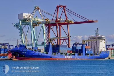
VERA A
Container Ship

Current Trip
| Time Travelled | 6 days |
|---|---|
| Remaining Time | --- |
| Distance Travelled | 1565.68 nm |
| Remaining Distance | --- |
| AVG Speed | 11 Knopen |
| MAX Speed | 14.5 Knopen |
| AVG Wind | 12.2 knots |
| MAX Wind | 31 knots |
| MIN Temp | 9.7°C / 49.46°F |
| MAX Temp | 17.4°C / 63.32°F |
| Diepgang | 8.6 M |
| Positie ontvangen | 3 d geleden |
Current Position
| Lengtegraad | --- |
|---|---|
| Breedtegraat | --- |
| Status | Under way using engine |
| Snelheid | 12.9 Knopen |
| Koers | 285.5° |
| Gebied | Mediterranean Sea - Eastern Basin |
| Station | T-AIS |
| Positie ontvangen | 3 d geleden |
Information
The current position of VERA A is in Mediterranean Sea - Eastern Basin with coordinates 37.23685° / 12.16070° as reported on 2025-03-27 04:34 by AIS to our vessel tracker app. The vessel's current speed is 12.9 Knopen
The vessel VERA A (IMO: 9372585, MMSI: 256579000) is a Container Ship that was built in 2011 ( 14 Jaar oud ). It's sailing under the flag of [MT] Malta.
In this page you can find informations about the vessels current position, last detected port calls, and current voyage information. If the vessels is not in coverage by AIS you will find the latest position.
The current position of VERA A is detected by our AIS receivers and we are not responsible for the reliability of the data. The last position was recorded while the vessel was in Coverage by the Ais receivers of our vessel tracking app.
The current draught of VERA A as reported by AIS is 8.6 meters
Weather
| Temperature | 14.7°C / 58.46°F |
|---|---|
| Wind Speed | 16 knots |
| Direction | 5° N |
| Pressure | 1017 hPa |
| Humidity | 61.3 % |
| Cloud Coverage | --- |


Featured Company
Last Port Calls
| Port | Arrival | Departure | Time In Port |
|---|---|---|---|
| 2025-03-22 11:18 | 2025-03-23 14:21 | 1 d | |
| 2025-03-21 15:12 | 2025-03-22 04:52 | 13 h | |
| 2025-03-13 21:16 | 2025-03-16 18:52 | 2 d | |
| 2025-03-09 07:44 | 2025-03-09 17:49 | 10 h | |
| 2025-03-07 07:23 | 2025-03-07 17:56 | 10 h | |
| 2025-03-03 16:47 | 2025-03-04 02:38 | 9 h | |
| 2025-03-02 16:29 | 2025-03-03 03:07 | 10 h | |
| 2025-02-28 17:29 | 2025-03-01 20:09 | 1 d | |
| 2025-02-26 03:13 | 2025-02-26 21:11 | 17 h | |
| 2025-02-24 17:49 | 2025-02-25 11:19 | 17 h |
Last Trips
| Origin | Departure | Destination | Arrival | Distance | |
|---|---|---|---|---|---|
| 2025-03-22 04:52 | 2025-03-22 11:18 | 57.52 nm | |||
| 2025-03-16 18:52 | 2025-03-21 15:12 | 1001.88 nm | |||
| 2025-03-09 17:49 | 2025-03-13 21:16 | 976.99 nm | |||
| 2025-03-07 17:56 | 2025-03-09 07:44 | 56.89 nm | |||
| 2025-03-04 02:38 | 2025-03-07 07:23 | 58.29 nm | |||
| 2025-03-03 03:07 | 2025-03-03 16:47 | 51.13 nm | |||
| 2025-03-01 20:09 | 2025-03-02 16:29 | 160.02 nm | |||
| 2025-02-26 21:11 | 2025-02-28 17:29 | 245.48 nm | |||
| 2025-02-25 11:19 | 2025-02-26 03:13 | 12.64 nm | |||
| 2025-02-19 03:45 | 2025-02-24 17:49 | 684.82 nm |
Events
| Tijd | Evenement | Details | Positie / Bestemming | Info |
|---|---|---|---|---|
| 2025-03-27 04:39 | Status Changed | Default Under way using engine |
37.24103 / 12.14191
DZALG
|
Snelheid: 12.9 kn Koers: 285.5° |
| 2025-03-27 04:34 | Buitenbereik |
37.23685 / 12.16070
Mediterranean Sea - Eastern Basin
DZALG
|
Snelheid: 12.9 kn Koers: 285.5° |
|
| 2025-03-27 04:34 | Status Changed | Under way using engine Default |
37.23637 / 12.16290
DZALG
|
Snelheid: 13 kn Koers: 285° |
| 2025-03-27 04:24 | Binnenbereik |
37.23637 / 12.16290
Mediterranean Sea - Eastern Basin
DZALG
|
Snelheid: 13 kn Koers: 284.7° |
|
| 2025-03-26 22:48 | Status Changed | Default Under way using engine |
36.87941 / 13.67962
DZALG
|
Snelheid: 12.6 kn Koers: 287.6° |
| 2025-03-26 22:42 | Buitenbereik |
36.87295 / 13.70467
Mediterranean Sea - Eastern Basin
DZALG
|
Snelheid: 12.6 kn Koers: 287.6° |
|
| 2025-03-26 22:19 | Status Changed | Under way using engine Default |
36.84991 / 13.79963
DZALG
|
Snelheid: 12.6 kn Koers: 286° |
| 2025-03-26 22:15 | Status Changed | Default Under way using engine |
36.84526 / 13.81945
DZALG
|
Snelheid: 12.6 kn Koers: 286.1° |
| 2025-03-26 22:11 | Status Changed | Under way using engine Default |
36.84166 / 13.83494
DZALG
|
Snelheid: 12.7 kn Koers: 286° |
| 2025-03-26 22:07 | Status Changed | Default Under way using engine |
36.83763 / 13.85193
DZALG
|
Snelheid: 12.7 kn Koers: 286.1° |