
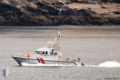
VCSM PENFELD
Law Enforcement
Current Trip
| Trip Time | 1 day |
|---|---|
| Trip Distance | 88.83 nm |
| AVG Speed | 19.8 Knopen |
| MAX Speed | 24.3 Knopen |
| Diepgang | 0 M |
| AVG Wind | 9.5 knots |
| MAX Wind | 16 knots |
| MIN Temp | 10.2°C / 50.36°F |
| MAX Temp | 13.9°C / 57.02°F |
| Positie ontvangen | 2 d geleden |
Current Position
| Lengtegraad | -4.49709° |
|---|---|
| Breedtegraat | 48.38605° |
| Status | Under way using engine |
| Snelheid | |
| Koers | --- |
| Gebied | Celtic Sea |
| Station | T-AIS |
| Positie ontvangen | 2 d geleden |
Info
Information
The current position of VCSM PENFELD is in Celtic Sea with coordinates 48.38605° / -4.49709° as reported on 2024-04-30 15:50 by AIS to our vessel tracker app. The vessel's current speed is 0 Knopen and is currently inside the port of BREST.
The vessel VCSM PENFELD (MMSI: 228817700) is a Law Enforcement It's sailing under the flag of [FR] France.
In this page you can find informations about the vessels current position, last detected port calls, and current voyage information. If the vessels is not in coverage by AIS you will find the latest position.
The current position of VCSM PENFELD is detected by our AIS receivers and we are not responsible for the reliability of the data. The last position was recorded while the vessel was in Coverage by the Ais receivers of our vessel tracking app.
Weather
| Temperature | 9.9°C / 49.82°F |
|---|---|
| Wind Speed | 7 knots |
| Direction | 222° SW |
| Pressure | 1006.9 hPa |
| Humidity | 81.8 % |
| Cloud Coverage | 100 % |
Featured Company
Events
| Tijd | Evenement | Details | Positie / Bestemming | Info |
|---|---|---|---|---|
| 2024-04-30 15:50 | Buitenbereik |
48.38605 / -4.49709
Celtic Sea
[FR] BREST
|
Snelheid: Koers: 511° |
|
| 2024-04-30 15:38 | Stop beweging |
48.38527 / -4.49653
[FR] BREST
|
Snelheid: Koers: 511° |
|
| 2024-04-30 15:28 | Aankomsthaven |
|
48.36809 / -4.48855
[FR] BREST
|
Snelheid: 10.7 kn Koers: 354.7° |
| 2024-04-30 13:55 | Gevonden in zee | French part of the Celtic Sea |
47.92971 / -4.66842
Celtic Sea
|
Snelheid: 16 kn Koers: 318.9° |
| 2024-04-30 13:55 | Binnenbereik |
47.92971 / -4.66842
Celtic Sea
|
Snelheid: 16 kn Koers: 318.9° |
|
| 2024-04-29 14:21 | Buitenbereik |
47.72447 / -3.72363
Bay of Biscay
|
Snelheid: 17.4 kn Koers: 265.3° |
|
| 2024-04-29 13:17 | Vertrekhaven |
|
47.72443 / -3.36606
|
Snelheid: 7.5 kn Koers: 197.6° |
| 2024-04-29 13:15 | Start beweging |
47.72795 / -3.36516
[FR] LORIENT
|
Snelheid: 6.6 kn Koers: 145.8° |
|
| 2024-04-29 12:47 | Stop beweging |
47.72919 / -3.36736
[FR] LORIENT
|
Snelheid: 0.1 kn Koers: 511° |
|
| 2024-04-29 12:46 | Aankomsthaven |
|
47.72918 / -3.36736
[FR] LORIENT
|
Snelheid: 1.1 kn Koers: 511° |