
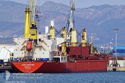
VANTAGE REEF
Bulk Carrier
Current Trip
| Trip Time | 45 days |
|---|---|
| Trip Distance | 9936.35 nm |
| AVG Speed | 10.9 Knopen |
| MAX Speed | 10.9 Knopen |
| Diepgang | 10.3 M |
| AVG Wind | 8.8 knots |
| MAX Wind | 29 knots |
| MIN Temp | 20.8°C / 69.44°F |
| MAX Temp | 30.9°C / 87.62°F |
| Positie ontvangen | 1 d geleden |
Current Position
| Lengtegraad | 120.00451° |
|---|---|
| Breedtegraat | 23.99253° |
| Status | Under way using engine |
| Snelheid | 10.7 Knopen |
| Koers | 34.6° |
| Gebied | South China Sea |
| Station | T-AIS |
| Positie ontvangen | 1 d geleden |
Info
Information
The current position of VANTAGE REEF is in South China Sea with coordinates 23.99253° / 120.00451° as reported on 2024-05-18 16:06 by AIS to our vessel tracker app. The vessel's current speed is 10.7 Knopen and is currently inside the port of TAICHUNG.
The vessel VANTAGE REEF (IMO: 9422495, MMSI: 636016244) is a Bulk Carrier that was built in 2010 ( 14 Jaar oud ). It's sailing under the flag of [LR] Liberia.
In this page you can find informations about the vessels current position, last detected port calls, and current voyage information. If the vessels is not in coverage by AIS you will find the latest position.
The current position of VANTAGE REEF is detected by our AIS receivers and we are not responsible for the reliability of the data. The last position was recorded while the vessel was in Coverage by the Ais receivers of our vessel tracking app.
The current draught of VANTAGE REEF as reported by AIS is 10.3 meters
Weather
| Temperature | 25.5°C / 77.9°F |
|---|---|
| Wind Speed | 9 knots |
| Direction | 7° N |
| Pressure | 1008.5 hPa |
| Humidity | 87.9 % |
| Cloud Coverage | 100 % |
Featured Company
Events
| Tijd | Evenement | Details | Positie / Bestemming | Info |
|---|---|---|---|---|
| 2024-05-19 01:04 | Stop beweging |
24.26325 / 120.50479
[TW] TAICHUNG
|
Snelheid: 0.1 kn Koers: 21° |
|
| 2024-05-19 00:24 | Aankomsthaven |
|
24.29092 / 120.50387
[TW] TAICHUNG
|
Snelheid: 5 kn Koers: 99° |
| 2024-05-18 23:03 | Start beweging | 4.35 nm, West of TAICHUNG |
24.24838 / 120.43914
TAICHUNG
|
Snelheid: 4.4 kn Koers: 290° |
| 2024-05-18 19:24 | Stop beweging | 4.09 nm, West of TAICHUNG |
24.24938 / 120.44380
TAICHUNG
|
Snelheid: 0.3 kn Koers: 127° |
| 2024-05-18 16:12 | Status Changed | Default Under way using engine |
24.00833 / 120.01667
TAICHUNG
|
Snelheid: 10.7 kn Koers: 34.6° |
| 2024-05-18 16:06 | Buitenbereik |
23.99253 / 120.00451
South China Sea
TAICHUNG
|
Snelheid: 10.7 kn Koers: 34.6° |
|
| 2024-05-18 15:34 | Status Changed | Under way using engine Default |
23.91492 / 119.94434
TAICHUNG
|
Snelheid: 11 kn Koers: 23° |
| 2024-05-18 15:25 | Status Changed | Default Under way using engine |
23.88741 / 119.93139
TAICHUNG
|
Snelheid: 11.4 kn Koers: 17° |
| 2024-05-18 15:14 | Draught Changed | 10.3 10.2 |
23.85533 / 119.92178
TAICHUNG
|
Snelheid: 11.7 kn Koers: 6.6° |
| 2024-05-18 15:14 | ETA Changed | 2024/05/18 20:00 2024/05/11 15:50 |
23.85533 / 119.92178
TAICHUNG
|
Snelheid: 11.7 kn Koers: 6.6° |