
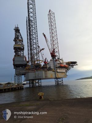
VALARIS 123
Other Type
Current Trip
ERSKINE
| Time Travelled | 6 days |
|---|---|
| Remaining Time | --- |
| Distance Travelled | 170.15 nm |
| Remaining Distance | --- |
| AVG Speed | 4.6 Knopen |
| MAX Speed | 5.6 Knopen |
| AVG Wind | 5.1 knots |
| MAX Wind | 6.8 knots |
| MIN Temp | 6°C / 42.8°F |
| MAX Temp | 9.8°C / 49.64°F |
| Diepgang | 0 M |
| Positie ontvangen | 5 d geleden |
Current Position
| Lengtegraad | 2.04714° |
|---|---|
| Breedtegraat | 57.04277° |
| Status | Restricted manoeuverability |
| Snelheid | 0.3 Knopen |
| Koers | --- |
| Gebied | North Sea |
| Station | T-AIS |
| Positie ontvangen | 5 d geleden |
Info
Information
The current position of VALARIS 123 is in North Sea with coordinates 57.04277° / 2.04714° as reported on 2024-04-21 21:15 by AIS to our vessel tracker app. The vessel's current speed is 0.3 Knopen
The vessel VALARIS 123 (IMO: 9721396, MMSI: 636016549) is a Other Type It's sailing under the flag of [LR] Liberia.
In this page you can find informations about the vessels current position, last detected port calls, and current voyage information. If the vessels is not in coverage by AIS you will find the latest position.
The current position of VALARIS 123 is detected by our AIS receivers and we are not responsible for the reliability of the data. The last position was recorded while the vessel was in Coverage by the Ais receivers of our vessel tracking app.
Weather
| Temperature | 6.2°C / 43.16°F |
|---|---|
| Wind Speed | 5 knots |
| Direction | 7° N |
| Pressure | 1032.3 hPa |
| Humidity | 65.1 % |
| Cloud Coverage | 100 % |
Featured Company
Most Visited Ports (Last year)
| Port | Arrivals | |
|---|---|---|
| 1 |
Last Trips
| Origin | Departure | Destination | Arrival | Distance |
|---|
Events
| Tijd | Evenement | Details | Positie / Bestemming | Info |
|---|---|---|---|---|
| 2024-04-21 21:15 | Buitenbereik |
57.04277 / 2.04714
North Sea
|
Snelheid: 0.3 kn Koers: 227.1° |
|
| 2024-04-21 21:11 | Stop beweging |
57.04293 / 2.04718
ERSKINE
|
Snelheid: 0.2 kn Koers: 511° |
|
| 2024-04-21 19:52 | Binnenbereik |
57.06667 / 1.96051
North Sea
|
Snelheid: 3.3 kn Koers: 96.9° |
|
| 2024-04-20 17:17 | Buitenbereik |
56.47008 / -2.25664
North Sea
|
Snelheid: 5.4 kn Koers: 87.3° |
|
| 2024-04-20 17:08 | Destination Changed | ERSKINE L11-16 ELLIOT |
56.46919 / -2.28117
ERSKINE
|
Snelheid: 5.4 kn Koers: 85.6° |
| 2024-04-20 15:00 | Start beweging | 5.02 nm, South of ARBROATH |
56.47100 / -2.59826
L11-16 ELLIOT
|
Snelheid: 3.1 kn Koers: 70° |
| 2024-04-20 14:32 | Stop beweging | 5.01 nm, South of ARBROATH |
56.47142 / -2.60398
L11-16 ELLIOT
|
Snelheid: 0.3 kn Koers: 511° |
| 2024-04-20 11:58 | Start beweging | 0.46 nm, North East of TAYPORT |
56.45592 / -2.86920
L11-16 ELLIOT
|
Snelheid: 3.1 kn Koers: 110° |
| 2024-04-20 10:59 | Vertrekhaven |
|
56.46119 / -2.94120
L11-16 ELLIOT
|
Snelheid: 1.8 kn Koers: 511° |
| 2024-04-19 10:05 | Binnenbereik |
56.46207 / -2.95016
North Sea
[GB] DUNDEE
|
Snelheid: Koers: 0° |