
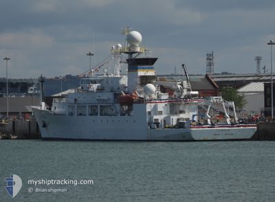
USNS BRUCE HEEZEN
Research/Survey Vessel
Current Trip
| Trip Time | 58 days |
|---|---|
| Trip Distance | 1149.43 nm |
| AVG Speed | 8.4 Knopen |
| MAX Speed | 13 Knopen |
| Diepgang | 0 M |
| AVG Wind | 10.3 knots |
| MAX Wind | 23 knots |
| MIN Temp | 20°C / 68°F |
| MAX Temp | 27.6°C / 81.68°F |
| Positie ontvangen | 13 h, 45 m geleden |
Current Position
| Lengtegraad | -6.25655° |
|---|---|
| Breedtegraat | 36.51197° |
| Status | Under way using engine |
| Snelheid | 7.6 Knopen |
| Koers | 179.2° |
| Gebied | North Atlantic Ocean |
| Station | T-AIS |
| Positie ontvangen | 13 h, 45 m geleden |
Info
Information
The current position of USNS BRUCE HEEZEN is in North Atlantic Ocean with coordinates 36.51197° / -6.25655° as reported on 2024-09-16 09:37 by AIS to our vessel tracker app. The vessel's current speed is 7.6 Knopen and is currently inside the port of CADIZ.
The vessel USNS BRUCE HEEZEN (IMO: 9117272, MMSI: 338934000) is a Research/Survey Vessel that was built in 2000 ( 24 Jaar oud ). It's sailing under the flag of [US] USA.
In this page you can find informations about the vessels current position, last detected port calls, and current voyage information. If the vessels is not in coverage by AIS you will find the latest position.
The current position of USNS BRUCE HEEZEN is detected by our AIS receivers and we are not responsible for the reliability of the data. The last position was recorded while the vessel was in Coverage by the Ais receivers of our vessel tracking app.
Weather
| Temperature | 27.3°C / 81.14°F |
|---|---|
| Wind Speed | 10 knots |
| Direction | 113° ESE |
| Pressure | 1013.6 hPa |
| Humidity | 38 % |
| Cloud Coverage | 100 % |
Featured Company
Events
| Tijd | Evenement | Details | Positie / Bestemming | Info |
|---|---|---|---|---|
| 2024-09-16 10:21 | Stop beweging |
36.50329 / -6.26283
[ES] CADIZ
|
Snelheid: Koers: 210° |
|
| 2024-09-16 09:45 | Aankomsthaven |
|
36.50329 / -6.26283
[ES] CADIZ
|
Snelheid: 3.2 kn Koers: 204° |
| 2024-09-16 09:43 | Status Changed | Default Under way using engine |
36.50484 / -6.26126
0000
|
Snelheid: 7.6 kn Koers: 179.2° |
| 2024-09-16 09:37 | Buitenbereik |
36.51197 / -6.25655
North Atlantic Ocean
[ES] CADIZ
|
Snelheid: 7.6 kn Koers: 179.2° |
|
| 2024-09-16 08:07 | Start beweging | 6.58 nm, West of ROTA |
36.57560 / -6.45888
0000
|
Snelheid: 3.5 kn Koers: 98° |
| 2024-09-16 07:18 | Stop beweging | 6.69 nm, West of ROTA |
36.57529 / -6.46116
0000
|
Snelheid: 0.3 kn Koers: 138° |
| 2024-09-16 05:32 | Status Changed | Under way using engine Default |
36.27603 / -6.53776
0000
|
Snelheid: 2.9 kn Koers: 53° |
| 2024-09-16 05:32 | Start beweging | 19.5 nm, West of CONIL |
36.27603 / -6.53776
0000
|
Snelheid: 8.8 kn Koers: 6.3° |
| 2024-09-16 05:20 | Status Changed | Default Under way using engine |
36.26897 / -6.54234
0000
|
Snelheid: 0.2 kn Koers: 85° |
| 2024-09-16 05:13 | Status Changed | Under way using engine Default |
36.26938 / -6.54237
0000
|
Snelheid: 0.2 kn Koers: 85° |