
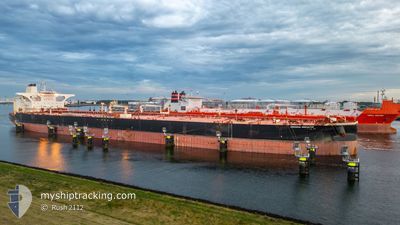
UNIVERSAL INNOVATOR
Tanker
Current Trip
| Time Travelled | 10 days |
|---|---|
| Remaining Time | --- |
| Distance Travelled | 2240.99 nm |
| Remaining Distance | --- |
| AVG Speed | 11.6 Knopen |
| MAX Speed | 16.8 Knopen |
| AVG Wind | 9.2 knots |
| MAX Wind | 17.7 knots |
| MIN Temp | 15.2°C / 59.36°F |
| MAX Temp | 30.9°C / 87.62°F |
| Diepgang | 11 M |
| Positie ontvangen | 2 d geleden |
Current Position
| Lengtegraad | --- |
|---|---|
| Breedtegraat | --- |
| Status | Under way using engine |
| Snelheid | 11.9 Knopen |
| Koers | 309.1° |
| Gebied | Malacca Strait |
| Station | T-AIS |
| Positie ontvangen | 2 d geleden |
Info
Information
The current position of UNIVERSAL INNOVATOR is in Malacca Strait with coordinates 1.27239° / 103.37619° as reported on 2025-03-15 18:46 by AIS to our vessel tracker app. The vessel's current speed is 11.9 Knopen and is heading at the port of ANGRA DOS REIS. The estimated time of arrival as calculated by MyShipTracking vessel tracking app is 2025-04-11 18:00 LT
The vessel UNIVERSAL INNOVATOR (IMO: 9829370, MMSI: 636022827) is a Tanker It's sailing under the flag of [LR] Liberia.
In this page you can find informations about the vessels current position, last detected port calls, and current voyage information. If the vessels is not in coverage by AIS you will find the latest position.
The current position of UNIVERSAL INNOVATOR is detected by our AIS receivers and we are not responsible for the reliability of the data. The last position was recorded while the vessel was in Coverage by the Ais receivers of our vessel tracking app.
The current draught of UNIVERSAL INNOVATOR as reported by AIS is 11 meters
Weather
| Temperature | 28.9°C / 84.02°F |
|---|---|
| Wind Speed | 12 knots |
| Direction | 37° NE |
| Pressure | 1012.2 hPa |
| Humidity | 71.5 % |
| Cloud Coverage | 100 % |
Featured Company
Most Visited Ports (Last year)
| Port | Arrivals | |
|---|---|---|
| 1 | ||
| 1 | ||
| 1 | ||
| 1 | ||
| 1 | ||
| 1 |
Events
| Tijd | Evenement | Details | Positie / Bestemming | Info |
|---|---|---|---|---|
| 2025-03-15 18:54 | Status Changed | Default Under way using engine |
1.28726 / 103.35766
BRADR
|
Snelheid: 11.9 kn Koers: 309.1° |
| 2025-03-15 18:46 | Buitenbereik |
1.27239 / 103.37619
Malacca Strait
BRADR
|
Snelheid: 11.9 kn Koers: 309.1° |
|
| 2025-03-15 18:16 | Wijzig zee gebeid | Malaysian part of the Malacca Strait Malaysian part of the Singapore Strait |
1.22398 / 103.46106
Malacca Strait
BRADR
|
Snelheid: 11.8 kn Koers: 281.7° |
| 2025-03-15 17:38 | Wijzig zee gebeid | Malaysian part of the Singapore Strait Indonesian part of the Singapore Strait |
1.19923 / 103.58186
Singapore Strait
BRADR
|
Snelheid: 11.9 kn Koers: 282.4° |
| 2025-03-15 16:50 | Wijzig zee gebeid | Indonesian part of the Singapore Strait Singaporean part of the Singapore Strait |
1.13735 / 103.72418
Singapore Strait
BRADR
|
Snelheid: 11.8 kn Koers: 295.7° |
| 2025-03-15 15:19 | Wijzig zee gebeid | Singaporean part of the Singapore Strait Indonesian part of the Singapore Strait |
1.25792 / 104.00301
Singapore Strait
BRADR
|
Snelheid: 12.2 kn Koers: 252.4° |
| 2025-03-15 15:13 | Wijzig zee gebeid | Indonesian part of the Singapore Strait Singaporean part of the Singapore Strait |
1.26418 / 104.02154
Singapore Strait
BRADR
|
Snelheid: 11.2 kn Koers: 242.1° |
| 2025-03-15 14:42 | Start beweging | 2.07 nm, East of TANAH MERAH |
1.30324 / 104.05109
BRADR
|
Snelheid: 3.1 kn Koers: 137° |
| 2025-03-15 14:26 | Status Changed | Under way using engine At anchor |
1.30160 / 104.04753
BRADR
|
Snelheid: 0.3 kn Koers: 62° |
| 2025-03-15 14:03 | Status Changed | At anchor Default |
1.30144 / 104.04739
BRADR
|
Snelheid: 0.1 kn Koers: 60° |