
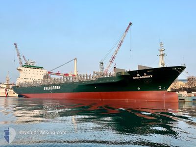
UNI ADROIT
Container Ship
Current Trip
| Time Travelled | 4 h, 3 mins |
|---|---|
| Remaining Time | 5 h, 27 mins |
| Distance Travelled | 25.98 nm |
| Remaining Distance | 97.93 nm |
| AVG Speed | 12 Knopen |
| MAX Speed | 13.3 Knopen |
| AVG Wind | 18.3 knots |
| MAX Wind | 25 knots |
| MIN Temp | 20°C / 68°F |
| MAX Temp | 23.2°C / 73.76°F |
| Diepgang | 7.7 M |
| Positie ontvangen | 2 h, 51 m geleden |
Current Position
| Lengtegraad | --- |
|---|---|
| Breedtegraat | --- |
| Status | Under way using engine |
| Snelheid | 13.1 Knopen |
| Koers | 348.5° |
| Gebied | South China Sea |
| Station | T-AIS |
| Positie ontvangen | 2 h, 51 m geleden |
Info
Information
The current position of UNI ADROIT is in South China Sea with coordinates 22.70134° / 120.09760° as reported on 2024-12-18 04:43 by AIS to our vessel tracker app. The vessel's current speed is 13.1 Knopen and is heading at the port of TAICHUNG. The estimated time of arrival as calculated by MyShipTracking vessel tracking app is 2024-12-18 13:02 LT
The vessel UNI ADROIT (IMO: 9130559, MMSI: 416341000) is a Container Ship that was built in 1998 ( 26 Jaar oud ). It's sailing under the flag of [TW] Taiwan.
In this page you can find informations about the vessels current position, last detected port calls, and current voyage information. If the vessels is not in coverage by AIS you will find the latest position.
The current position of UNI ADROIT is detected by our AIS receivers and we are not responsible for the reliability of the data. The last position was recorded while the vessel was in Coverage by the Ais receivers of our vessel tracking app.
The current draught of UNI ADROIT as reported by AIS is 7.7 meters
Weather
| Temperature | 20.1°C / 68.18°F |
|---|---|
| Wind Speed | 25 knots |
| Direction | 360° N |
| Pressure | 1016.5 hPa |
| Humidity | 72.2 % |
| Cloud Coverage | 65 % |
Featured Company
Last Port Calls
| Port | Arrival | Departure | Time In Port |
|---|---|---|---|
| 2024-12-17 04:25 | 2024-12-18 03:32 | 23 h | |
| 2024-12-15 12:47 | 2024-12-16 12:49 | 1 d | |
| 2024-12-13 11:42 | 2024-12-14 13:50 | 1 d | |
| 2024-12-11 16:16 | 2024-12-12 21:13 | 1 d | |
| 2024-12-10 04:14 | 2024-12-10 23:25 | 19 h | |
| 2024-12-08 13:09 | 2024-12-09 16:42 | 1 d | |
| 2024-12-06 23:30 | 2024-12-07 22:44 | 23 h | |
| 2024-12-05 03:53 | 2024-12-06 04:59 | 1 d | |
| 2024-12-03 10:40 | 2024-12-04 11:46 | 1 d | |
| 2024-12-02 02:10 | 2024-12-02 13:28 | 11 h |
Last Trips
| Origin | Departure | Destination | Arrival | Distance | |
|---|---|---|---|---|---|
| 2024-12-16 20:49 | 2024-12-17 12:25 | 177.73 nm | |||
| 2024-12-14 21:50 | 2024-12-15 20:47 | 176.95 nm | |||
| 2024-12-13 05:13 | 2024-12-13 19:42 | 180.32 nm | |||
| 2024-12-11 07:25 | 2024-12-12 00:16 | 153.65 nm | |||
| 2024-12-10 00:42 | 2024-12-10 12:14 | 132.41 nm | |||
| 2024-12-08 06:44 | 2024-12-08 21:09 | 175.75 nm | |||
| 2024-12-06 12:59 | 2024-12-07 07:30 | 177.08 nm | |||
| 2024-12-04 19:46 | 2024-12-05 11:53 | 180.54 nm | |||
| 2024-12-02 21:28 | 2024-12-03 18:40 | 149.33 nm | |||
| 2024-12-02 00:00 | 2024-12-02 10:10 | 131.85 nm |
Events
| Tijd | Evenement | Details | Positie / Bestemming | Info |
|---|---|---|---|---|
| 2024-12-18 05:56 | Stop beweging | 5.2 nm, North West of YUNG AN |
22.86126 / 120.11951
TWKHH TO TWTXG
|
Snelheid: 0.3 kn Koers: 353° |
| 2024-12-18 04:49 | Status Changed | Default Under way using engine |
22.72126 / 120.09285
TWKHH TO TWTXG
|
Snelheid: 13.1 kn Koers: 348.5° |
| 2024-12-18 04:43 | Status Changed | Under way using engine Default |
22.70134 / 120.09760
TWKHH TO TWTXG
|
Snelheid: 13.1 kn Koers: 348° |
| 2024-12-18 04:43 | Buitenbereik |
22.70134 / 120.09760
South China Sea
TWKHH TO TWTXG
|
Snelheid: 13.1 kn Koers: 348.5° |
|
| 2024-12-18 04:37 | Status Changed | Default Under way using engine |
22.67806 / 120.10271
TWKHH TO TWTXG
|
Snelheid: 13.1 kn Koers: 324.4° |
| 2024-12-18 04:15 | Status Changed | Under way using engine Default |
22.61143 / 120.14655
TWKHH TO TWTXG
|
Snelheid: 13.1 kn Koers: 323° |
| 2024-12-18 04:13 | Status Changed | Default Under way using engine |
22.60558 / 120.15151
TWKHH TO TWTXG
|
Snelheid: 13.1 kn Koers: 326.7° |
| 2024-12-18 03:51 | Status Changed | Under way using engine Default |
22.54790 / 120.20603
TWKHH TO TWTXG
|
Snelheid: 13 kn Koers: 272° |
| 2024-12-18 03:47 | Status Changed | Default Under way using engine |
22.54759 / 120.22298
TWKHH TO TWTXG
|
Snelheid: 12.5 kn Koers: 268.5° |
| 2024-12-18 03:35 | Status Changed | Under way using engine Default |
22.54792 / 120.26869
TWKHH TO TWTXG
|
Snelheid: 12.1 kn Koers: 274° |