
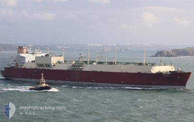
UMM SLAL
Lng Tanker
Current Trip
| Time Travelled | 9 days |
|---|---|
| Remaining Time | --- |
| Distance Travelled | 3508.60 nm |
| Remaining Distance | --- |
| AVG Speed | 15.1 Knopen |
| MAX Speed | 18 Knopen |
| AVG Wind | 9.4 knots |
| MAX Wind | 21.5 knots |
| MIN Temp | 23.6°C / 74.48°F |
| MAX Temp | 30.9°C / 87.62°F |
| Diepgang | 9.3 M |
| Positie ontvangen | 2 d geleden |
Current Position
| Lengtegraad | --- |
|---|---|
| Breedtegraat | --- |
| Status | Under way using engine |
| Snelheid | 15.7 Knopen |
| Koers | 293.4° |
| Gebied | Laccadive Sea |
| Station | T-AIS |
| Positie ontvangen | 2 d geleden |
Info
Information
The current position of UMM SLAL is in Laccadive Sea with coordinates 7.13846° / 77.07120° as reported on 2026-01-03 01:56 by AIS to our vessel tracker app. The vessel's current speed is 15.7 Knopen and is heading at the port of DOHA. The estimated time of arrival as calculated by MyShipTracking vessel tracking app is 2026-01-08 18:15 LT
The vessel UMM SLAL (IMO: 9372731, MMSI: 538003300) is a Lng Tanker that was built in 2008 ( 18 Jaar oud ). It's sailing under the flag of [MH] Marshall Is.
In this page you can find informations about the vessels current position, last detected port calls, and current voyage information. If the vessels is not in coverage by AIS you will find the latest position.
The current position of UMM SLAL is detected by our AIS receivers and we are not responsible for the reliability of the data. The last position was recorded while the vessel was in Coverage by the Ais receivers of our vessel tracking app.
The current draught of UMM SLAL as reported by AIS is 9.3 meters
Weather
| Temperature | 23.6°C / 74.48°F |
|---|---|
| Wind Speed | 12 knots |
| Direction | 37° NE |
| Pressure | 1016.4 hPa |
| Humidity | 67.7 % |
| Cloud Coverage | --- |
Featured Company
Last Port Calls
| Port | Arrival | Departure | Time In Port |
|---|---|---|---|
| 2025-12-26 06:25 | 2025-12-27 11:52 | 1 d | |
| 2025-12-09 23:17 | 2025-12-11 03:47 | 1 d | |
| 2025-11-01 05:13 |
Most Visited Ports (Last year)
| Port | Arrivals | |
|---|---|---|
| 11 | ||
| 4 | ||
| 1 |
Last Trips
| Origin | Departure | Destination | Arrival | Distance | |
|---|---|---|---|---|---|
| 2025-12-11 03:47 | 2025-12-26 06:25 | 4526.52 nm | |||
| 2025-11-01 05:13 | 2025-12-09 23:17 | 12407.10 nm |
Events
| Tijd | Evenement | Details | Positie / Bestemming | Info |
|---|---|---|---|---|
| 2026-01-03 02:00 | Status Changed | Default Under way using engine |
7.14712 / 77.05151
QATAR
|
Snelheid: 15.7 kn Koers: 293.4° |
| 2026-01-03 01:56 | Buitenbereik |
7.13846 / 77.07120
Laccadive Sea
QATAR
|
Snelheid: 15.7 kn Koers: 293.4° |
|
| 2026-01-03 01:51 | Wijzig zee gebeid | Indian part of the Laccadive Sea Malaysian part of the Malacca Strait |
7.13098 / 77.08874
Laccadive Sea
QATAR
|
Snelheid: 15.6 kn Koers: 293.1° |
| 2026-01-03 01:51 | Status Changed | Under way using engine Default |
7.13098 / 77.08874
QATAR
|
Snelheid: 16 kn Koers: 292° |
| 2026-01-03 01:39 | Binnenbereik |
7.13098 / 77.08874
Laccadive Sea
QATAR
|
Snelheid: 15.6 kn Koers: 293.1° |
|
| 2025-12-29 17:00 | Status Changed | Default Under way using engine |
2.18676 / 101.97253
QATAR
|
Snelheid: 14.7 kn Koers: 309.5° |
| 2025-12-29 16:55 | Buitenbereik |
2.17494 / 101.98689
Malacca Strait
QATAR
|
Snelheid: 14.7 kn Koers: 309.5° |
|
| 2025-12-29 15:19 | Gevonden in zee | Malaysian part of the Malacca Strait |
1.92771 / 102.30053
Malacca Strait
QATAR
|
Snelheid: 15.6 kn Koers: 295.1° |
| 2025-12-29 15:19 | Status Changed | Under way using engine Default |
1.92734 / 102.30131
QATAR
|
Snelheid: 15.6 kn Koers: 295° |
| 2025-12-29 15:01 | Binnenbereik |
1.92771 / 102.30053
Malacca Strait
QATAR
|
Snelheid: 15.6 kn Koers: 295.1° |