
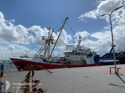
UK200 HENDRIK SR
Fishing
Current Trip
| Trip Time | 3 days |
|---|---|
| Trip Distance | 120.63 nm |
| AVG Speed | 6.9 Knopen |
| MAX Speed | 9.3 Knopen |
| Diepgang | 0 M |
| AVG Wind | 15 knots |
| MAX Wind | 25 knots |
| MIN Temp | 3.6°C / 38.48°F |
| MAX Temp | 7.8°C / 46.04°F |
| Positie ontvangen | 1 m geleden |
Current Position
| Lengtegraad | --- |
|---|---|
| Breedtegraat | --- |
| Status | Engaged in Fishing |
| Snelheid | |
| Koers | 116° |
| Gebied | North Sea |
| Station | T-AIS |
| Positie ontvangen | 1 m geleden |
Information
The current position of UK200 HENDRIK SR is in North Sea with coordinates 52.45947° / 4.58955° as reported on 2025-02-13 10:47 by AIS to our vessel tracker app. The vessel's current speed is 0 Knopen and is currently inside the port of IJMUIDEN.
The vessel UK200 HENDRIK SR (IMO: 9680920, MMSI: 244790677) is a Fishing It's sailing under the flag of [NL] Netherlands.
In this page you can find informations about the vessels current position, last detected port calls, and current voyage information. If the vessels is not in coverage by AIS you will find the latest position.
The current position of UK200 HENDRIK SR is detected by our AIS receivers and we are not responsible for the reliability of the data. The last position was recorded while the vessel was in Coverage by the Ais receivers of our vessel tracking app.
Weather
| Temperature | 1.6°C / 34.88°F |
|---|---|
| Wind Speed | 10 knots |
| Direction | 52° NE |
| Pressure | 1022.7 hPa |
| Humidity | 75.8 % |
| Cloud Coverage | 61 % |
Featured Company
Last Port Calls
| Port | Arrival | Departure | Time In Port |
|---|---|---|---|
| 2025-02-06 22:35 | |||
| 2025-02-01 21:00 | 2025-02-03 01:53 | 1 d | |
| 2025-01-23 18:54 | 2025-01-29 22:20 | 6 d | |
| 2025-01-17 20:55 | 2025-01-20 00:45 | 2 d | |
| 2025-01-15 21:03 | 2025-01-15 22:48 | 1 h | |
| 2025-01-10 18:07 | 2025-01-13 02:28 | 2 d | |
| 2025-01-04 15:00 | 2025-01-07 23:32 | 3 d | |
| 2024-12-20 23:35 | 2025-01-02 00:20 | 12 d | |
| 2024-12-18 02:14 | 2024-12-19 04:36 | 1 d | |
| 2024-12-14 21:47 | 2024-12-16 00:46 | 1 d |
Most Visited Ports (Last year)
| Port | Arrivals | |
|---|---|---|
| 25 | ||
| 7 | ||
| 4 | ||
| 4 | ||
| 3 | ||
| 2 |
Last Trips
| Origin | Departure | Destination | Arrival | Distance | |
|---|---|---|---|---|---|
| 2025-02-03 02:53 | 2025-02-06 23:35 | 120.63 nm | |||
| 2025-01-29 23:20 | 2025-02-01 22:00 | 40.78 nm | |||
| 2025-01-20 01:45 | 2025-01-23 19:54 | 307.27 nm | |||
| 2025-01-15 23:48 | 2025-01-17 21:55 | 214.41 nm | |||
| 2025-01-13 03:28 | 2025-01-15 22:03 | 253.62 nm | |||
| 2025-01-08 00:32 | 2025-01-10 19:07 | 228.43 nm | |||
| 2025-01-02 01:20 | 2025-01-04 16:00 | 242.08 nm | |||
| 2024-12-19 05:36 | 2024-12-21 00:35 | 210.18 nm | |||
| 2024-12-16 01:46 | 2024-12-18 03:14 | 227.65 nm | |||
| 2024-12-13 05:58 | 2024-12-14 22:47 | 185.08 nm |
Events
| Tijd | Evenement | Details | Positie / Bestemming | Info |
|---|---|---|---|---|
| 2025-02-07 00:04 | Stop beweging |
52.45965 / 4.58966
[NL] IJMUIDEN
|
Snelheid: 0.3 kn Koers: 168° |
|
| 2025-02-07 00:03 | Start beweging |
52.45958 / 4.59061
[NL] IJMUIDEN
|
Snelheid: 3.1 kn Koers: 288° |
|
| 2025-02-06 22:38 | Stop beweging |
52.45874 / 4.59331
[NL] IJMUIDEN
|
Snelheid: 0.3 kn Koers: 57° |
|
| 2025-02-06 22:35 | Aankomsthaven |
|
52.45912 / 4.59216
[NL] IJMUIDEN
|
Snelheid: 0.6 kn Koers: 105° |
| 2025-02-06 20:03 | Gevonden in zee | Dutch part of the North Sea |
52.50767 / 4.08892
North Sea
|
Snelheid: 7.5 kn Koers: 91° |
| 2025-02-06 20:03 | Binnenbereik |
52.50767 / 4.08892
North Sea
|
Snelheid: 7.5 kn Koers: 91° |
|
| 2025-02-04 15:25 | Buitenbereik |
52.70670 / 3.01011
North Sea
|
Snelheid: 3.8 kn Koers: 5.5° |
|
| 2025-02-04 15:21 | Binnenbereik |
52.70249 / 3.00949
North Sea
|
Snelheid: 3.6 kn Koers: 0.4° |
|
| 2025-02-04 00:15 | Buitenbereik |
52.60724 / 3.12791
North Sea
|
Snelheid: 3.3 kn Koers: 219.8° |
|
| 2025-02-04 00:15 | Gevonden in zee | United Kingdom part of the North Sea |
52.60724 / 3.12791
North Sea
|
Snelheid: 3.3 kn Koers: 219.8° |