
TRIANGLE
Cargo
Current Trip
| Time Travelled | 1 day |
|---|---|
| Remaining Time | 18 h, 40 mins |
| Distance Travelled | 152.80 nm |
| Remaining Distance | 102.23 nm |
| AVG Speed | 4.8 Knopen |
| MAX Speed | 9.6 Knopen |
| AVG Wind | 11.3 knots |
| MAX Wind | 19 knots |
| MIN Temp | 7.2°C / 44.96°F |
| MAX Temp | 11.7°C / 53.06°F |
| Diepgang | 3.7 M |
| Positie ontvangen | 5 h, 28 m geleden |
Current Position
| Lengtegraad | --- |
|---|---|
| Breedtegraat | --- |
| Status | Under way using engine |
| Snelheid | 4.6 Knopen |
| Koers | 163° |
| Gebied | North Sea |
| Station | T-AIS |
| Positie ontvangen | 5 h, 28 m geleden |
Info
Information
The current position of TRIANGLE is in North Sea with coordinates 50.53882° / 7.28722° as reported on 2026-02-22 08:43 by AIS to our vessel tracker app. The vessel's current speed is 4.6 Knopen and is heading at the port of MANNHEIM. The estimated time of arrival as calculated by MyShipTracking vessel tracking app is 2026-02-23 09:52 LT
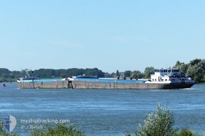
The vessel TRIANGLE (MMSI: 244710133) is a Cargo It's sailing under the flag of [NL] Netherlands.
In this page you can find informations about the vessels current position, last detected port calls, and current voyage information. If the vessels is not in coverage by AIS you will find the latest position.
The current position of TRIANGLE is detected by our AIS receivers and we are not responsible for the reliability of the data. The last position was recorded while the vessel was in Coverage by the Ais receivers of our vessel tracking app.
The current draught of TRIANGLE as reported by AIS is 3.7 meters
Weather
| Temperature | 10.6°C / 51.08°F |
|---|---|
| Wind Speed | 9 knots |
| Direction | 243° WSW |
| Pressure | 1019.7 hPa |
| Humidity | 93.6 % |
| Cloud Coverage | 100 % |
Featured Company
Last Port Calls
| Port | Arrival | Departure | Time In Port |
|---|---|---|---|
| 2026-02-20 22:08 | 2026-02-20 22:37 | 28 m | |
| 2026-02-20 10:01 | 2026-02-20 17:39 | 7 h | |
| 2026-02-20 05:50 | 2026-02-20 06:37 | 47 m | |
| 2026-02-17 16:49 | 2026-02-19 21:01 | 2 d | |
| 2026-02-14 19:44 | 2026-02-15 13:30 | 17 h | |
| 2026-02-13 09:23 | 2026-02-14 12:45 | 1 d | |
| 2026-02-10 22:06 | 2026-02-10 23:36 | 1 h | |
| 2026-02-10 15:33 | 2026-02-10 15:43 | 10 m | |
| 2026-02-10 04:40 | 2026-02-10 12:47 | 8 h | |
| 2026-02-08 01:57 | 2026-02-10 01:53 | 1 d |
Most Visited Ports (Last year)
| Port | Arrivals | |
|---|---|---|
| 37 | ||
| 37 | ||
| 33 | ||
| 22 | ||
| 19 | ||
| 13 |
Last Trips
| Origin | Departure | Destination | Arrival | Distance | |
|---|---|---|---|---|---|
| 2026-02-20 17:39 | 2026-02-20 22:08 | 31.21 nm | |||
| 2026-02-20 06:37 | 2026-02-20 10:01 | 32.35 nm | |||
| 2026-02-19 21:01 | 2026-02-20 05:50 | 65.78 nm | |||
| 2026-02-15 13:30 | 2026-02-17 16:49 | 306.39 nm | |||
| 2026-02-14 12:45 | 2026-02-14 19:44 | 6.53 nm | |||
| 2026-02-10 23:36 | 2026-02-13 09:23 | 281.43 nm | |||
| 2026-02-10 15:43 | 2026-02-10 22:06 | 43.57 nm | |||
| 2026-02-10 12:47 | 2026-02-10 15:33 | 18.28 nm | |||
| 2026-02-10 01:53 | 2026-02-10 04:40 | 28.37 nm | |||
| 2026-02-06 17:05 | 2026-02-08 01:57 | 302.02 nm |
Events
| Tijd | Evenement | Details | Positie / Bestemming | Info |
|---|---|---|---|---|
| 2026-02-22 08:43 | Buitenbereik |
50.53882 / 7.28722
North Sea
MANNHEIM
|
Snelheid: 4.6 kn Koers: 163.7° |
|
| 2026-02-22 07:51 | Binnenbereik |
50.57920 / 7.24077
North Sea
MANNHEIM
|
Snelheid: 5.1 kn Koers: 101.3° |
|
| 2026-02-22 06:10 | Buitenbereik |
50.68880 / 7.17593
North Sea
MANNHEIM
|
Snelheid: 4.7 kn Koers: 158.4° |
|
| 2026-02-21 21:10 | Binnenbereik |
51.14464 / 6.84873
North Sea
MANNHEIM
|
Snelheid: 4.5 kn Koers: 194.9° |
|
| 2026-02-21 19:20 | Buitenbereik |
51.18124 / 6.75468
North Sea
MANNHEIM
|
Snelheid: 4.6 kn Koers: 91.2° |
|
| 2026-02-21 09:03 | Binnenbereik |
51.65815 / 6.58526
North Sea
MANNHEIM
|
Snelheid: 3 kn Koers: 97.5° |
|
| 2026-02-21 05:01 | Buitenbereik |
51.82815 / 6.23628
North Sea
MANNHEIM
|
Snelheid: 5.6 kn Koers: 97.2° |
|
| 2026-02-20 23:24 | Start beweging | --- |
51.89032 / 5.45976
MANNHEIM
|
Snelheid: 3.5 kn Koers: 108° |
| 2026-02-20 23:17 | Stop beweging | --- |
51.89204 / 5.45889
MANNHEIM
|
Snelheid: 0.2 kn Koers: 135° |
| 2026-02-20 23:04 | Start beweging | --- |
51.90068 / 5.45508
MANNHEIM
|
Snelheid: 3.1 kn Koers: 160° |