
TRAWIND WISDOM
Cargo
Current Trip
| Time Travelled | 14 days |
|---|---|
| Remaining Time | 3 days |
| Distance Travelled | 3585.85 nm |
| Remaining Distance | 1212.30 nm |
| AVG Speed | 10.1 Knopen |
| MAX Speed | 13.2 Knopen |
| AVG Wind | 8.7 knots |
| MAX Wind | 36.1 knots |
| MIN Temp | 20.9°C / 69.62°F |
| MAX Temp | 30.4°C / 86.72°F |
| Diepgang | 7.2 M |
| Positie ontvangen | 19 h, 56 m geleden |
Current Position
| Lengtegraad | --- |
|---|---|
| Breedtegraat | --- |
| Status | Under way using engine |
| Snelheid | 11.9 Knopen |
| Koers | 308.4° |
| Gebied | Malacca Strait |
| Station | T-AIS |
| Positie ontvangen | 19 h, 56 m geleden |
Info
Information
The current position of TRAWIND WISDOM is in Malacca Strait with coordinates 2.43119° / 101.67123° as reported on 2024-10-02 15:35 by AIS to our vessel tracker app. The vessel's current speed is 11.9 Knopen and is heading at the port of CHITTAGONG. The estimated time of arrival as calculated by MyShipTracking vessel tracking app is 2024-10-07 08:13 LT
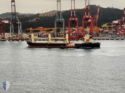
The vessel TRAWIND WISDOM (IMO: 9431109, MMSI: 372976000) is a Cargo It's sailing under the flag of [PA] Panama.
In this page you can find informations about the vessels current position, last detected port calls, and current voyage information. If the vessels is not in coverage by AIS you will find the latest position.
The current position of TRAWIND WISDOM is detected by our AIS receivers and we are not responsible for the reliability of the data. The last position was recorded while the vessel was in Coverage by the Ais receivers of our vessel tracking app.
The current draught of TRAWIND WISDOM as reported by AIS is 7.2 meters
Weather
| Temperature | 28.9°C / 84.02°F |
|---|---|
| Wind Speed | 8 knots |
| Direction | 299° WNW |
| Pressure | 1007.6 hPa |
| Humidity | 71.9 % |
| Cloud Coverage | 89 % |
Featured Company
Last Port Calls
| Port | Arrival | Departure | Time In Port |
|---|---|---|---|
| 2024-09-08 21:22 | 2024-09-19 04:44 | 10 d | |
| 2024-09-03 22:45 | 2024-09-05 15:39 | 1 d | |
| 2024-09-01 20:10 | 2024-09-02 10:13 | 14 h | |
| 2024-08-05 15:32 |
Events
| Tijd | Evenement | Details | Positie / Bestemming | Info |
|---|---|---|---|---|
| 2024-10-02 15:38 | Status Changed | Default Under way using engine |
2.43636 / 101.66476
BD CGP
|
Snelheid: 11.9 kn Koers: 308.4° |
| 2024-10-02 15:35 | Buitenbereik |
2.43119 / 101.67123
Malacca Strait
BD CGP
|
Snelheid: 11.9 kn Koers: 308.4° |
|
| 2024-10-02 14:16 | Wijzig zee gebeid | Malaysian part of the Malacca Strait Malaysian part of the Singapore Strait |
2.27241 / 101.87850
Malacca Strait
BD CGP
|
Snelheid: 11 kn Koers: 306.4° |
| 2024-10-02 14:14 | Status Changed | Under way using engine Default |
2.26817 / 101.88424
BD CGP
|
Snelheid: 10.9 kn Koers: 307° |
| 2024-10-02 14:14 | Binnenbereik |
2.27241 / 101.87850
Malacca Strait
BD CGP
|
Snelheid: 11 kn Koers: 306.4° |
|
| 2024-10-02 14:13 | Status Changed | Default Under way using engine |
2.26662 / 101.88631
BD CGP
|
Snelheid: 11 kn Koers: 306.8° |
| 2024-10-02 14:10 | Status Changed | Under way using engine Default |
2.26055 / 101.89448
BD CGP
|
Snelheid: 10.8 kn Koers: 306° |
| 2024-10-02 03:07 | Status Changed | Default Under way using engine |
1.19806 / 103.56567
BD CGP
|
Snelheid: 9.9 kn Koers: 288.3° |
| 2024-10-02 03:04 | Buitenbereik |
1.19560 / 103.57264
Singapore Strait
BD CGP
|
Snelheid: 9.9 kn Koers: 288.3° |
|
| 2024-10-02 03:01 | Wijzig zee gebeid | Malaysian part of the Singapore Strait Indonesian part of the Singapore Strait |
1.19284 / 103.58089
Singapore Strait
BD CGP
|
Snelheid: 9.8 kn Koers: 286.5° |