
TORONTO
Vehicles Carrier
Current Trip
| Time Travelled | 7 days |
|---|---|
| Remaining Time | --- |
| Distance Travelled | 2887.93 nm |
| Remaining Distance | --- |
| AVG Speed | 15.9 Knopen |
| MAX Speed | 18.5 Knopen |
| AVG Wind | 13.9 knots |
| MAX Wind | 26.8 knots |
| MIN Temp | 6.4°C / 43.52°F |
| MAX Temp | 28.3°C / 82.94°F |
| Diepgang | 10.4 M |
| Positie ontvangen | 8 h, 53 m geleden |
Current Position
| Lengtegraad | -16.67068° |
|---|---|
| Breedtegraat | 9.45412° |
| Status | Under way using engine |
| Snelheid | 16.6 Knopen |
| Koers | 144° |
| Gebied | North Atlantic Ocean |
| Station | T-AIS |
| Positie ontvangen | 8 h, 53 m geleden |
Info
Information
The current position of TORONTO is in North Atlantic Ocean with coordinates 9.45412° / -16.67068° as reported on 2024-05-02 03:37 by AIS to our vessel tracker app. The vessel's current speed is 16.6 Knopen and is heading at the port of EAST LONDON. The estimated time of arrival as calculated by MyShipTracking vessel tracking app is 2024-05-12 03:00 LT
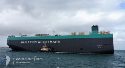
The vessel TORONTO (IMO: 9302205, MMSI: 248924000) is a Vehicles Carrier that was built in 2005 ( 19 Jaar oud ). It's sailing under the flag of [MT] Malta.
In this page you can find informations about the vessels current position, last detected port calls, and current voyage information. If the vessels is not in coverage by AIS you will find the latest position.
The current position of TORONTO is detected by our AIS receivers and we are not responsible for the reliability of the data. The last position was recorded while the vessel was in Coverage by the Ais receivers of our vessel tracking app.
The current draught of TORONTO as reported by AIS is 10.4 meters
Weather
| Temperature | 28.4°C / 83.12°F |
|---|---|
| Wind Speed | 4 knots |
| Direction | 296° WNW |
| Pressure | 1010.7 hPa |
| Humidity | 79.5 % |
| Cloud Coverage | 75 % |
Featured Company
Last Port Calls
| Port | Arrival | Departure | Time In Port |
|---|---|---|---|
| 2024-04-24 07:31 | 2024-04-24 22:06 | 14 h | |
| 2024-04-21 03:35 | 2024-04-23 14:38 | 2 d | |
| 2024-04-18 22:57 | 2024-04-20 00:19 | 1 d | |
| 2024-04-04 21:11 | 2024-04-06 01:37 | 1 d | |
| 2024-04-02 06:42 | 2024-04-02 18:36 | 11 h | |
| 2024-03-30 06:08 | 2024-03-31 00:34 | 18 h | |
| 2024-03-28 14:47 | 2024-03-29 14:18 | 23 h | |
| 2024-03-24 06:03 | 2024-03-24 06:11 | 7 m | |
| 2024-03-24 03:28 | |||
| 2024-03-02 07:10 |
Most Visited Ports (Last year)
| Port | Arrivals | |
|---|---|---|
| 3 | ||
| 2 | ||
| 2 | ||
| 2 | ||
| 2 | ||
| 2 |
Last Trips
| Origin | Departure | Destination | Arrival | Distance | |
|---|---|---|---|---|---|
| 2024-04-23 16:38 | 2024-04-24 08:31 | 205.99 nm | |||
| 2024-04-20 02:19 | 2024-04-21 05:35 | 331.91 nm | |||
| 2024-04-05 21:37 | 2024-04-19 00:57 | 3723.01 nm | |||
| 2024-04-02 14:36 | 2024-04-04 17:11 | 250.92 nm | |||
| 2024-03-30 20:34 | 2024-04-02 02:42 | 694.78 nm | |||
| 2024-03-29 10:18 | 2024-03-30 02:08 | 128.06 nm | |||
| 2024-03-24 01:11 | 2024-03-28 10:47 | 1527.91 nm | |||
| 2024-03-02 16:10 | 2024-03-24 01:03 | 8233.58 nm | |||
| 2024-03-02 16:10 | 2024-03-23 22:28 | 8233.50 nm |
Events
| Tijd | Evenement | Details | Positie / Bestemming | Info |
|---|---|---|---|---|
| 2024-05-02 03:52 | Status Changed | Default Under way using engine |
9.37318 / -16.60953
ZA ELS
|
Snelheid: 16.6 kn Koers: 144° |
| 2024-05-02 03:37 | Buitenbereik |
9.45412 / -16.67068
North Atlantic Ocean
ZA ELS
|
Snelheid: 16.6 kn Koers: 144° |
|
| 2024-05-02 03:26 | Wijzig zee gebeid | Guinean part of the North Atlantic Ocean Guinea Bissau part of the North Atlantic Ocean |
9.49633 / -16.70225
North Atlantic Ocean
ZA ELS
|
Snelheid: 16.6 kn Koers: 144° |
| 2024-05-02 03:26 | Status Changed | Under way using engine Default |
9.49633 / -16.70225
ZA ELS
|
Snelheid: 16.5 kn Koers: 144° |
| 2024-05-02 03:07 | Binnenbereik |
9.49633 / -16.70225
North Atlantic Ocean
ZA ELS
|
Snelheid: 16.6 kn Koers: 144° |
|
| 2024-05-01 18:38 | Status Changed | Default Under way using engine |
11.72673 / -17.47843
ZA ELS
|
Snelheid: 16.6 kn Koers: 167° |
| 2024-05-01 18:20 | Buitenbereik |
11.84285 / -17.50667
North Atlantic Ocean
ZA ELS
|
Snelheid: 16.6 kn Koers: 167° |
|
| 2024-05-01 18:17 | Wijzig zee gebeid | Guinea Bissau part of the North Atlantic Ocean Senegalese part of the North Atlantic Ocean |
11.85922 / -17.51057
North Atlantic Ocean
ZA ELS
|
Snelheid: 16.7 kn Koers: 166° |
| 2024-05-01 15:54 | Status Changed | Under way using engine Default |
12.49913 / -17.66355
ZA ELS
|
Snelheid: 16.5 kn Koers: 167° |
| 2024-05-01 15:47 | Binnenbereik |
12.49913 / -17.66355
North Atlantic Ocean
ZA ELS
|
Snelheid: 16.2 kn Koers: 166° |