

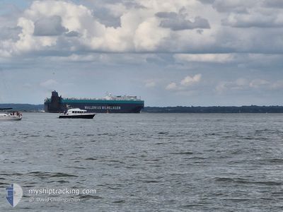
TONSBERG
Vehicles Carrier

Current Trip
| Time Travelled | 5 days |
|---|---|
| Remaining Time | --- |
| Distance Travelled | 1865.55 nm |
| Remaining Distance | --- |
| AVG Speed | 13.2 Knopen |
| MAX Speed | 18.3 Knopen |
| AVG Wind | 10.7 knots |
| MAX Wind | 25.5 knots |
| MIN Temp | 4.8°C / 40.64°F |
| MAX Temp | 17.4°C / 63.32°F |
| Diepgang | 9.9 M |
| Positie ontvangen | 16 h, 47 m geleden |
Current Position
| Lengtegraad | --- |
|---|---|
| Breedtegraat | --- |
| Status | Under way using engine |
| Snelheid | 12.4 Knopen |
| Koers | 234.6° |
| Gebied | North Atlantic Ocean |
| Station | T-AIS |
| Positie ontvangen | 16 h, 47 m geleden |
Information
The current position of TONSBERG is in North Atlantic Ocean with coordinates 38.35637° / -34.96336° as reported on 2025-03-05 01:47 by AIS to our vessel tracker app. The vessel's current speed is 12.4 Knopen and is heading at the port of BALTIMORE. The estimated time of arrival as calculated by MyShipTracking vessel tracking app is 2025-03-14 23:59 LT
The vessel TONSBERG (IMO: 9515383, MMSI: 249904000) is a Vehicles Carrier that was built in 2011 ( 14 Jaar oud ). It's sailing under the flag of [MT] Malta.
In this page you can find informations about the vessels current position, last detected port calls, and current voyage information. If the vessels is not in coverage by AIS you will find the latest position.
The current position of TONSBERG is detected by our AIS receivers and we are not responsible for the reliability of the data. The last position was recorded while the vessel was in Coverage by the Ais receivers of our vessel tracking app.
The current draught of TONSBERG as reported by AIS is 9.9 meters
Weather
| Temperature | 14.8°C / 58.64°F |
|---|---|
| Wind Speed | 12 knots |
| Direction | 340° NNW |
| Pressure | 1023 hPa |
| Humidity | 57.9 % |
| Cloud Coverage | 46 % |


Featured Company
Last Port Calls
| Port | Arrival | Departure | Time In Port |
|---|---|---|---|
| 2025-02-26 04:29 | 2025-02-27 20:41 | 1 d | |
| 2025-02-23 16:37 | 2025-02-25 12:13 | 1 d | |
| 2025-02-21 02:08 | 2025-02-22 23:01 | 1 d | |
| 2025-02-12 12:41 | 2025-02-20 03:00 | 7 d | |
| 2025-02-01 09:31 | 2025-02-02 22:46 | 1 d | |
| 2025-01-28 11:37 | 2025-01-29 05:43 | 18 h | |
| 2025-01-25 22:13 | 2025-01-27 23:16 | 2 d | |
| 2025-01-24 08:38 | 2025-01-25 09:12 | 1 d | |
| 2025-01-20 10:43 | 2025-01-21 22:23 | 1 d | |
| 2025-01-14 00:59 | 2025-01-14 20:31 | 19 h |
Most Visited Ports (Last year)
| Port | Arrivals | |
|---|---|---|
| 4 | ||
| 3 | ||
| 3 | ||
| 3 | ||
| 3 | ||
| 3 |
Last Trips
| Origin | Departure | Destination | Arrival | Distance | |
|---|---|---|---|---|---|
| 2025-02-25 13:13 | 2025-02-26 04:29 | 136.13 nm | |||
| 2025-02-23 00:01 | 2025-02-23 17:37 | 232.59 nm | |||
| 2025-02-20 04:00 | 2025-02-21 03:08 | 332.47 nm | |||
| 2025-02-02 17:46 | 2025-02-12 13:41 | 3625.08 nm | |||
| 2025-01-29 00:43 | 2025-02-01 04:31 | 652.13 nm | |||
| 2025-01-27 18:16 | 2025-01-28 06:37 | 169.82 nm | |||
| 2025-01-25 04:12 | 2025-01-25 17:13 | 34.83 nm | |||
| 2025-01-21 17:23 | 2025-01-24 03:38 | 737.58 nm | |||
| 2025-01-14 15:31 | 2025-01-20 05:43 | 1923.36 nm | |||
| 2024-12-19 19:21 | 2025-01-13 19:59 | 8445.81 nm |
Events
| Tijd | Evenement | Details | Positie / Bestemming | Info |
|---|---|---|---|---|
| 2025-03-05 01:53 | Status Changed | Default Under way using engine |
38.34394 / -34.98542
US BAL
|
Snelheid: 12.4 kn Koers: 234.6° |
| 2025-03-05 01:47 | Status Changed | Under way using engine Default |
38.35637 / -34.96336
US BAL
|
Snelheid: 12.2 kn Koers: 232° |
| 2025-03-05 01:47 | Binnenbereik |
38.35637 / -34.96336
North Atlantic Ocean
US BAL
|
Snelheid: 12.4 kn Koers: 234.6° |
|
| 2025-03-05 01:47 | Buitenbereik |
38.35637 / -34.96336
North Atlantic Ocean
US BAL
|
Snelheid: 12.4 kn Koers: 234.6° |
|
| 2025-03-04 04:31 | Status Changed | Default Under way using engine |
41.01067 / -30.32176
US BAL
|
Snelheid: 14.3 kn Koers: 232.3° |
| 2025-03-04 04:25 | Wijzig zee gebeid | Portuguese (Azores) part of the North Atlantic Ocean High seas of the North Atlantic Ocean |
41.02616 / -30.29533
North Atlantic Ocean
US BAL
|
Snelheid: 14.3 kn Koers: 232.3° |
| 2025-03-04 04:25 | Buitenbereik |
41.02616 / -30.29533
North Atlantic Ocean
US BAL
|
Snelheid: 14.3 kn Koers: 232.3° |
|
| 2025-03-04 04:24 | Status Changed | Under way using engine Default |
41.02786 / -30.29242
US BAL
|
Snelheid: 14.2 kn Koers: 233° |
| 2025-03-04 04:13 | Binnenbereik |
41.02616 / -30.29533
North Atlantic Ocean
US BAL
|
Snelheid: 14.3 kn Koers: 232.3° |
|
| 2025-03-02 21:39 | Buitenbereik |
44.97465 / -23.01090
North Atlantic Ocean
US BAL
|
Snelheid: 13.8 kn Koers: 231.4° |