
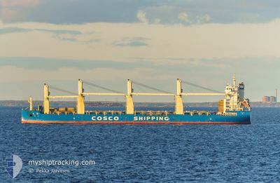
TIAN LE
Cargo
Current Trip
| Time Travelled | 23 days |
|---|---|
| Remaining Time | 3 days |
| Distance Travelled | 6848.64 nm |
| Remaining Distance | 1067.83 nm |
| AVG Speed | 12.6 Knopen |
| MAX Speed | 14.7 Knopen |
| AVG Wind | 8.5 knots |
| MAX Wind | 21.8 knots |
| MIN Temp | 10.7°C / 51.26°F |
| MAX Temp | 31.1°C / 87.98°F |
| Diepgang | 11.1 M |
| Positie ontvangen | 23 h, 52 m geleden |
Current Position
| Lengtegraad | 104.33532° |
|---|---|
| Breedtegraat | 1.29717° |
| Status | Under way using engine |
| Snelheid | 11.9 Knopen |
| Koers | 50.1° |
| Gebied | Singapore Strait |
| Station | T-AIS |
| Positie ontvangen | 23 h, 52 m geleden |
Info
Information
The current position of TIAN LE is in Singapore Strait with coordinates 1.29717° / 104.33532° as reported on 2024-04-26 09:02 by AIS to our vessel tracker app. The vessel's current speed is 11.9 Knopen and is heading at the port of FANGCHENG. The estimated time of arrival as calculated by MyShipTracking vessel tracking app is 2024-04-30 16:56 LT
The vessel TIAN LE (IMO: 9722730, MMSI: 412478730) is a Cargo It's sailing under the flag of [CN] China.
In this page you can find informations about the vessels current position, last detected port calls, and current voyage information. If the vessels is not in coverage by AIS you will find the latest position.
The current position of TIAN LE is detected by our AIS receivers and we are not responsible for the reliability of the data. The last position was recorded while the vessel was in Coverage by the Ais receivers of our vessel tracking app.
The current draught of TIAN LE as reported by AIS is 11.1 meters
Weather
| Temperature | 30.1°C / 86.18°F |
|---|---|
| Wind Speed | 6 knots |
| Direction | 122° ESE |
| Pressure | 1005.4 hPa |
| Humidity | 69.4 % |
| Cloud Coverage | 98 % |
Featured Company
Last Port Calls
| Port | Arrival | Departure | Time In Port |
|---|---|---|---|
| 2024-04-09 04:03 | 2024-04-09 12:57 | 8 h | |
| 2024-03-27 23:09 | 2024-04-03 20:37 | 6 d | |
| 2024-03-22 06:01 | 2024-03-26 14:09 | 4 d | |
| 2024-02-29 12:51 | 2024-03-01 21:13 | 1 d | |
| 2024-02-29 11:36 | 2024-02-29 12:36 | 1 h | |
| 2024-02-20 08:31 | 2024-02-25 09:48 | 5 d |
Last Trips
| Origin | Departure | Destination | Arrival | Distance | |
|---|---|---|---|---|---|
| 2024-04-03 22:37 | 2024-04-09 06:03 | 1366.97 nm | |||
| 2024-03-26 15:09 | 2024-03-28 00:09 | 369.64 nm | |||
| 2024-03-01 22:13 | 2024-03-22 07:01 | 3351.62 nm | |||
| 2024-02-29 13:36 | 2024-02-29 13:51 | 0.48 nm | |||
| 2024-02-25 10:48 | 2024-02-29 12:36 | 522.29 nm | |||
| 2024-01-08 10:07 | 2024-02-20 09:31 | 14133.85 nm |
Events
| Tijd | Evenement | Details | Positie / Bestemming | Info |
|---|---|---|---|---|
| 2024-04-26 09:08 | Status Changed | Default Under way using engine |
1.31028 / 104.35078
CNFAN
|
Snelheid: 11.9 kn Koers: 50.1° |
| 2024-04-26 09:02 | Buitenbereik |
1.29717 / 104.33532
Singapore Strait
CNFAN
|
Snelheid: 11.9 kn Koers: 50.1° |
|
| 2024-04-26 08:07 | Wijzig zee gebeid | Malaysian part of the Singapore Strait Indonesian part of the Singapore Strait |
1.26040 / 104.15397
Singapore Strait
CNFAN
|
Snelheid: 12.3 kn Koers: 80.5° |
| 2024-04-26 05:22 | Wijzig zee gebeid | Indonesian part of the Singapore Strait Indonesian part of the South China Sea |
1.04397 / 103.67648
Singapore Strait
CNFAN
|
Snelheid: 11.3 kn Koers: 51.2° |
| 2024-04-26 05:15 | Wijzig zee gebeid | Indonesian part of the South China Sea Indonesian part of the Singapore Strait |
1.03366 / 103.65632
South China Sea
CNFAN
|
Snelheid: 13.1 kn Koers: 99.4° |
| 2024-04-26 04:24 | Destination Changed | CNFAN MY PKG |
1.13723 / 103.48847
CNFAN
|
Snelheid: 13.8 kn Koers: 124.8° |
| 2024-04-26 04:24 | ETA Changed | 2024/05/01 08:00 2024/04/25 08:00 |
1.13723 / 103.48847
CNFAN
|
Snelheid: 13.8 kn Koers: 124.8° |
| 2024-04-26 04:04 | Wijzig zee gebeid | Indonesian part of the Singapore Strait Indonesian part of the Malacca Strait |
1.17338 / 103.42235
Singapore Strait
|
Snelheid: 13.8 kn Koers: 121.9° |
| 2024-04-26 03:55 | Gevonden in zee | Indonesian part of the Malacca Strait |
1.19688 / 103.39547
Malacca Strait
|
Snelheid: 14.2 kn Koers: 134° |
| 2024-04-26 03:53 | Status Changed | Under way using engine Default |
1.20237 / 103.38983
MY PKG
|
Snelheid: 14.2 kn Koers: 134° |