
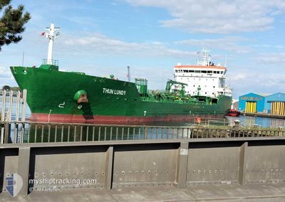
THUN LUNDY
Tanker
Current Trip
| Trip Time | 1 day |
|---|---|
| Trip Distance | 225.93 nm |
| AVG Speed | 8.6 Knopen |
| MAX Speed | 11.6 Knopen |
| Diepgang | 8.1 M |
| AVG Wind | 13 knots |
| MAX Wind | 16 knots |
| MIN Temp | 7.3°C / 45.14°F |
| MAX Temp | 10.1°C / 50.18°F |
| Positie ontvangen | 16 h, 57 m geleden |
Current Position
| Lengtegraad | --- |
|---|---|
| Breedtegraat | --- |
| Status | Moored |
| Snelheid | |
| Koers | 180° |
| Gebied | Inner Seas off the West Coast of Scotland |
| Station | T-AIS |
| Positie ontvangen | 16 h, 57 m geleden |
Information
The current position of THUN LUNDY is in Inner Seas off the West Coast of Scotland with coordinates 54.61597° / -5.88764° as reported on 2025-03-10 09:41 by AIS to our vessel tracker app. The vessel's current speed is 0 Knopen and is currently inside the port of BELFAST.
The vessel THUN LUNDY (IMO: 9837872, MMSI: 244069000) is a Tanker It's sailing under the flag of [NL] Netherlands.
In this page you can find informations about the vessels current position, last detected port calls, and current voyage information. If the vessels is not in coverage by AIS you will find the latest position.
The current position of THUN LUNDY is detected by our AIS receivers and we are not responsible for the reliability of the data. The last position was recorded while the vessel was in Coverage by the Ais receivers of our vessel tracking app.
The current draught of THUN LUNDY as reported by AIS is 8.1 meters
Weather
| Temperature | 2°C / 35.6°F |
|---|---|
| Wind Speed | 7 knots |
| Direction | 49° NE |
| Pressure | 1014.8 hPa |
| Humidity | 80.9 % |
| Cloud Coverage | 59 % |
Featured Company
Last Port Calls
| Port | Arrival | Departure | Time In Port |
|---|---|---|---|
| 2025-03-10 08:41 | |||
| 2025-03-08 09:00 | 2025-03-09 05:53 | 20 h | |
| 2025-03-06 09:45 | 2025-03-07 23:10 | 1 d | |
| 2025-03-05 01:44 | 2025-03-06 01:04 | 23 h | |
| 2025-03-02 06:23 | 2025-03-02 06:32 | 8 m | |
| 2025-02-28 13:35 | 2025-03-01 12:55 | 23 h | |
| 2025-02-24 15:27 | 2025-02-25 18:20 | 1 d | |
| 2025-02-22 22:47 | 2025-02-24 01:57 | 1 d | |
| 2025-02-19 15:34 | 2025-02-21 15:31 | 1 d | |
| 2025-02-17 11:46 | 2025-02-18 16:31 | 1 d |
Last Trips
| Origin | Departure | Destination | Arrival | Distance | |
|---|---|---|---|---|---|
| 2025-03-09 05:53 | 2025-03-10 08:41 | 225.93 nm | |||
| 2025-03-07 23:10 | 2025-03-08 09:00 | 89.18 nm | |||
| 2025-03-06 01:04 | 2025-03-06 09:45 | 89.26 nm | |||
| 2025-03-02 06:32 | 2025-03-05 01:44 | 187.89 nm | |||
| 2025-03-01 12:55 | 2025-03-02 06:23 | 193.46 nm | |||
| 2025-02-25 18:20 | 2025-02-28 13:35 | 97.16 nm | |||
| 2025-02-24 01:57 | 2025-02-24 15:27 | 89.53 nm | |||
| 2025-02-21 15:31 | 2025-02-22 22:47 | 221.29 nm | |||
| 2025-02-18 16:31 | 2025-02-19 15:34 | 226.76 nm | |||
| 2025-02-16 10:06 | 2025-02-17 11:46 | 208.47 nm |
Events
| Tijd | Evenement | Details | Positie / Bestemming | Info |
|---|---|---|---|---|
| 2025-03-10 09:46 | Status Changed | Default Moored |
54.61601 / -5.88768
[GB] BELFAST
|
Snelheid: Koers: 180° |
| 2025-03-10 09:41 | Buitenbereik |
54.61597 / -5.88764
Inner Seas off the West Coast of Scotland
[GB] BELFAST
|
Snelheid: Koers: 155.4° |
|
| 2025-03-10 09:40 | Status Changed | Moored Under way using engine |
54.61597 / -5.88766
[GB] BELFAST
|
Snelheid: Koers: 180° |
| 2025-03-10 09:10 | Stop beweging |
54.61617 / -5.88778
[GB] BELFAST
|
Snelheid: 0.3 kn Koers: 176° |
|
| 2025-03-10 08:41 | Aankomsthaven |
|
54.64417 / -5.86643
[GB] BELFAST
|
Snelheid: 7.7 kn Koers: 215.8° |
| 2025-03-10 04:53 | Wijzig zee gebeid | United Kingdom part of the Inner Seas off the West Coast of Scotland United Kingdom part of the Irish Sea and St. George's Channel |
54.44163 / -5.34764
Inner Seas off the West Coast of Scotland
GBBEL
|
Snelheid: 9.7 kn Koers: 345.5° |
| 2025-03-10 02:23 | Status Changed | Under way using engine Default |
54.08794 / -5.38979
GBBEL
|
Snelheid: 8.3 kn Koers: 3° |
| 2025-03-10 02:20 | Binnenbereik |
54.09580 / -5.38900
Irish Sea and St. George's Channel
GBBEL
|
Snelheid: 8.1 kn Koers: 3.6° |
|
| 2025-03-10 01:20 | Status Changed | Default Under way using engine |
53.94360 / -5.41956
GBBEL
|
Snelheid: 8.4 kn Koers: 6.3° |
| 2025-03-10 01:13 | Buitenbereik |
53.92795 / -5.42261
Irish Sea and St. George's Channel
GBBEL
|
Snelheid: 8.4 kn Koers: 6.3° |