
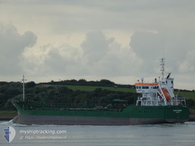
THUN GEMINI
Oil/Chemical Tanker

Current Trip
| Time Travelled | 17 h, 0 mins |
|---|---|
| Remaining Time | 1 day |
| Distance Travelled | 174.64 nm |
| Remaining Distance | 411.13 nm |
| AVG Speed | 10 Knopen |
| MAX Speed | 11.7 Knopen |
| AVG Wind | 16.1 knots |
| MAX Wind | 24 knots |
| MIN Temp | 4.8°C / 40.64°F |
| MAX Temp | 8.4°C / 47.12°F |
| Diepgang | 6.5 M |
| Positie ontvangen | 54 m geleden |
Current Position
| Lengtegraad | --- |
|---|---|
| Breedtegraat | --- |
| Status | Under way using engine |
| Snelheid | 9.7 Knopen |
| Koers | 89.1° |
| Gebied | English Channel |
| Station | T-AIS |
| Positie ontvangen | 54 m geleden |
Information
The current position of THUN GEMINI is in English Channel with coordinates 49.90785° / -5.56750° as reported on 2025-03-12 20:28 by AIS to our vessel tracker app. The vessel's current speed is 9.7 Knopen and is heading at the port of THAMES. The estimated time of arrival as calculated by MyShipTracking vessel tracking app is 2025-03-14 13:31 LT
The vessel THUN GEMINI (IMO: 9263590, MMSI: 245610000) is a Oil/Chemical Tanker that was built in 2003 ( 22 Jaar oud ). It's sailing under the flag of [NL] Netherlands.
In this page you can find informations about the vessels current position, last detected port calls, and current voyage information. If the vessels is not in coverage by AIS you will find the latest position.
The current position of THUN GEMINI is detected by our AIS receivers and we are not responsible for the reliability of the data. The last position was recorded while the vessel was in Coverage by the Ais receivers of our vessel tracking app.
The current draught of THUN GEMINI as reported by AIS is 6.5 meters
Weather
| Temperature | 4.9°C / 40.82°F |
|---|---|
| Wind Speed | 11 knots |
| Direction | 25° NNE |
| Pressure | 1005.5 hPa |
| Humidity | 79.2 % |
| Cloud Coverage | 7 % |


Featured Company
Last Port Calls
| Port | Arrival | Departure | Time In Port |
|---|---|---|---|
| 2025-03-11 03:14 | 2025-03-12 04:22 | 1 d | |
| 2025-03-09 15:23 | 2025-03-10 10:19 | 18 h | |
| 2025-03-07 19:57 | 2025-03-08 21:14 | 1 d | |
| 2025-03-05 19:39 | 2025-03-06 21:08 | 1 d | |
| 2025-03-01 04:20 | 2025-03-02 07:28 | 1 d | |
| 2025-02-23 17:03 | 2025-02-24 23:53 | 1 d | |
| 2025-02-19 04:40 | 2025-02-20 12:19 | 1 d | |
| 2025-02-15 15:36 | 2025-02-16 10:13 | 18 h | |
| 2025-02-15 08:20 | 2025-02-15 15:31 | 7 h | |
| 2025-02-11 15:56 | 2025-02-13 00:35 | 1 d |
Last Trips
| Origin | Departure | Destination | Arrival | Distance | |
|---|---|---|---|---|---|
| 2025-03-10 10:19 | 2025-03-11 03:14 | 163.44 nm | |||
| 2025-03-08 21:14 | 2025-03-09 15:23 | 170.70 nm | |||
| 2025-03-06 21:08 | 2025-03-07 19:57 | 228.77 nm | |||
| 2025-03-02 08:28 | 2025-03-05 19:39 | 763.77 nm | |||
| 2025-02-25 00:53 | 2025-03-01 05:20 | 100.34 nm | |||
| 2025-02-20 12:19 | 2025-02-23 18:03 | 581.00 nm | |||
| 2025-02-16 10:13 | 2025-02-19 04:40 | 392.43 nm | |||
| 2025-02-15 15:31 | 2025-02-15 15:36 | 0.19 nm | |||
| 2025-02-13 01:35 | 2025-02-15 08:20 | 572.06 nm | |||
| 2025-02-09 02:59 | 2025-02-11 16:56 | 580.25 nm |
Events
| Tijd | Evenement | Details | Positie / Bestemming | Info |
|---|---|---|---|---|
| 2025-03-12 20:36 | Status Changed | Default Under way using engine |
49.90821 / -5.53544
THAMES
|
Snelheid: 9.7 kn Koers: 89.1° |
| 2025-03-12 20:28 | Gevonden in zee | United Kingdom part of the English Channel |
49.90785 / -5.56750
English Channel
THAMES
|
Snelheid: 9.7 kn Koers: 89.1° |
| 2025-03-12 20:28 | Status Changed | Under way using engine Default |
49.90782 / -5.56890
THAMES
|
Snelheid: 9.8 kn Koers: 87° |
| 2025-03-12 20:24 | Binnenbereik |
49.90785 / -5.56750
English Channel
THAMES
|
Snelheid: 9.7 kn Koers: 89.1° |
|
| 2025-03-12 08:15 | Buitenbereik |
51.32819 / -7.57092
Celtic Sea
THAMES
|
Snelheid: 10.6 kn Koers: 132.2° |
|
| 2025-03-12 04:22 | Vertrekhaven |
|
51.83177 / -8.26581
THAMES
|
Snelheid: 5.7 kn Koers: 218° |
| 2025-03-12 04:20 | Start beweging |
51.83355 / -8.26294
[IE] WHITEGATE
|
Snelheid: 3.5 kn Koers: 223° |
|
| 2025-03-12 04:18 | Status Changed | Under way using engine Moored |
51.83407 / -8.26170
[IE] WHITEGATE
|
Snelheid: 0.1 kn Koers: 213° |
| 2025-03-12 03:53 | Destination Changed | THAMES IE WHI |
51.83404 / -8.26133
[IE] WHITEGATE
|
Snelheid: Koers: 205° |
| 2025-03-12 03:53 | ETA Changed | 2025/03/14 06:00 2025/03/11 03:00 |
51.83404 / -8.26133
[IE] WHITEGATE
|
Snelheid: Koers: 205° |